- Home
- :
- All Communities
- :
- Industries
- :
- Water Resources
- :
- Water Resources Questions
- :
- Smoothing the DEM
- Subscribe to RSS Feed
- Mark Topic as New
- Mark Topic as Read
- Float this Topic for Current User
- Bookmark
- Subscribe
- Mute
- Printer Friendly Page
Smoothing the DEM
- Mark as New
- Bookmark
- Subscribe
- Mute
- Subscribe to RSS Feed
- Permalink
Hello everyone,
I am working on the Archydro toolset and I am facing an issue with the perona malik smoothing method, the mean and median areworking normally but the perona malik is not working and showing the error below.
(I am using the DEM I generated from the LAS file data)

- Mark as New
- Bookmark
- Subscribe
- Mute
- Subscribe to RSS Feed
- Permalink
Hello @HusamAbuOqer ! Perona Malik requires the input DEM to be in the .tif format. While other formats may work with the other smoothing methods, it is highly recommended that .tif files be used as inputs anyway. Please let me know if this resolves your issue. Thanks!
-Gina
- Mark as New
- Bookmark
- Subscribe
- Mute
- Subscribe to RSS Feed
- Permalink
Hi Gina,
Thank you for your reply.
I think that was the issue I have been running through last, now I solved it by converting the DEM to a tif format.
Currently I am running the "Run random tree step and I am getting a raster of one value only (0), any recommendations for this issue?
Thanks.
- Mark as New
- Bookmark
- Subscribe
- Mute
- Subscribe to RSS Feed
- Permalink
Great!
You may be seeing a prediction value of just the 0 class if your training data is highly imbalanced towards the 0 class. If the imbalance is the issue, you can try significantly undersampling the majority class (0) when running Train Test Split: set the sampling percent for class 0 to be much lower thanthe sampling percent for class 1
- Mark as New
- Bookmark
- Subscribe
- Mute
- Subscribe to RSS Feed
- Permalink
Hello. I am receiving this error when attempting to use Perona Malik method. It is is TIFF format, 1m resolution. Any insight would be helpful.

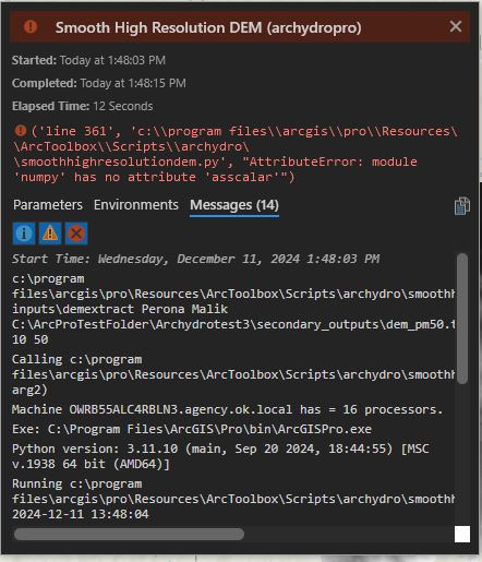
- Mark as New
- Bookmark
- Subscribe
- Mute
- Subscribe to RSS Feed
- Permalink
I am having this same error. Did you find a solution?
- Mark as New
- Bookmark
- Subscribe
- Mute
- Subscribe to RSS Feed
- Permalink
Hi @HusamAbuOqer ,
I believe your study area is too large. I recommend working in units of watersheds and from DEM data that is 3m resolution. I've found that 3m DEMs clipped to HUC12 watersheds works well with the tool's size limits. How large is your area? And are you confident in both the wetland coverage and nonwetland coverage in this entire area?
- Mark as New
- Bookmark
- Subscribe
- Mute
- Subscribe to RSS Feed
- Permalink
Hello @GinaO_Neil
My study area is 23 sqKM with a DEM resolution of 25 centimeters.
And I am using ground truth data for Alberta from a government data source showing the wetland and non-wetland areas.
The test data area I tried it before and it worked normally was with almost the same size (but the resolution for this DEM was 1 meter)
Is this area considered a big area for the toolset or it's because of the high resolution of the DEM I am using?