- Home
- :
- All Communities
- :
- Industries
- :
- Water Resources
- :
- Water Resources Questions
- :
- Re: Longest Flow Path ERROR 010088
- Subscribe to RSS Feed
- Mark Topic as New
- Mark Topic as Read
- Float this Topic for Current User
- Bookmark
- Subscribe
- Mute
- Printer Friendly Page
- Mark as New
- Bookmark
- Subscribe
- Mute
- Subscribe to RSS Feed
- Permalink
Hi,
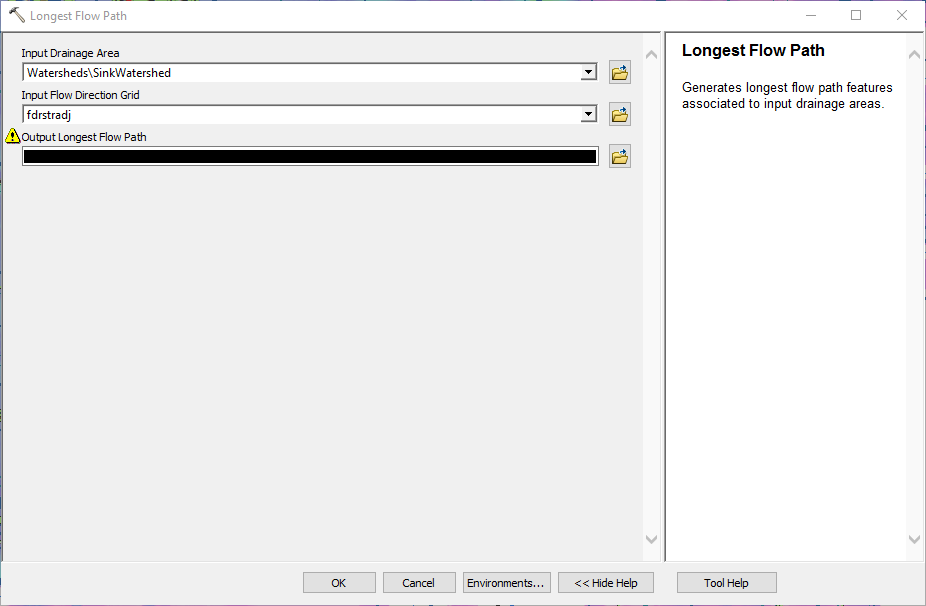
I'm having issues running the Longest Flow Path tool in ArcHydro.
Attempting to run the Longest Flow Path tool results in the following warning error message:
"Longest flow path could not be generated for input drainage area OID=1.
ERROR 010088: Invalid input geodataset (Layer, Tin, etc.)."
This message repeats for each drainage area

Any idea what's causing this? I am using sink watersheds as my drainage area and and fdrstradj (stream flow direction adjusted flow direction raster) for input.

Thank you, any help or suggestions are appreciated!
Solved! Go to Solution.
Accepted Solutions
- Mark as New
- Bookmark
- Subscribe
- Mute
- Subscribe to RSS Feed
- Permalink
Ah, the above problem was resolved by the tried and true ArcHydro Troubleshoot method of make sure you are working from the local C: drive and not a network drive and if not, move your project there, close & delete current .mxd, clear %temp% folder, create new blank .mxd to replace deleted, re-set targets, make sure geoprocessing extent is max of all features in dataframe, make sure your dataframe has the correct projected coordinate system set, and turn off background geoprocessing - then try again.