- Home
- :
- All Communities
- :
- Products
- :
- Spatial Data Science
- :
- Spatial Data Science Questions
- :
- Re: Is Spatial Join the correct tool here?
- Subscribe to RSS Feed
- Mark Topic as New
- Mark Topic as Read
- Float this Topic for Current User
- Bookmark
- Subscribe
- Mute
- Printer Friendly Page
Is Spatial Join the correct tool here?
- Mark as New
- Bookmark
- Subscribe
- Mute
- Subscribe to RSS Feed
- Permalink
Hello community,
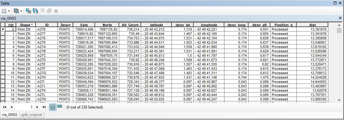
I have a feature layer (via_GNSS) that contains a bunch of points collected with a GPS:
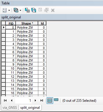
Also, I have another layer (split_original) with many polylines connecting all of those points, creating a "path":
Here is the data view with these two layers activated:
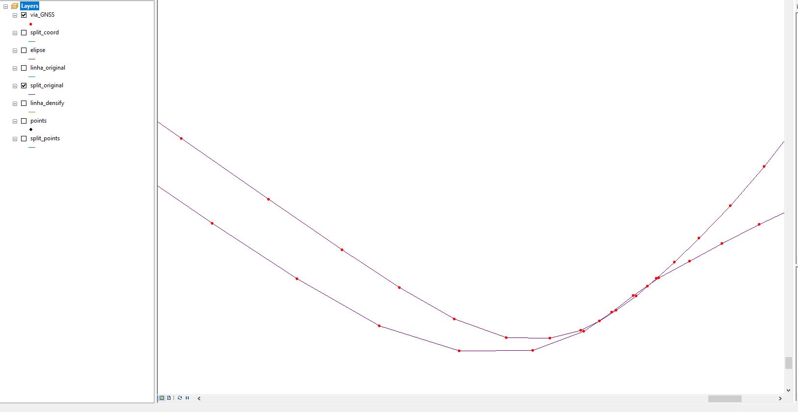
Like you can see, each polyline has two points that are associated with it. How can I "transfer" the attribute fields of each pair of points to its associated polyline? With Spatial Join, I could only manage to get two rows for each polyline, each one containing the attributes of one of the points. I would like to have ONE row for each polyline, but in that row I want information of both points. Is it possible through the Spatial Join tool? If it's not, how can I do that? Thanks everyone.
- Mark as New
- Bookmark
- Subscribe
- Mute
- Subscribe to RSS Feed
- Permalink
Spatial join
http://pro.arcgis.com/en/pro-app/tool-reference/analysis/spatial-join.htm
perhaps you could try to join the polylines to the points, then save as a layer file (see the join options one-to-many) to get the polyline attributes into the point file. If that is successful, then an attribute 'relate' will get the attributes associated with the original polyline file.
There is only one-to-one or one-to-many for spatial joins, you want 'many-to-one' which isn't supported, so you will have to try the workaround or decide what information is critical.
Alternately, you could reconfigure your table so produce segmented polylines from your input point sequence which would require a bit of coding
- Mark as New
- Bookmark
- Subscribe
- Mute
- Subscribe to RSS Feed
- Permalink
Thank you for the quick reply Dan.
The reason why I want that "many-to-one" tool, is because I want to create a new field and use the "field calculator" to operate data from both points. Is there any way to use field calculator to operate data from two different rows (without coding)? That would also solve my problem. Thank you.
- Mark as New
- Bookmark
- Subscribe
- Mute
- Subscribe to RSS Feed
- Permalink
If the FIDS from one represented the other you could do a table join. However, if it is as small as 235 you have shown it may be simpler and quicker to simply go through one at a time and copy and paste the attributes. if that is what you want to end up with.
Spatial join may end up with errors especially where the slope changes quite a bit.