- Home
- :
- All Communities
- :
- Products
- :
- Spatial Data Science
- :
- Spatial Data Science Questions
- :
- Re: extract values from DEM and create polygon cla...
- Subscribe to RSS Feed
- Mark Topic as New
- Mark Topic as Read
- Float this Topic for Current User
- Bookmark
- Subscribe
- Mute
- Printer Friendly Page
extract values from DEM and create polygon class
- Mark as New
- Bookmark
- Subscribe
- Mute
- Subscribe to RSS Feed
- Permalink
I'm working with a DEM of Great Britain, and I need to isolate particular regions. The criteria is slopes 15% or greater AND elevation is above 400m AND aspect is oriented North-East. I need to create a polygon feature class of this three-pronged criteria. I'm not that familiar with the Toolbox modules that can isolate these criteria.
Solved! Go to Solution.
Accepted Solutions
- Mark as New
- Bookmark
- Subscribe
- Mute
- Subscribe to RSS Feed
- Permalink
I would produce your DEM, Slope, and Aspect rasters separately, then use the Con(Raster Calculator) Tool to create a binary raster for each of your criteria. I would then Raster Calculator Tool to sum up the 3 binary rasters then use the raster to polygon tool to create polygons that each contain areas where the sum of the binaries. Once you have that, Definition Query the data into a new dataset and export to a new file if you wish.
- Mark as New
- Bookmark
- Subscribe
- Mute
- Subscribe to RSS Feed
- Permalink
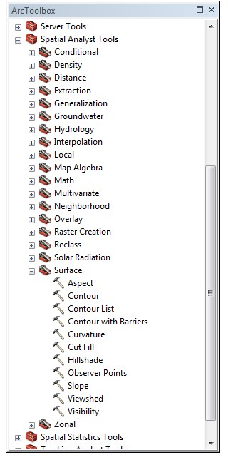
Do you have access to the Spatial Analyst Extension and/or the 3D Analyst Extension? Both have tools for what you would like to do. In particular, the Aspect and Slope tools in the Spatial Analyst toolbox. Note that if you just have 3D Analyst, that automatically gives you access to many of these Spatial Analyst tools.
ArcGIS Help (10.2, 10.2.1, and 10.2.2) - Spatial Analyst introduction

Chris Donohue, GISP
- Mark as New
- Bookmark
- Subscribe
- Mute
- Subscribe to RSS Feed
- Permalink
I would produce your DEM, Slope, and Aspect rasters separately, then use the Con(Raster Calculator) Tool to create a binary raster for each of your criteria. I would then Raster Calculator Tool to sum up the 3 binary rasters then use the raster to polygon tool to create polygons that each contain areas where the sum of the binaries. Once you have that, Definition Query the data into a new dataset and export to a new file if you wish.
- Mark as New
- Bookmark
- Subscribe
- Mute
- Subscribe to RSS Feed
- Permalink
I want to add, after you finish Raster to Polygon for all raster criteria ( slope > = 15, Aspect =45 or >22.5 AND < 67.5 , Dem for above 400 meter ), put all polygons in Intersect Tool Intersect—Help | ArcGIS Desktop to get the place that has all this criteria .
- Mark as New
- Bookmark
- Subscribe
- Mute
- Subscribe to RSS Feed
- Permalink
Actually at that point you would have polygons for the entirety of Great Britain that would have integer values between 0 and 3. Places where they overlap would already by a polygon with a Value Field with a value of 3, so I don't believe any further steps would be needed. The method I used would Sum the three binaries, leaving only one polygon feature to create from the sum raster.
You could raster to polygon each binary of course then do an intersect, but I'd rather save two geoprocessing operations if I could help it.
- Mark as New
- Bookmark
- Subscribe
- Mute
- Subscribe to RSS Feed
- Permalink
sorry, I thought you meant Con Tool Con—Help | ArcGIS Desktop that run on one raster.
but you mean using con in expression in Raster Calculator Raster Calculator—Help | ArcGIS Desktop .
sorry about miss understand.
- Mark as New
- Bookmark
- Subscribe
- Mute
- Subscribe to RSS Feed
- Permalink
This approach will work best. I would just change "sum of the binaries" to "product of the binaries" - then it is either 1 or 0.