- Home
- :
- All Communities
- :
- Products
- :
- Spatial Data Science
- :
- Spatial Data Science Questions
- :
- Difficulty to create a polygon
- Subscribe to RSS Feed
- Mark Topic as New
- Mark Topic as Read
- Float this Topic for Current User
- Bookmark
- Subscribe
- Mute
- Printer Friendly Page
Difficulty to create a polygon
- Mark as New
- Bookmark
- Subscribe
- Mute
- Subscribe to RSS Feed
- Permalink
Hi,
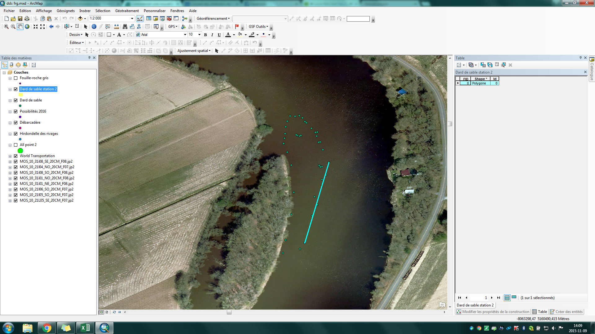
I'm trying to create a polygon base on GPS data on my map but when I finish and click on save it is totaly different it's like arcgis save only 2 points.
- Mark as New
- Bookmark
- Subscribe
- Mute
- Subscribe to RSS Feed
- Permalink
Are clicking on every point?
- Mark as New
- Bookmark
- Subscribe
- Mute
- Subscribe to RSS Feed
- Permalink
Yes it's me who create de polygon so I made every point
- Mark as New
- Bookmark
- Subscribe
- Mute
- Subscribe to RSS Feed
- Permalink
Some ideas:
I wonder if the Snapping Tolerance is set really high? Or possibly the Tolerance in the feature class when it was first created was set higher than intended?
One temporary workaround I've found that sometimes resolves this is to save your work, save ArcMap, then reopen ArcMap. This seems to work in cases where several dozen edits have already been done and computer seems to essentially run out of memory, which leads to strangeness when editing.
If the feature class you are digitizing to resides in a File or Personal Geodatabase, it may help to run the Compact (Data Management) Tool.
ArcGIS Help (10.2, 10.2.1, and 10.2.2)
Chris Donohue, GISP
- Mark as New
- Bookmark
- Subscribe
- Mute
- Subscribe to RSS Feed
- Permalink
I totally delete the polygon and do it again and I have the same problem. I try the second idea and it doesn't work needer.
Where I'm suppose to see the tolerance?
- Mark as New
- Bookmark
- Subscribe
- Mute
- Subscribe to RSS Feed
- Permalink
Please check, and post, the coordinate system and xy tolerance and xy resolution values of the feature class that you're trying to save the polygon to.
Going by the coordinates in the status bar, is the data frame using WGS 1984 Web Mercator (Auxiliary Sphere) AKA EPSG:3857?
Melita
- Mark as New
- Bookmark
- Subscribe
- Mute
- Subscribe to RSS Feed
- Permalink
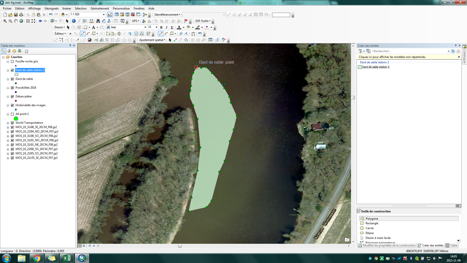
There's no data it's like my polygon doesn't exist
This is what I do for create it tell me if it's ok ;
1) Click right on catalog --> New --> Shapefile --> polygon --> ok
2) Start editing --> choose new_shapfile
3) create new entites
4) click on every point I want for make my polygon
5) double click on my new polygon
6) save editing
And after this my polygon desapear....
- Mark as New
- Bookmark
- Subscribe
- Mute
- Subscribe to RSS Feed
- Permalink
To state what Melita Kennedy mentioned in a different way, what may be causing the issue is the coordinate system assigned to your shapefile may not be appropriate for what you are trying to do. When you create the new shapefile, you will need to assign an appropriate projection/coordinate system for it; so far the information you posted suggests that coordinate system is off.
To check the coordinate system, right-click on your shapefile while in ArcCatalog. Select Properties from the pulldown. Then click on the XY Coordinate System tab and look at the lower window under Current Coordinate System to see what system is in use. If it says Undefined, that will can be the issue. If it only has a Geographic Coordinate System (like WGS84) that also could be the issue. If it is instead a Projected Coordinate System it is likely then that this is not an issue, but it will still depend upon if the chosen projected coordinate system is appropriate.
Chris Donohue, GISP
- Mark as New
- Bookmark
- Subscribe
- Mute
- Subscribe to RSS Feed
- Permalink
You say that you created them from gps coordinates... there is a chance that one of the points is in error and out of order. You might want to try to download your GPS data using DNRGPS
http://www.dnr.state.mn.us/mis/gis/tools/arcview/extensions/DNRGarmin/DNRGarmin.html
to create a shapefile or link to arcmap. They handle gps data extremely well.
Also, the 2 point thing, sounds like you downloaded a 2 point track which happens occasionally when you are using tracklogs and or inadvertently marked the end of a route.
- Mark as New
- Bookmark
- Subscribe
- Mute
- Subscribe to RSS Feed
- Permalink
Yes, That should help since DNRGPS software is awesome to have !