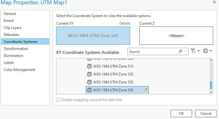
I've updated a map production script from ArcMap which imports a UTM layout and changes the coordinate system of the map to the correct UTM zone (based off the map centrepoint in MGRS that the user inputs).
That all works fine.
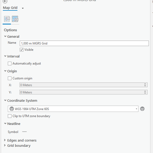
What doesn't work is the MGRS grid which maintains the coordinate system of the source layout and is therefore misaligned. While the user can manually reset this to the correct UTM zone through the UI (i.e. set coordinate system to the that of the updated map), is there anyway via python to force a refresh so that the map grid spatial reference matches the maps spatial reference?