- Home
- :
- All Communities
- :
- Developers
- :
- Python
- :
- Python Questions
- :
- Update ID Feature.
- Subscribe to RSS Feed
- Mark Topic as New
- Mark Topic as Read
- Float this Topic for Current User
- Bookmark
- Subscribe
- Mute
- Printer Friendly Page
Update ID Feature.
- Mark as New
- Bookmark
- Subscribe
- Mute
- Subscribe to RSS Feed
- Permalink
Hello,
I have point Feature, I need to update Point Feature Id to whose touch the Point Feature using Python Script. Kindly request to suggest me.

Regards,
Raj P
- Mark as New
- Bookmark
- Subscribe
- Mute
- Subscribe to RSS Feed
- Permalink
Hi Raj,
Take a look at using the Spatial Join function.
- Mark as New
- Bookmark
- Subscribe
- Mute
- Subscribe to RSS Feed
- Permalink
Could you maybe elaborate on what you are trying to do? What is touching the point feature? What is the Point Feature ID that you are trying to update? Do you have a completed example in an attribute table that you could share with us?
- Mark as New
- Bookmark
- Subscribe
- Mute
- Subscribe to RSS Feed
- Permalink
Helllo,
Line Features is touching the point Feature, So I need to update the PointID to the Line feature attribute table.
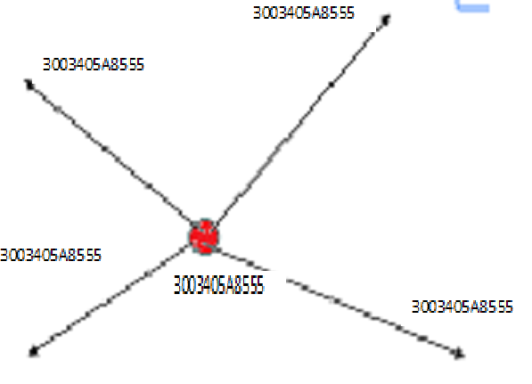
Point Feature:
OBJECTID * | Shape * | Gis ID | Point Name |
1 | Point | 3003405A8555 | TOWN-1 |
2 | Point | 3003405A8556 | TOWN-1 |
3 | Point | 3003405A8558 | TOWN-1 |
4 | Point | 3003405A8561 | TOWN-1 |
5 | Point | 3003405A8564 | TOWN-1 |
6 | Point | 3003405A8565 | TOWN-1 |
7 | Point | 3003405A8573 | TOWN-5 |
8 | Point | 3003405A8575 | TOWN-5 |
Line Feature:
OBJECTID * | Shape * | Gis ID | LineName |
1 | Polyline | 3003405A8555 | LT |
2 | Polyline | 3003405A8555 | HT |
3 | Polyline | 3003405A8555 | LT |
4 | Polyline | 3003405A8555 | LT |
5 | Polyline | 3003405A8564 | HT |
6 | Polyline | 3003405A8561 | LT |
7 | Polyline | 3003405A8573 | HT |
8 | Polyline | 3003405A8573 | LT |
Regards,
Raj P
- Mark as New
- Bookmark
- Subscribe
- Mute
- Subscribe to RSS Feed
- Permalink
You didn't answer the previous suggestions... does a spatial join not provide the necessary data? If so, they you can simply emulate the script example for spatial join or provide an example of your scripting attempts so far
- Mark as New
- Bookmark
- Subscribe
- Mute
- Subscribe to RSS Feed
- Permalink
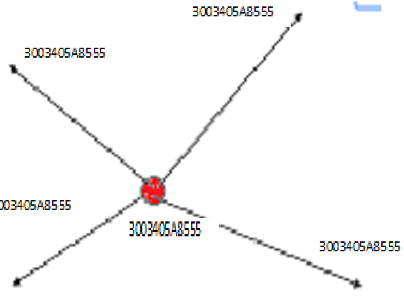
Hello,
I have Point Feature class, In these Point Feature is "GIS_ID" field, SO I need to update the "GIS_ID" values which Line Feature class touch the point feature using Python Script automatically.
Point Feature:
OBJECTID * | Shape * | Gis ID | Point Name |
1 | Point | 3003405A8555 | TOWN-1 |
2 | Point | 3003405A8556 | TOWN-1 |
3 | Point | 3003405A8558 | TOWN-1 |
4 | Point | 3003405A8561 | TOWN-1 |
5 | Point | 3003405A8564 | TOWN-1 |
6 | Point | 3003405A8565 | TOWN-1 |
7 | Point | 3003405A8573 | TOWN-5 |
8 | Point | 3003405A8575 | TOWN-5 |
Line Feature:
OBJECTID * | Shape * | Gis ID | LineName |
1 | Polyline | 3003405A8555 | LT |
2 | Polyline | 3003405A8555 | HT |
3 | Polyline | 3003405A8555 | LT |
4 | Polyline | 3003405A8555 | LT |
5 | Polyline | 3003405A8564 | HT |
6 | Polyline | 3003405A8561 | LT |
7 | Polyline | 3003405A8573 | HT |
8 | Polyline | 3003405A8573 | LT
|
Regards,
Raj P
- Mark as New
- Bookmark
- Subscribe
- Mute
- Subscribe to RSS Feed
- Permalink
I am not sure why you think your response is so much clearer when the original answer is repeated with bold faces sections. Mark Jake's reply correct, or provide the code that you have produces so far and are having trouble with.
- Mark as New
- Bookmark
- Subscribe
- Mute
- Subscribe to RSS Feed
- Permalink
If you are trying to see who last edited an item, you may want to look at ArcGIS Help working with edit tracking. To update a point ID field, you could maybe query the last edit date and then increment the ID. But as Luke mentioned, it's hard to know exactly what you are trying to do without a few more details.
- Mark as New
- Bookmark
- Subscribe
- Mute
- Subscribe to RSS Feed
- Permalink
Hello,
I have Point Feature class, In these Point Feature is "GIS_ID" field, SO I need to update the "GIS_ID" values which Line Feature class touch the point feature using Python Script automatically.
Point Feature:
OBJECTID * | Shape * | Gis ID | Point Name |
1 | Point | 3003405A8555 | TOWN-1 |
2 | Point | 3003405A8556 | TOWN-1 |
3 | Point | 3003405A8558 | TOWN-1 |
4 | Point | 3003405A8561 | TOWN-1 |
5 | Point | 3003405A8564 | TOWN-1 |
6 | Point | 3003405A8565 | TOWN-1 |
7 | Point | 3003405A8573 | TOWN-5 |
8 | Point | 3003405A8575 | TOWN-5 |
Line Feature:
OBJECTID * | Shape * | Gis ID | LineName |
1 | Polyline | 3003405A8555 | LT |
2 | Polyline | 3003405A8555 | HT |
3 | Polyline | 3003405A8555 | LT |
4 | Polyline | 3003405A8555 | LT |
5 | Polyline | 3003405A8564 | HT |
6 | Polyline | 3003405A8561 | LT |
7 | Polyline | 3003405A8573 | HT |
8 | Polyline | 3003405A8573 | LT
|

Regards,
Raj P
- Mark as New
- Bookmark
- Subscribe
- Mute
- Subscribe to RSS Feed
- Permalink
Then mark Jake Skinner's reply as the answer for sure. Just use spatial join with any of the optional parameters:
import arcpy
arcpy.SpatialJoin_analysis (pointFeatureClass, lineFeatureClass, outputFeatureClass,"JOIN_ONE_TO_MANY", "KEEP_ALL")