- Home
- :
- All Communities
- :
- Developers
- :
- Python
- :
- Python Questions
- :
- Grid inside polygon
- Subscribe to RSS Feed
- Mark Topic as New
- Mark Topic as Read
- Float this Topic for Current User
- Bookmark
- Subscribe
- Mute
- Printer Friendly Page
Grid inside polygon
- Mark as New
- Bookmark
- Subscribe
- Mute
- Subscribe to RSS Feed
- Permalink
I am trying to create a grid inside polygon. I applied a fishnet solution. Nevertheless, when I run the code the polygon is expanding (see attached photos). Could you point me what I am doing wrong? I am using the code that I have found in one of discussions. I have changed many things, but maybe I have omitted something important. Many thanks for help!
class NetButton(object):
"""Implementation for NetButton.button (Button)"""
def __init__(self):
self.enabled = True
self.checked = False
def onClick(self):
in_polys= ExcavationZone #established earlier as global
out_loc= "\\\\abc\\home\\xxx\\Documents\\moje dokumenty\\xyz\\arcgis" #final grid
cell_x= 0
cell_y= 0
n_rows= 30
n_cols= 30
# Create file gdb to store data
gdb = str(arcpy.CreateFileGDB_management(out_loc, 'Fishnets.gdb').getOutput(0))
# spatial reference
arcpy.env.outputCoordinateSystem = arcpy.Describe(in_polys).spatialReference
# Loop thru rows of input polygons
with arcpy.da.SearchCursor(in_polys, ['SHAPE@', 'OID@']) as rows:
for row in rows:
ext = row[0].extent
st = '%f %f' %(ext.XMin, ext.YMin)
orien = '%f %f' %(ext.XMin, ext.YMax)
# Create fishnet
out = os.path.join(gdb, 'fish_{0}'.format(row[1]))
arcpy.CreateFishnet_management(out, st, orien, cell_x,
cell_y, n_rows, n_cols,
labels='NO_LABELS',
geometry_type='POLYGON')
# set workspace to new gdb
arcpy.env.workspace = gdb
fishnets = arcpy.ListFeatureClasses()
targ = fishnets[0]
for i, fish in enumerate(fishnets):
# Add field for original polygon ID
fid = fish.split('_')[1]
arcpy.AddField_management(fish, 'POLY_ID', 'LONG')
with arcpy.da.UpdateCursor(fish, ['POLY_ID']) as rows:
for row in rows:
row[0] = fid
rows.updateRow(row)
# append fishnets into one feature class
if i > 0:
arcpy.Append_management([fish], targ, 'NO_TEST')
arcpy.Delete_management(fish)
print 'Appended: {0}'.format(fish)
print 'Done'
return
if __name__ == '__main__':
polys = "\\\\abc\\home\\xxx\\Documents\\moje dokumenty\\abc\\arcgis\\PolygonGrid"
loc = "\\\\abc\\home\\xxx\\Documents\\moje dokumenty\\abc\\arcgis"
CreateFishnetsForFeats(polys, loc, 100, 100, 22, 22)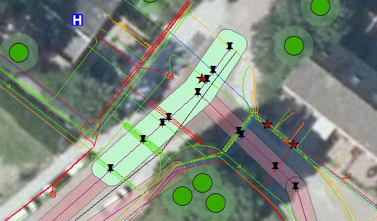
- Mark as New
- Bookmark
- Subscribe
- Mute
- Subscribe to RSS Feed
- Permalink
Ensure you are using a Projected Coordinate System for the input (and output) Feature Class with appropriate linear units (Meters/Feet).
Think Location
- Mark as New
- Bookmark
- Subscribe
- Mute
- Subscribe to RSS Feed
- Permalink
The "polygon" option does not necessarily limit within the polygon, but will make the output polygons (i.e. grid cells) vs. lines. (Try clipping if if you need that, but that may not b what you were asking)
geometry_type (Optional):Determines if the output fishnet cells will be polyline or polygon features.
- POLYLINE —Output is a polyline feature class. Each cell is defined by four line features.
- POLYGON —Output is a polygon feature class. Each cell is defined by one polygon feature.
But as Jayanta Poddar mention, it probably has something to do with the coordinate you are providing not being the same as the coordinates of the Feature Class.
I would review the help
Create Fishnet—Help | ArcGIS Desktop
How Create Fishnet works—Help | ArcGIS Desktop
and especially take note of this
Note:
The order of the parameters in the tool dialog box is different than the order of the parameters in the Python syntax.
If you have problems, it is always best to try it manually first using the tool, then you can see what the issue may be, and right-click the results to capture the python snippet...but the note above will be important when you go back to your tool.
- Mark as New
- Bookmark
- Subscribe
- Mute
- Subscribe to RSS Feed
- Permalink
Hi!
Thank you all for answers. Meanwhile I tried a little bit different approach. Because my next step is to create raster and assign values to it ( I want to create a risk map) I decided to first create an extent. Nevertheless, I don't know if it is a good approach, thus I will appreciate your suggestions and feedback in case you disagree with my idea. I was thinking that maybe Minimum Bounding Geometry would be better but I am not sure of that...
My code for creating an extent:
class NetButton(object):
"""Implementation for NetButton.button (Button)"""
def __init__(self):
self.enabled = True
self.checked = False
def onClick(self):
fc = ExcavationZone
ExtentOutput="\\\\abc\\home\\xxx\\Documents\\moje dokumenty\\xyz\\arcgis\\ExtentOutput"
mxd = arcpy.mapping.MapDocument ("CURRENT")
sr = mxd.activeDataFrame.spatialReference
desc = arcpy.Describe(fc)
extent = desc.extent
pts = [arcpy.Point(extent.XMin, extent.YMin),
arcpy.Point(extent.XMax, extent.YMin),
arcpy.Point(extent.XMax, extent.YMax),
arcpy.Point(extent.XMin, extent.YMax)]
#print extent.XMin,extent.YMin,extent.XMax,extent.YMax
print ("XMax:",extent.XMax,"YMax:",extent.YMax)
print ("XMin:",extent.XMin,"YMin:",extent.YMin)
print ("XMax:",extent.XMax,"YMax:",extent.YMin)
print ("XMax:",extent.XMin,"YMax:",extent.YMax)
array = arcpy.Array(pts)
poly = arcpy.Polygon(array,sr)
#New shapefile
if arcpy.Exists(ExtentOutput):
arcpy.Append_management(poly, ExtentOutput)
else:
arcpy.CopyFeatures_management(poly, ExtentOutput)
print "Done!"