- Home
- :
- All Communities
- :
- Industries
- :
- Transportation
- :
- Public Transit
- :
- Public Transit Questions
- :
- Re: how can i make a transit bus map (schematic) u...
- Subscribe to RSS Feed
- Mark Topic as New
- Mark Topic as Read
- Float this Topic for Current User
- Bookmark
- Subscribe
- Mute
- Printer Friendly Page
how can i make a transit bus map (schematic) using ArcGIS schematic? or any other product?
- Mark as New
- Bookmark
- Subscribe
- Mute
- Subscribe to RSS Feed
- Permalink
I have an opportunity with a client of mine, the scenario is as follow, they wanted to draw the transport lines on the map using GPS coordinates from the field, and after getting all the coordinates for the bus, they wanted to export as schematic map to be printed and distributed in every bus station.
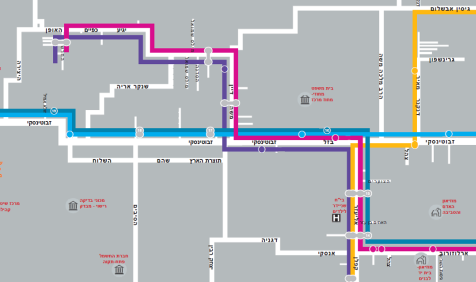
an example of the requested result

- Mark as New
- Bookmark
- Subscribe
- Mute
- Subscribe to RSS Feed
- Permalink
Hello
We have developed an automated process for the transportation ministry to do just this, based on geometric network of the bus routes & ArcGIS Schematics.
You can see a copy of the sample map we produced using this process on the ArcGIS Map Book Vol.28 (page 96): Map Book 28
If you want we can discuss possibilities of using the knowledge & code we have. Please contact me through email: [email protected] .
Regards