- Home
- :
- All Communities
- :
- User Groups
- :
- New to GIS
- :
- Questions
- :
- Re: Adding Points to a Existing Map
- Subscribe to RSS Feed
- Mark Topic as New
- Mark Topic as Read
- Float this Topic for Current User
- Bookmark
- Subscribe
- Mute
- Printer Friendly Page
Adding Points to a Existing Map
- Mark as New
- Bookmark
- Subscribe
- Mute
- Subscribe to RSS Feed
- Permalink
Hello- I am having one heck of a time just doing a simple thing on my map- not sure why.
the map is one I found in my office share drive, have repointed it to the server, and I am using 10.6
I need to add three different color points to mark off the Towns Parking lots handicap, 1,2,3 hour parking spaces.
It should very simple but I am not finding a way to does this.,
Could you make some suggestions to me?
Thanks for your support.
- Mark as New
- Bookmark
- Subscribe
- Mute
- Subscribe to RSS Feed
- Permalink
I think you're close. Try the following steps while you are in an edit session:
- In the Create Features window, right-click each entry and click Delete. Now your feature template will be gone. You'll see the message "There are no templates to show" in the Create Features window.
- In the Table of Contents, where you have the symbology you want, right-click the Parking Spots layer. On the context menu, point to Edit Features and click Organize Feature Templates.
- In the Organize Feature Templates dialog box, click New Template at the top.
- In the Create New Templates Wizard, the Parking Spots layer should appear with a check mark. Click Next.
- On the next panel of the wizard, you should see your layer symbols (the ones you want). Click Finish.
- Close the Organize Feature Templates dialog box.
Now in the Create Features window, I think the correct symbols will appear. You should be able to choose them and start adding points. There may be a problem with the <all other values> symbol because I don't think that entry can be part of a feature template. In your layer symbology, you may have to define a categorical value called Other so that it can be added to the feature template. But the rest should be okay, I think. Give it a try.
- Mark as New
- Bookmark
- Subscribe
- Mute
- Subscribe to RSS Feed
- Permalink
Tim- that seems to work-
Question on my attribute table- this doesn't look right to me-

- Mark as New
- Bookmark
- Subscribe
- Mute
- Subscribe to RSS Feed
- Permalink
You can assign the attributes to the table after if you want. It looks like you have 18 points of geometry and I presume that not all the attributes have all time attributes.
You do have a handicap spot in the one hour spot... was that a mistake? or a real limit
- Mark as New
- Bookmark
- Subscribe
- Mute
- Subscribe to RSS Feed
- Permalink
Hello Dan-
I did not put anything in there myself- I just wanted to check to see if there was anything-
It's odd to me how it got populated with so many points- I only need four.
Also not sure how but each column has all the "spots" in them except one- the handicap column
If it has no effect on the map- I could just leave it alone, however it would effect the map, I would like to edit it.
The challenge to me would be what should stay and what should go- I have to look up attribute tables and study them some more.
Any help appreciated as well
Thanks again Dan-
- Mark as New
- Bookmark
- Subscribe
- Mute
- Subscribe to RSS Feed
- Permalink
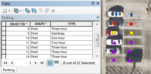
You probably don't want a field in the table for each parking value. You just need one field. Call it TYPE, for example. Then your different parking values go into that field. So your table would look more like this picture.

- Mark as New
- Bookmark
- Subscribe
- Mute
- Subscribe to RSS Feed
- Permalink
Thanks Tim- So I paired down the table to one "type" and so then I added the missing points. When I did, I noticed that additional Objectid where added. So I summarized that each point will get it each Object ID- which is like a excel sheet-
which I sure has a benefit in terms of figuring out how many of these parking spaces do we have in out town...very interesting.
- Mark as New
- Bookmark
- Subscribe
- Mute
- Subscribe to RSS Feed
- Permalink
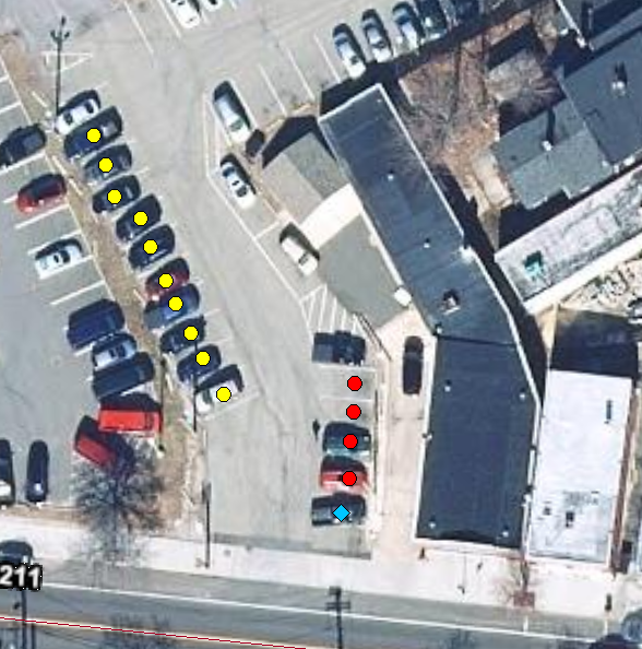
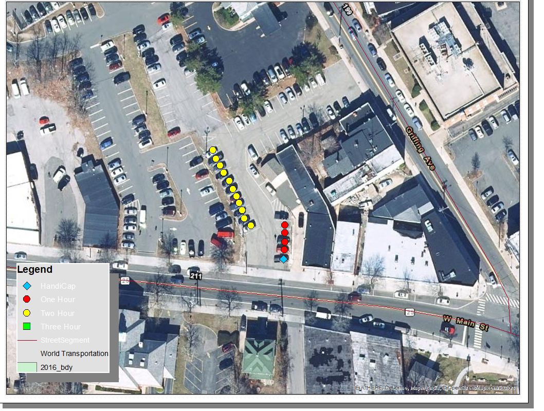
Here is a picture is what I have so far.

Need to figure out how to make a legend after my maps are done..
- « Previous
-
- 1
- 2
- Next »
- « Previous
-
- 1
- 2
- Next »
