- Home
- :
- All Communities
- :
- Developers
- :
- Native Maps SDKs
- :
- .NET Maps SDK Questions
- :
- Re: Soil survey shows holes in 100.5
- Subscribe to RSS Feed
- Mark Topic as New
- Mark Topic as Read
- Float this Topic for Current User
- Bookmark
- Subscribe
- Mute
- Printer Friendly Page
Soil survey shows holes in 100.5
- Mark as New
- Bookmark
- Subscribe
- Mute
- Subscribe to RSS Feed
- Permalink
Hi,
We are in the process of migrating our android and iOS xamarin apps from 10.2.
One of the maps we are using: soil survey, is showing holes in certain areas of the map. It looks like lakes and bodies of water are displayed as holes. Version 10.2 show the same areas are gray areas.
Additionally, version 100.5 does not return any results after calling IdentifyLayerAsync. 10.2 is able to give us the soil information that we need to display in our app.
In 10.2 we were using a AGSTiledMapServiceLayer while in 100.5 we are using ArcGISMapImageLayer.
Is there something in particular that we need to do differently in version 100.5 to achieve the same behavior as in 10.2
Best,
Hector
- Mark as New
- Bookmark
- Subscribe
- Mute
- Subscribe to RSS Feed
- Permalink
I am not sure what kind of differences your are seeing but I do see you are using wrong layer type between two versions 10.2 and 100.5.
AGSTiledMapServiceLayer in 10.2 version translates to "ArcGISTiledLayer" in ArcGIS Runtime SDK 100.5 version. I think if you switch layer type to ArcGISTiledLayer it will render as you expected.
Please refer to:
Just as an FYI, the latest released version of SDK is 100.7 , if you want to move to latest.
- Mark as New
- Bookmark
- Subscribe
- Mute
- Subscribe to RSS Feed
- Permalink
Hi Preeti Maske,
Thanks a lot for your quick response!
I had already tried using ArcGISTiledLayer but got the same results.
I was able to reproduce the issue in both Android and iOS using v100.7.0 in the samples solution from ESRI ArcGIS
I used the ArcGISTiledLayerUrl.cs samples and used the following code to reference the soil layer:
private void Initialize()
{
// Create new Map
Map myMap = new Map();
// Create uri to the tiled service
Uri serviceUri = new Uri(
"https://server.arcgisonline.com/ArcGIS/rest/services/Specialty/Soil_Survey_Map/MapServer");
//Uri serviceUri = new Uri(
// "https://services.arcgisonline.com/arcgis/rest/services/World_Topo_Map/MapServer");
// Create new tiled layer from the url
ArcGISTiledLayer imageLayer = new ArcGISTiledLayer(serviceUri);
// Add created layer to the basemaps collection
myMap.Basemap.BaseLayers.Add(imageLayer);
// Assign the map to the MapView
_myMapView.Map = myMap;
//Zoom to location around Page Lake MN
_myMapView.SetViewpointCenterAsync(45.525613, -95.806157, 7e4);
}
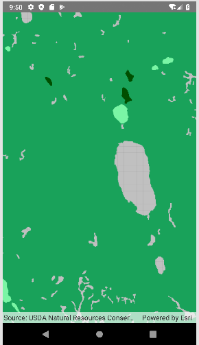
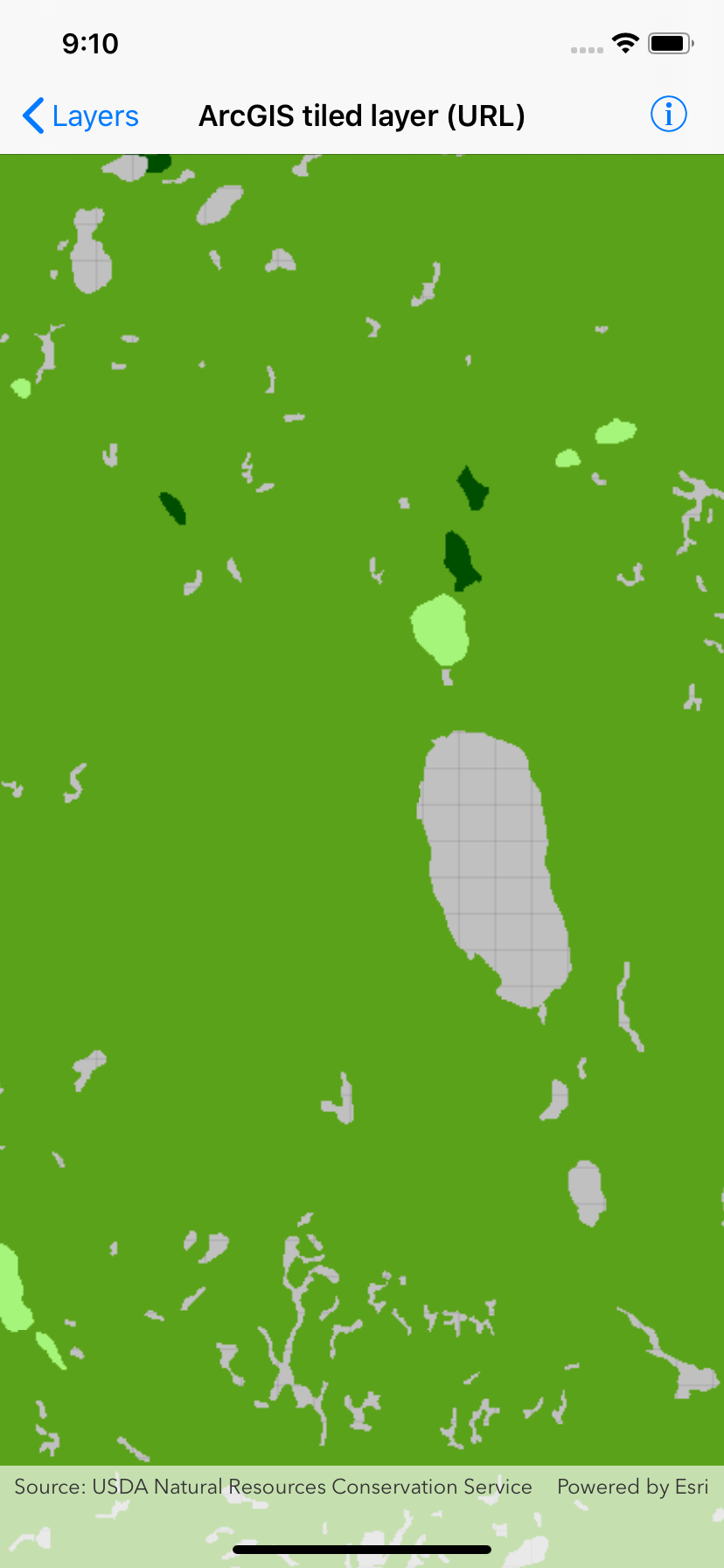
Here are some screenshots of what I'm seeing:
Soil Layer in Android v100.7

Soil Layer in iOS v100.7

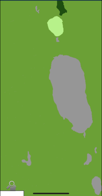
by contrast, the soil layer displays correctly in our current version 10.2

Hopefully there's something else I can try to fix this issue. BTW, I don't see any errors happening while executing the new code in v100.7.
Best,
Hector
- Mark as New
- Bookmark
- Subscribe
- Mute
- Subscribe to RSS Feed
- Permalink
Hector, I don't think what you are seeing is a bug. It is merely a difference in ArcGISTiledlayer rendering at different Lods in two versions.
I can see that at 10.2 the grid lines show up at different scale when compared to 100.7. See First two images for 10.2 above. First one does not show the grid lines but as I zoom in the grid lines start showing up. However in third image which is 100.7, the grid appears much sooner and it is not a bug because there is actually no data in those areas at those levels.
The image you had for 10.2 was on android device and perhaps the background is darker on Android ( I haven't tested that). My test app was a WPF app using 10.2 and 100.7, but it shouldn't matter.
I am almost certain if you zoom in further you will see the grid. It's hard to see the grey grid lines on dark gray. Perhaps there is MapBackground set in your for 10.2 app?
I hope it makes sense. Please let me know if you still have concerns or questions.
-Preeti
- Mark as New
- Bookmark
- Subscribe
- Mute
- Subscribe to RSS Feed
- Permalink
You are right Preeti, v 10.2 of our app sets the background to gray and the grid width to 0. Therefore it looks like there's no hole but a gray type of "soil"...
Thanks!!
- Mark as New
- Bookmark
- Subscribe
- Mute
- Subscribe to RSS Feed
- Permalink
Good to know 🙂