- Home
- :
- All Communities
- :
- Developers
- :
- Native Maps SDKs
- :
- .NET Maps SDK Questions
- :
- Re: Incorrect results of GeometryEngine.Project fo...
- Subscribe to RSS Feed
- Mark Topic as New
- Mark Topic as Read
- Float this Topic for Current User
- Bookmark
- Subscribe
- Mute
- Printer Friendly Page
Incorrect results of GeometryEngine.Project for EPSG:31468 in 10.2.6
- Mark as New
- Bookmark
- Subscribe
- Mute
- Subscribe to RSS Feed
- Permalink
Hello,
I recently updated our runtime Version from 10.2.4 to 10.2.6. Now there is a incorrect projection from EPSG:31468 to EPSG:4326.
Example:
var mappoint = new MapPoint(4594314.825,5821864.005, new SpatialReference(31468));
var projectedMappoint = GeometryEngine.Project(mappoint, new SpatialReference(4326));
Result 10.2.4:
var mappoint = {MapPoint[X=4594314.825, Y=5821864.005, Wkid=31468]}
var projectedMappoint = {MapPoint[X=13.3880091660746, Y=52.5217421380065, Wkid=4326]}
Results 10.2.6 & 10.2.7:
var mappoint = {MapPoint[X=4594314.825, Y=5821864.005, Wkid=31468]}
var projectedMappoint = {MapPoint[X=13.3897513416898, Y=52.5231506263074, Wkid=4326]}
I doublechecked the result on different websites and my results is, the calculation in the new version is not correct any more.
Can anybody please check this for me or give me a hint, where I can open a support ticket.
Thanks a lot!
- Mark as New
- Bookmark
- Subscribe
- Mute
- Subscribe to RSS Feed
- Permalink
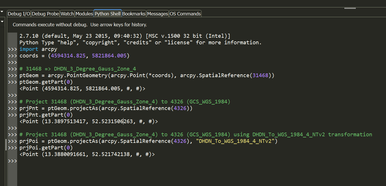
It looks like 10.2.4 was applying a transformation and 10.2.6/10.2.7 aren't applying the transformation. I can get both results using python against ArcGIS for Desktop 10.4.

- Mark as New
- Bookmark
- Subscribe
- Mute
- Subscribe to RSS Feed
- Permalink
Hi Oliver,
Please can you add your repro app / test code which demonstrates this issue? That will help us greatly when investigating this issue.
Question:
- Are both the 10.2.4 app and the 10.2.7 app running as the same target architecture? i.e. 32-bit or 64-bit
- Are both the 10.2.4 app and the 10.2.7 app running on the same machine?
Cheers
Mike
- Mark as New
- Bookmark
- Subscribe
- Mute
- Subscribe to RSS Feed
- Permalink
Hello Mike,
Both apps are running on the same machine. I only changed the runtime Version for investigating the false map placement. My System is a Windows 7 x64. We are using Visuals Studio 2012 for developing.
It's definitely the different version of the runtime.
My example from above:
var mappoint = new MapPoint(4594314.825,5821864.005, new SpatialReference(31468));
var projectedMappoint = GeometryEngine.Project(mappoint, new SpatialReference(4326));
await _MapView.SetViewAsync(mappoint, 2000);
This code snippet should be enough to reproduce the differnt results.
The differences are only a few hundred meters.
Cheers
Oliver
- Mark as New
- Bookmark
- Subscribe
- Mute
- Subscribe to RSS Feed
- Permalink
Hello,
could you find out anything? Currently I am using a third party library for projecting. This is definitely a bug.
Is it possible to force the runtime using the transformation? This would help me.
Cheers
Oli
- Mark as New
- Bookmark
- Subscribe
- Mute
- Subscribe to RSS Feed
- Permalink
Try using ArcGIS for Server's Geometry Service's project end point. You have more control with it as it allows you to specify the geotransformation parameters rather than depending on the runtime to select some default for you. Alternatively, you can use the service without the datum transformation and direction parameters, and it would assume these for you (although I've always supplied them when i know a transformation is required)