- Home
- :
- All Communities
- :
- Industries
- :
- Natural Resources
- :
- Natural Resources Questions
- :
- Re: Struggling with raster reclass?
- Subscribe to RSS Feed
- Mark Topic as New
- Mark Topic as Read
- Float this Topic for Current User
- Bookmark
- Subscribe
- Mute
- Printer Friendly Page
Struggling with raster reclass?
- Mark as New
- Bookmark
- Subscribe
- Mute
- Subscribe to RSS Feed
- Permalink
Hey everyone,
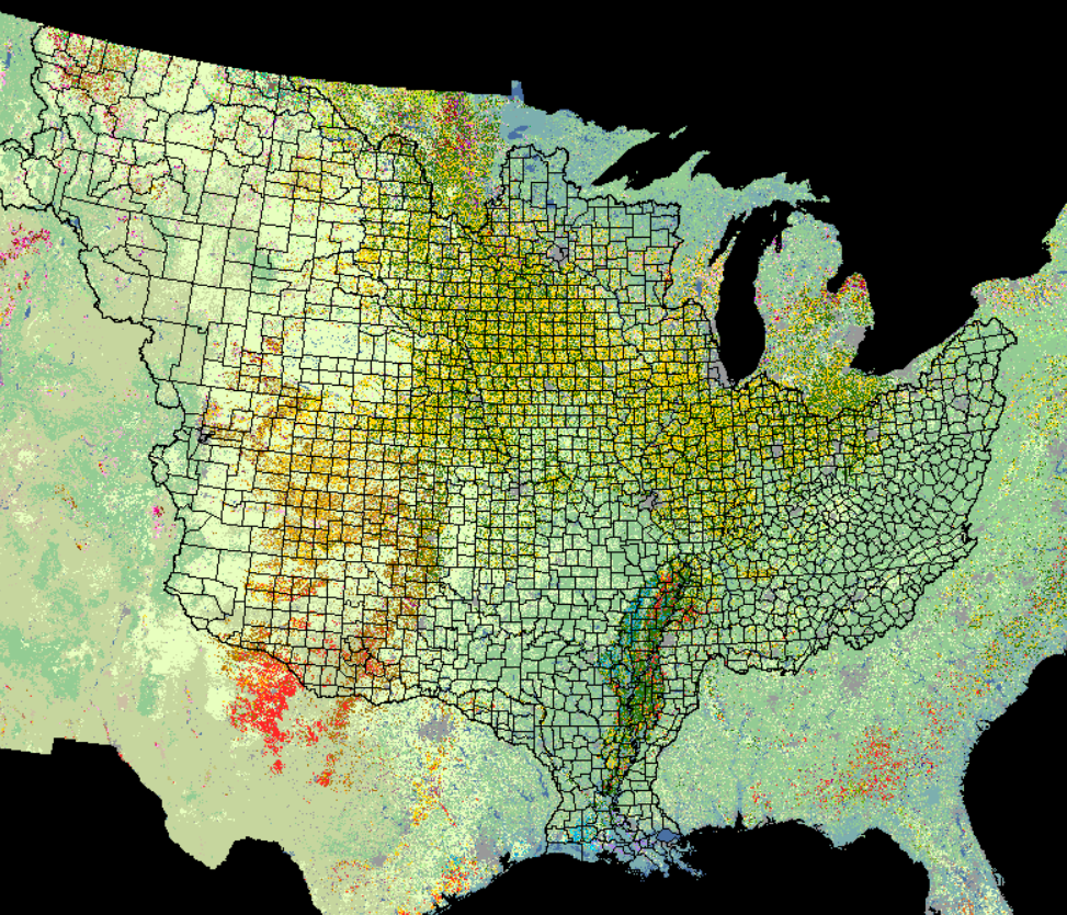
I have a 2017 Land use-Land Cover map of the US that I'm trying to reclassify. It has 256 different values right now and my plan is to only have nine at the end - a few crops I care about and 'other'. I made a table in Excel that I'm trying to import into the reclassify tool so I won't have to change 256 values in ArcMap by hand.
The table is, for example,
| Input Cell Values | Output Reclassified Values |
|---|---|
| 0 | 9 |
And so on. When I try to load the table into the reclassify tool, it says "error, couldn't load table" and nothing else. I've tried it as a .xslx and a .txt file
Additionally, when I try loading the table to my ArcMap file first, it then becomes corrupted and I can't open that file from my desktop anymore.
Please let me know if you know what to do or if you need more info.
Thanks
Here's an example of my data
- Mark as New
- Bookmark
- Subscribe
- Mute
- Subscribe to RSS Feed
- Permalink
Reclass by Table—Help | ArcGIS Desktop
There are lots of mini-rules, but if you have it in Excel, bring it into arcmap or ArcGIS pro using the Excel to Table tool to check that it is consistent with the requirements. If the columns are of the wrong type (ie text instead of integer) you will know pretty quickly that it is not good.
- Mark as New
- Bookmark
- Subscribe
- Mute
- Subscribe to RSS Feed
- Permalink
I've converted my table, but I'm still getting the same error when I try to load it as a remap table. There are no spaces or special characters in the table, though.
- Mark as New
- Bookmark
- Subscribe
- Mute
- Subscribe to RSS Feed
- Permalink
time to show the table... screen grab if it is a geodatabase table... excel is too iffy.
And when you say things get corrupt right away.
make sure you do testing with the data stored on your local machine to rule out server or web or whatever issues.
Simple folder, no spaces or other flotsam in the paths is best
- Mark as New
- Bookmark
- Subscribe
- Mute
- Subscribe to RSS Feed
- Permalink
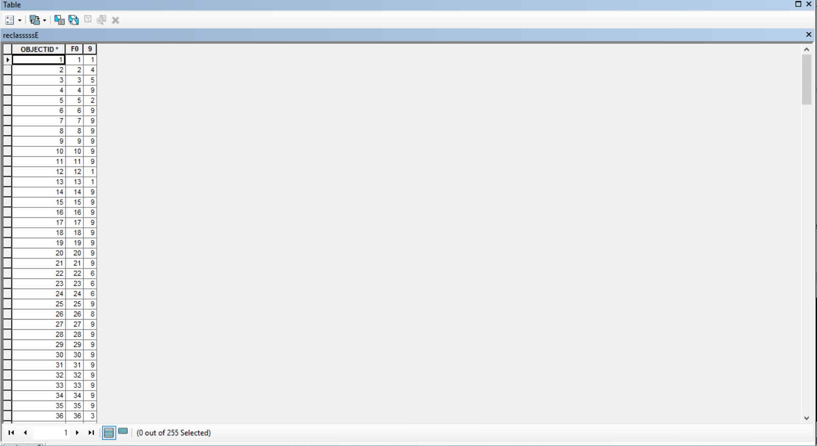
Here's the table in question. Part of it, at least.
- Mark as New
- Bookmark
- Subscribe
- Mute
- Subscribe to RSS Feed
- Permalink
the 'to' field name is a number... probably not good. How did that happen?
- Mark as New
- Bookmark
- Subscribe
- Mute
- Subscribe to RSS Feed
- Permalink
Y'know what, I goofed up. The first row was 0,9 and should have been something to be converted. I'll try giving them some normal names and let you know.
- Mark as New
- Bookmark
- Subscribe
- Mute
- Subscribe to RSS Feed
- Permalink
I fixed the column names to "O" and "N" and it still failed, here's a screengrab of the failure in the results
- Mark as New
- Bookmark
- Subscribe
- Mute
- Subscribe to RSS Feed
- Permalink
Ok... simple folder, not users and not a folder that begins with a number especially if you aren't specifying a file a file extension for the output raster since it will default to an esri grid which won't accept numbers for the first letter of the name and no spaces and less than 10 characters.
Is your table IN a geodatabase (just checking).
Where is the input raster stored? (check the "Inputs" section of the error message
Make sure you specify a file extension (tif is preferred) for the raster AND put it in a folder … ie c:/myfolder/MyReclassedRaster.tif
- Mark as New
- Bookmark
- Subscribe
- Mute
- Subscribe to RSS Feed
- Permalink
Besides what Dan Patterson specified, ensure there are no spaces in filename and folders. Having a space can be the kiss of death when running raster processes. If a space was used for clarity, use an underscore _ instead.
For example, the path showing in the run message appears to end with "2017RC DATA". Throw an underscore in there instead of the space. I.E. "2017RC_DATA".
It terms of file naming and structure, Rasters are finicky...
Chris Donohue, GISP