- Home
- :
- All Communities
- :
- Industries
- :
- Natural Resources
- :
- Mining
- :
- Mining Questions
- :
- Re: Why won't my Georeferenced JPGs draw online?
- Subscribe to RSS Feed
- Mark Topic as New
- Mark Topic as Read
- Float this Topic for Current User
- Bookmark
- Subscribe
- Mute
- Printer Friendly Page
Why won't my Georeferenced JPGs draw online?
- Mark as New
- Bookmark
- Subscribe
- Mute
- Subscribe to RSS Feed
- Permalink
- Report Inappropriate Content
I am running into an issue with JPGs I have georeferenced not drawing in ArcGIS Online web map, or in its web application. I created the map and did all the work in ArcPro, and the JPGs will display in Pro. I have adjusted all the sharing settings as well as the visible range settings. I am adding JPGs of topo maps in an area a coworker needs to collect data using ArcCollector. She wants to be able to use the topo JPG and she her location represetned on the map, similar to Avenza.
Any help wold be greatly appreciated.
Thanks
- Mark as New
- Bookmark
- Subscribe
- Mute
- Subscribe to RSS Feed
- Permalink
- Report Inappropriate Content
does the other application use world files to position the raster?
- Mark as New
- Bookmark
- Subscribe
- Mute
- Subscribe to RSS Feed
- Permalink
- Report Inappropriate Content
Michael,
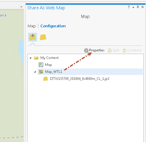
In ArcGIS Pro you are Sharing as Webmap?
If so, click Configuration

A tile service will be created for the Image layer in your map... Click to highlight it, and click properties.
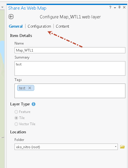
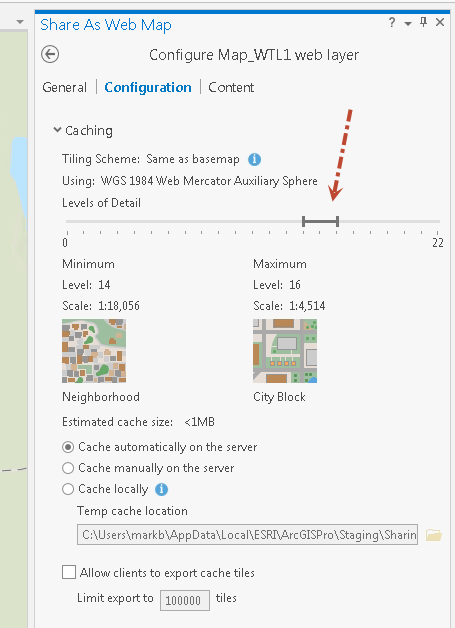
Then click Configuration for it.
This will show you at which scales the layer will be view-able, check to make sure this works for you.
Is your Collector user going to be working offline?
There is another option for putting a basemap on the collector device that can be used with the editable webmap.
Go offline—Collector for ArcGIS | ArcGIS
Basically, in ArcGIS Pro you can use the Create Map Tile Package tool, to convert your JPG into a tile package (.TPK) The tile package can be put on the users device, and be used as a basemap.
Mark
- Mark as New
- Bookmark
- Subscribe
- Mute
- Subscribe to RSS Feed
- Permalink
- Report Inappropriate Content
Hi Mark,
I have published my jpgs as hosted tile layers to my ArcGIS online account. I have the level of detail all the way in both directions, and the sharing enabled for the jpgs. Whats odd is that when I open my map in ArcPro (where I created the map) the JPGs will draw in the correct georeference location. When I open my web map created from this Pro map, the images do not draw nor do I get any error messages about them not drawing. This issue is the same for the web app I built for the web map to be viewed by my coworkers. Again, when i open the map in Collector I have the JPGs as layers but when I click them on nothing draws, again with no errors.
thanks for reaching out
Michael
- Mark as New
- Bookmark
- Subscribe
- Mute
- Subscribe to RSS Feed
- Permalink
- Report Inappropriate Content
Michael,
Not sure about the cause of the problem, but
What coordinate system are you using? in Pro and the Webmap
Which basemap are you using in your webmap?
Mark
- Mark as New
- Bookmark
- Subscribe
- Mute
- Subscribe to RSS Feed
- Permalink
- Report Inappropriate Content
Mark,
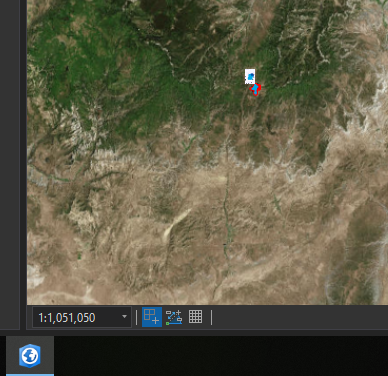
It is very odd, when I zoom to the layer, the map will zoom to the correct place though nothing draws. I am using UTM NAD 1983 Zone 12N as the coordinate system throughout my maps and layers. I am using the ESRI "Imagery with labels" as my base map.
Michael
- Mark as New
- Bookmark
- Subscribe
- Mute
- Subscribe to RSS Feed
- Permalink
- Report Inappropriate Content
In ArcGIS Pro, when you press the full extent zoom button, does the extent for the map include the extent of your image layer?

I set a custom extent for the map, that did not align with the imagery, and was able reproduce similar behavior in the webmap. The Tile layer would not display.
Mark
- Mark as New
- Bookmark
- Subscribe
- Mute
- Subscribe to RSS Feed
- Permalink
- Report Inappropriate Content
Yes, when zoomed to full extent my jpgs are within the extent of my map. I have re-published the images to arconline but I am still running into the problem.