- Home
- :
- All Communities
- :
- Products
- :
- Mapping
- :
- Mapping Questions
- :
- The First Ecological Land Units Map of the World
- Subscribe to RSS Feed
- Mark Topic as New
- Mark Topic as Read
- Float this Topic for Current User
- Bookmark
- Subscribe
- Mute
- Printer Friendly Page
The First Ecological Land Units Map of the World
- Mark as New
- Bookmark
- Subscribe
- Mute
- Subscribe to RSS Feed
- Permalink
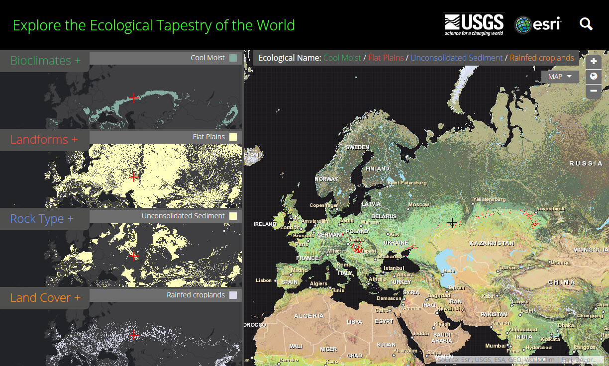
The U.S. Geological Survey (USGS) and Esri are pleased to announce the publication of the most detailed global ecological land units map in the world. This exciting new global content provides a science platform for better understanding and accounting of the world’s resources. Scientists, land managers, conservationists, developers and the public will use this map to improve regional, national and global resource management, planning and decision making.
Find out more: http://esriurl.com/8674
- Mark as New
- Bookmark
- Subscribe
- Mute
- Subscribe to RSS Feed
- Permalink
Classification: UNCLASSIFIED
Caveats: NONE
Hello Katie,
This is an outstanding product. And very addicting. so many places I need
to visit.
Check out the following, I think the description is misplaced. Or I'm just
missing something.
Thanks for sending this out,
Mark
Slide 30:
Beinn na Duatharach SCOTLAND, UNITED KINGDOM
"Above the Komati River Gorge in the Drakensberg, South Africa, this area of
breaks and hills has a warm moist climate. The vegetation here is closed to
open savanna, with closed to open patches of shrubs and trees."
Mark Books, CF
Remote Sensing/GIS Forester
CSU-CEMML @ Fort A.P. Hill, VA
DSN (312) 578 - 8753
Phone (804) 633 - 8753
mark.a.books.ctr@mail.mil
CEMML-CSU_HORIZONTAL_BlackBackground
Please provide feedback on the support provided to you from the Directorate
of Public Works at:
http://ice.disa.mil/index.cfm?fa=site
<http://ice.disa.mil/index.cfm?fa=site&site_id=357&dep=DoD>
&site_id=357&dep=DoD
- Mark as New
- Bookmark
- Subscribe
- Mute
- Subscribe to RSS Feed
- Permalink
Thanks Mark! I actually don't see the slide post description you outlined above. I've looked into it but I haven't been able to find it.