- Home
- :
- All Communities
- :
- Products
- :
- Mapping
- :
- Mapping Questions
- :
- small labels drastically increase PDF size
- Subscribe to RSS Feed
- Mark Topic as New
- Mark Topic as Read
- Float this Topic for Current User
- Bookmark
- Subscribe
- Mute
- Printer Friendly Page
small labels drastically increase PDF size
- Mark as New
- Bookmark
- Subscribe
- Mute
- Subscribe to RSS Feed
- Permalink
Is it normal for labels to triple the file size of an exported PDF?
I have a moderately complex map consisting of a raster background with a few thousand polyline features overlaid (roadway network). Exporting this to PDF produces a <10 MB file.
When I enable a separate layer contains labels, and re-export, the file-size bloats to over 20MB. These are just basic labels consisting of a white circle with a number inside.
Here's a screenshot of a section of the map with and without labels.
How does a few hundred (at most) labels increase the file-size by that much?!
Thanks in advance for any advice on reducing the bloat due to labeling.
- Mark as New
- Bookmark
- Subscribe
- Mute
- Subscribe to RSS Feed
- Permalink
I think that is regular behavior since these labels are essentially OCR'd and will be drawn to scale.
Here are some suggestions on reducing the PDF file size:
36524 - Reduce the size of PDFs exported from ArcMap
Also, there is an idea on reducing PDF file size on stack exchange:
- Mark as New
- Bookmark
- Subscribe
- Mute
- Subscribe to RSS Feed
- Permalink
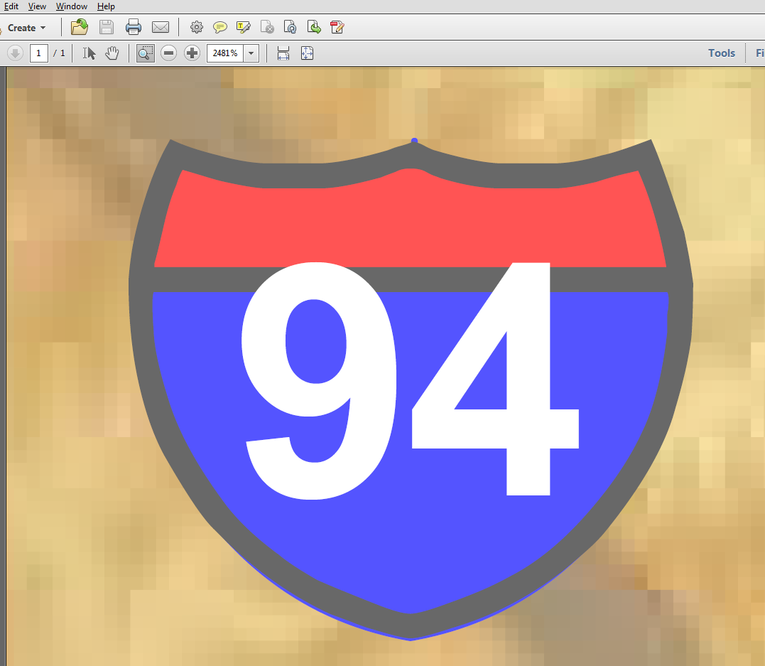
Thanks Adrian. I was able to reduce the file-size by 50% using some of the ideas from the pages you suggested!! Still nowhere near the size without labels.
You're correct that the labels are being exported as text (I think this is what you mean by OCR) with a vector background to represent the highway shield. The quality never degrades no matter how far I zoom (see screenshot from Adobe Acrobat - zoomed in to a ~5x5 mile area)
That's why this doesn't make any sense (to me - with my set of assumptions). Text and vectors are normally very efficient. And most of the labels are just a white circle with a number inside! I would think only a few dozen KB would be necessary.