- Home
- :
- All Communities
- :
- Products
- :
- Mapping
- :
- Mapping Questions
- :
- Sharing Maps
- Subscribe to RSS Feed
- Mark Topic as New
- Mark Topic as Read
- Float this Topic for Current User
- Bookmark
- Subscribe
- Mute
- Printer Friendly Page
Sharing Maps
- Mark as New
- Bookmark
- Subscribe
- Mute
- Subscribe to RSS Feed
- Permalink
Hi everybody,
OK, I am trying to find the best way to share maps with colleagues and clients whereby the original map can be interrogated but not edited.
The original map is being produced in ArcGIS for Desktop however not all viewers have access to ArcGIS desktop.
I thought ArcGIS Explorer could open .mxd files however when I have tried to access the map I am looking to share, the only file type available to open is an .nmf file.
So my question is, what and how is the best way to share a map that can pan, zoom, identify, select and deselect layers, keep the zoom extents, keep all hyperlinks, and show the attribute table.
Any comments / suggestions welcome.
Thanks in advance
- Mark as New
- Bookmark
- Subscribe
- Mute
- Subscribe to RSS Feed
- Permalink
Have you considered using ArcGIS Online? You can create your map as well as webmap applications so you can share information among your colleagues.
- Mark as New
- Bookmark
- Subscribe
- Mute
- Subscribe to RSS Feed
- Permalink
I have only used ArcGIS online through a mooc.
Is ArcGIS Online free? And will the map have to be produced on ArcGIS online or can you upload mxd's from the desktop version?
Is there anyway of achieving my goal without online?
Thanks
- Mark as New
- Bookmark
- Subscribe
- Mute
- Subscribe to RSS Feed
- Permalink
Hi Jodie,
Try working with Layer Package. You could open it in ArcGIS Explorer from Add Layer.
Thanks,
Jay
Think Location
- Mark as New
- Bookmark
- Subscribe
- Mute
- Subscribe to RSS Feed
- Permalink
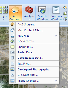
Jodie,
This video shows working with local data (shapefile and layer package) it shows a strategy for leveraging ArcGIS
online.
As Jayanta states you can add Layer Packages (ArcGIS Layers) directly via the Add Content button.
Mark