- Home
- :
- All Communities
- :
- Products
- :
- Mapping
- :
- Mapping Questions
- :
- Re: Importing GPS Coordinates from Excel into ArcM...
- Subscribe to RSS Feed
- Mark Topic as New
- Mark Topic as Read
- Float this Topic for Current User
- Bookmark
- Subscribe
- Mute
- Printer Friendly Page
Importing GPS Coordinates from Excel into ArcMap
- Mark as New
- Bookmark
- Subscribe
- Mute
- Subscribe to RSS Feed
- Permalink
Dear All,
I am Nancy, new to ArcGIS, and I appreciated anyone's help here!
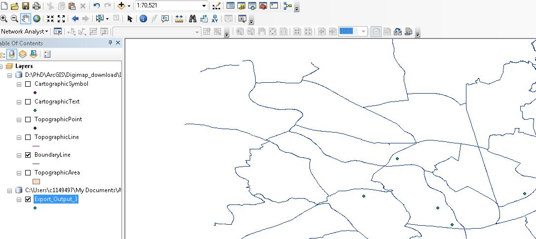
When I was trying to import Coordinates from Excel into ArcMap, I followed the step from the help menu, it really helped. When it was finished, it shows on the map window (which is shown below). However, then when I add my map (Download from Digimap), it only showed the coordinates, not showing the map. And then I tried add map first, it showed on the map window properly, and then add coordinates, unfortunately, the coordinates are not showing on the map.
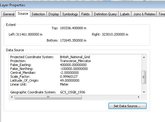
Firstly, I checked the coordinates system. They are the same using British National Grid for projected coordinates system and for Geographic coordinate system, GCS_OSGB_1936 are selected as default.
Then, I added data, coordinates and map many times, it gave me same results. It seems that the coordinates could not show on my map.
Thanks for helping!
Nancy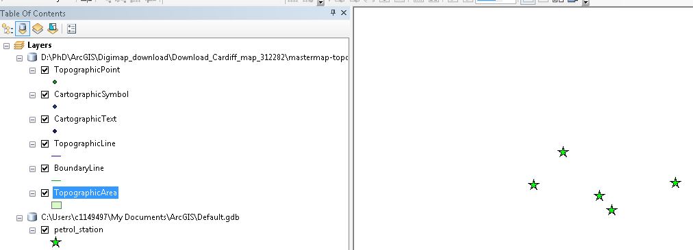
Solved! Go to Solution.
- Mark as New
- Bookmark
- Subscribe
- Mute
- Subscribe to RSS Feed
- Permalink
Under the hood all GPS units use WGS84 geographic coordinates. I am guessing that a coordinate system hasn't been applied to the data when it was imported so ArcMap can't reproject it to match your other map data. Following these steps should resolve the issue:
Open a blank map document in ArcMap then go to File > Add Data > Add XY Data
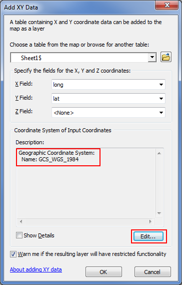
Click on the Edit button then browse to Geographic Coordinate Systems > World > WGS84. The Coordinate System should now show GCS_WGS_1984.
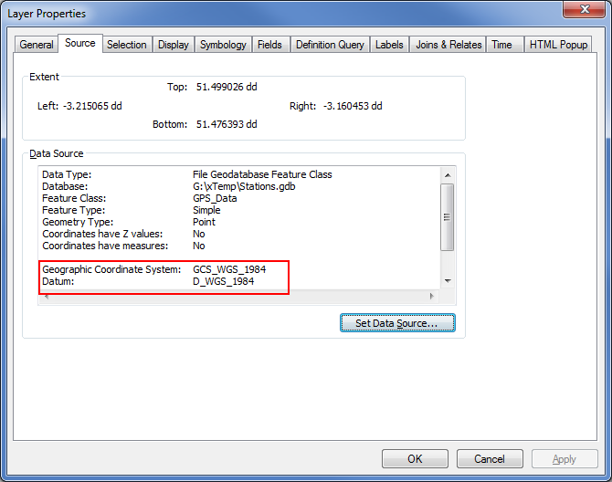
After the xy-event layer is added to the map you can export it to a feature class by right-clicking on it and selecting Data > Export Data.
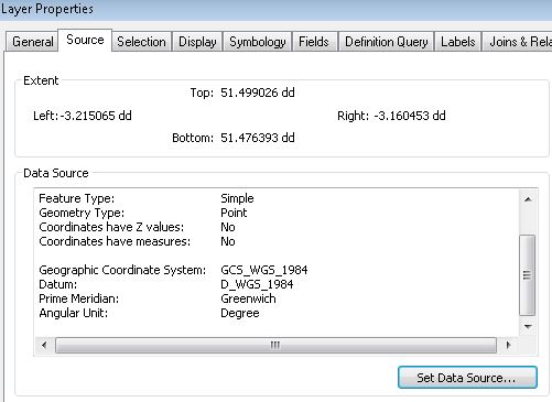
Export all features using the same coordinate system as the source data. When prompted add the feature class to the map. If you check the layer properties you will notice that the data has the correct coordinate system assigned:
When you add this data to your other map data ArcMap should be able to reproject your GPS points on the fly to match the coordinate system of your map.
If there are alignment issues you may need to apply a datum transformation within ArcMap or when projecting the data to match your other data.
- Mark as New
- Bookmark
- Subscribe
- Mute
- Subscribe to RSS Feed
- Permalink
Hey Owen,
Thanks for your help! It works now, the locations show on my map.
The only thing I am confused here is that the two layers are in different geographic coordinates system, station locations layer is in GCS_WGS_1984, however, my map is in GCS_OSGB_1936, and it works fine, actually, I dont have to project the station location to match my map data.
Thanks again!
Nancy
- « Previous
-
- 1
- 2
- Next »
- « Previous
-
- 1
- 2
- Next »