- Home
- :
- All Communities
- :
- Products
- :
- Mapping
- :
- Mapping Questions
- :
- Re: How to view results of geocoding?
- Subscribe to RSS Feed
- Mark Topic as New
- Mark Topic as Read
- Float this Topic for Current User
- Bookmark
- Subscribe
- Mute
- Printer Friendly Page
- Mark as New
- Bookmark
- Subscribe
- Mute
- Subscribe to RSS Feed
- Permalink
Hello,
I'm very new to ArcGIS and I'm trying to get started using it. I have created an excel file with just one address and I went through and geocoded it, but i'm not sure how to view the results? How can I add the census address data?
Please excuse me if I'm asking a very simple question.
Thank you
Solved! Go to Solution.
Accepted Solutions
- Mark as New
- Bookmark
- Subscribe
- Mute
- Subscribe to RSS Feed
- Permalink
If you ran the Geocoding process "Geocode a table of addresses" (button on toolbar), it creates a feature class as an output.

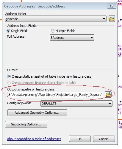
Which process did you use to Geocode?
Chris Donohue, GISP
- Mark as New
- Bookmark
- Subscribe
- Mute
- Subscribe to RSS Feed
- Permalink
The geocoding process should have created a point feature class with a single entry in it. IF not somethings not right.
Is the census address data you have in the form of a feature class or a table of addresses? Either way, just use the add data button and navigate to where it is.
- Mark as New
- Bookmark
- Subscribe
- Mute
- Subscribe to RSS Feed
- Permalink
If you ran the Geocoding process "Geocode a table of addresses" (button on toolbar), it creates a feature class as an output.
Which process did you use to Geocode?
Chris Donohue, GISP
- Mark as New
- Bookmark
- Subscribe
- Mute
- Subscribe to RSS Feed
- Permalink
Thank you both for your replies.
This is what I did.
1. I went to file -> Data -> Add Data and added my xlsx file which has 5 test addresses with Address, City, State and Zip columns.
2. Once it is added under layers in the left panel I right click on Sheet1$ and click on Geocode Addresses and select "Composite_US" as the address locator. I'm not sure for what i'm doing if this is the best locator. I click OK
3. Then the Geocode Addresses menu appers. Everything looks correct so I click OK. All 5 addresses have a match.
4. Now I see 5 red dots on a white backaground. Am I supposed to load a map of the US before I do this?
5. I right click on the Geocoding_Results on the left and go to "Join and Relate" and click join.
6. It tells me to choose a layer, but I need multiple layers because I need to get Census Tract, Block, Block Group, Place, Fips St, Fips County, etc.
If I use the county level file will it give me the tract, block, places, etc.. or do I have to use each file?
7. I selected census counties and left "it falls inside" as the radio button selected.
8. It is also creating a shp file called Join_Output.shp. I click OK and a Join_Output shows in the left panel.
9. Now when I right click on Join_Output in the left panel and right click I can click on "Open attribute table" and I see the results.
Do I just join again using Join_Output, if I want Tract or Block data?
Thank you so much for your help
- Mark as New
- Bookmark
- Subscribe
- Mute
- Subscribe to RSS Feed
- Permalink
In regards to item 4 (above), I'd load a reference map of some type to check the output from the geocoding. Like a streetmap, aerial, or some other relevant information that you can use to see if your geocoding makes sense.
For item 6, for the Join, if you have one file that you can join to that will give you all the information, that will be the easiest. However, oftentimes their are multiple files that need to be joined. The best way to handle this is the way you are doing it - do a Join, save the result as a new file, then with the new result do the next Join, save it as a new file, etc.
Chris Donohue, GISP
- Mark as New
- Bookmark
- Subscribe
- Mute
- Subscribe to RSS Feed
- Permalink
Thank you so much for your help.
It's been some what frustrating because of how many options are available. At least now I have a direction.
Thank you
- Mark as New
- Bookmark
- Subscribe
- Mute
- Subscribe to RSS Feed
- Permalink
Glad to be of assistance.
Chris Donohue, GISP