- Home
- :
- All Communities
- :
- Products
- :
- Mapping
- :
- Mapping Questions
- :
- How to convert KML file to layer , on an alrady ex...
- Subscribe to RSS Feed
- Mark Topic as New
- Mark Topic as Read
- Float this Topic for Current User
- Bookmark
- Subscribe
- Mute
- Printer Friendly Page
How to convert KML file to layer , on an alrady existing map in arcgis
- Mark as New
- Bookmark
- Subscribe
- Mute
- Subscribe to RSS Feed
- Permalink
I have a map in arcGIS, and i want some kml data to be shown over that map. But if i convert kml to layer, the data is not visible on that map. Both the layers can be seen separately by "zoom to layer" option but not simultaneously. Even if the map itself is converted from KML file, the other data when i convert goes to somewhere else and does not show over that map (Though that was over the map in Google earth) Please help
- Mark as New
- Bookmark
- Subscribe
- Mute
- Subscribe to RSS Feed
- Permalink
Hi Saadia,
Could you verify the extent of your map and the layer that has been converted from the KML/KMZ file. I could be an issue of wrong extent/projection defined.
Snapshots of the extent and projection system would be helpful.
Think Location
- Mark as New
- Bookmark
- Subscribe
- Mute
- Subscribe to RSS Feed
- Permalink
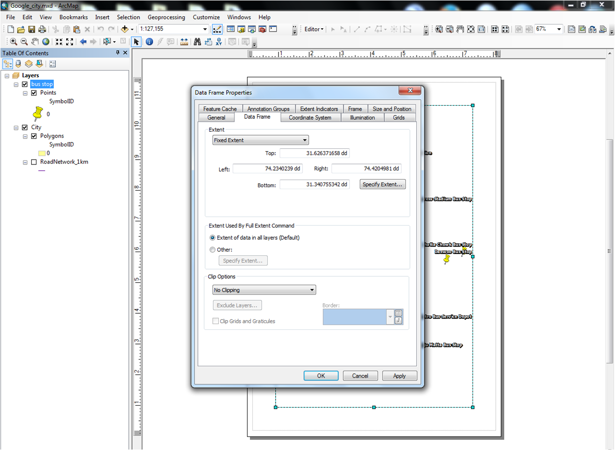
The map and the layer both have the different extent, as you can see from the snapshots. But when i try to make the extent same, it doesn't work. Is there any other way to make them same?
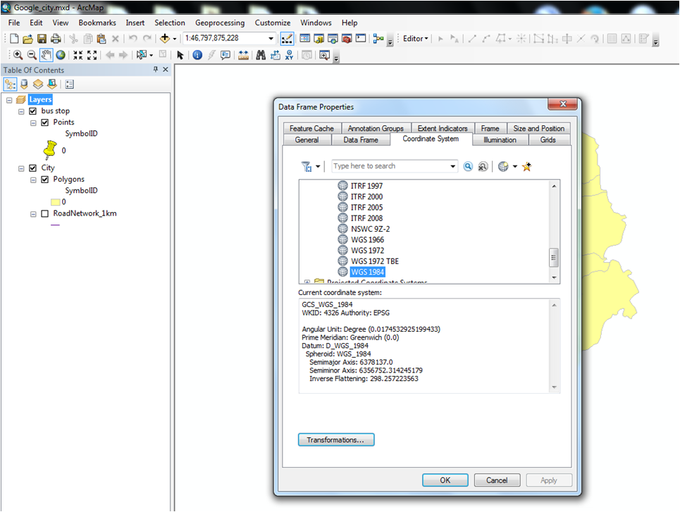
As far as the projection is concerned, i am not sure about it that how to confirm it. I check the coordinate system from data frame properties and its GCS_WCS_1984.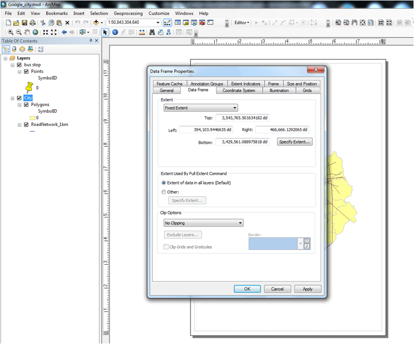
- Mark as New
- Bookmark
- Subscribe
- Mute
- Subscribe to RSS Feed
- Permalink
In this image i covert, also the city layer form google earth and the bus stop layer is also from google earth. But when i convert them into layer they are visible in different extents. Though the stops are over the map in google earth view.
- Mark as New
- Bookmark
- Subscribe
- Mute
- Subscribe to RSS Feed
- Permalink
It sounds like you have incorrectly defined the projection for the KML file. Do you mind moving this question to Mapping? You will have better luck their, as this space is for question about the GeoNet forum. Thanks!
- Mark as New
- Bookmark
- Subscribe
- Mute
- Subscribe to RSS Feed
- Permalink
I myself did not define any projection system, i just converted these from KML, which was from google earth.
- Mark as New
- Bookmark
- Subscribe
- Mute
- Subscribe to RSS Feed
- Permalink
Google Earth uses a Projected Coordinate system called WGS 1984 Web Mercator (Auxiliary Sphere) according to a variety of likes on the web ie
so give that a try
- Mark as New
- Bookmark
- Subscribe
- Mute
- Subscribe to RSS Feed
- Permalink
Thank you for the response, and the link you shared. I have tried this transformation but it didn't work for me. Whenever i change the coordinate system, the 'city' layer got disappeared.
- Mark as New
- Bookmark
- Subscribe
- Mute
- Subscribe to RSS Feed
- Permalink
I'm really confused from your screenshots. While I see all the layers in the table of contents in one data frame, your screenshots are three different data frame properties screenshots, rather than two different layer properties, and one data frame properties. Somehow, you seem to have your layers in different data frames, one of which is in GCS projection, and the other is not.
- Mark as New
- Bookmark
- Subscribe
- Mute
- Subscribe to RSS Feed
- Permalink
Thats so. But i don't know how to fix them to the same system.
As far as the screenshots are concerned: i am working with two layers one is city other is bus stop, both the layers are converted from tools/conversion/from kml to layer . The first 2 screenshots show the different extent for both the layers and the last one shows the coordinate system of the data frame from which both the layers do belong.