Turn on suggestions
Auto-suggest helps you quickly narrow down your search results by suggesting possible matches as you type.
Cancel
- Home
- :
- All Communities
- :
- Products
- :
- Mapping
- :
- Mapping Questions
- :
- Getting Data Driven Pages to scale raster symbolog...
Options
- Subscribe to RSS Feed
- Mark Topic as New
- Mark Topic as Read
- Float this Topic for Current User
- Bookmark
- Subscribe
- Mute
- Printer Friendly Page
Getting Data Driven Pages to scale raster symbology from each page's current extent
Subscribe
02-05-2013
06:54 AM
- Mark as New
- Bookmark
- Subscribe
- Mute
- Subscribe to RSS Feed
- Permalink
I'm generating a country-wide atlas at the (U.S. equivalent) county level. I'm auto-clipping the raster coverages to each county-equivalent. All is fine and good, except that the rasters do not scale to the current display extent unless I go to layer propertieson each individual layer. That's not a practical solution.
So, is there a python script that will both recalculate the stretch for every data page and then export each page as an appropriately named PDF file? Or is there an ESRI patch that will address this refresh issue?
Thanks,
Jeff
So, is there a python script that will both recalculate the stretch for every data page and then export each page as an appropriately named PDF file? Or is there an ESRI patch that will address this refresh issue?
Thanks,
Jeff
Solved! Go to Solution.
1 Solution
Accepted Solutions
02-08-2013
05:53 AM
- Mark as New
- Bookmark
- Subscribe
- Mute
- Subscribe to RSS Feed
- Permalink
Unfortunately arcpy.mapping can't work with the stretched renderer. Rather than the raster being a permanent layer in the MXD, what if you tried adding and deleting it with each page?
Below is a sample snippet of code from the arcpy.mapping DDP Class help topic that I modified to add/remove your raster between DDP pages. It just requires that you save your raster out as a layer file.
Jeff
Below is a sample snippet of code from the arcpy.mapping DDP Class help topic that I modified to add/remove your raster between DDP pages. It just requires that you save your raster out as a layer file.
import arcpy
mxd = arcpy.mapping.MapDocument(r"C:\Project\ParcelAtlas.mxd")
df = arcpy.mapping.ListDataFrames(mxd, "Layers")[0]
rasLyrFile = arcpy.mapping.Layer(r"C:\Project\Data\Basemap.lyr")
for pageNum in range(1, mxd.dataDrivenPages.pageCount + 1):
    mxd.dataDrivenPages.currentPageID = pageNum
    arcpy.mapping.AddLayer(df, rasLyrFile, "BOTTOM")   #You can use InsertLayer for more precise placement
    mxd.dataDrivenPages.exportToPDF(r"C:\Project\Output\Page" + str(pageNum) + ".pdf", "CURRENT")
    arcpy.mapping.RemoveLayer(df, rasLyrFile)
del mxd
Jeff
4 Replies
02-06-2013
07:21 AM
- Mark as New
- Bookmark
- Subscribe
- Mute
- Subscribe to RSS Feed
- Permalink
I'm not sure what you mean by "rasters do not scale to the current display extent".
If the rasters are symbolized with a raster classified renderer you may be able to call .Refresh() to get what you want. Take a look at:
http://resources.arcgis.com/en/help/main/10.1/#/RasterClassifiedSymbology/00s30000005p000000/
Jeff
If the rasters are symbolized with a raster classified renderer you may be able to call .Refresh() to get what you want. Take a look at:
http://resources.arcgis.com/en/help/main/10.1/#/RasterClassifiedSymbology/00s30000005p000000/
Jeff
02-07-2013
08:41 AM
- Mark as New
- Bookmark
- Subscribe
- Mute
- Subscribe to RSS Feed
- Permalink
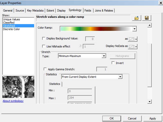
What I mean by "rasters do not scale to the current display extent" is that as each new page is generated with, say a DEM, the scale does not change according to the current display extent, but remains what is was on page 1. In the case of the DEM, I'd like to have each data driven page recalculate the layer properties to rescale the DEM according to the current extent - see attached image.
02-08-2013
05:53 AM
- Mark as New
- Bookmark
- Subscribe
- Mute
- Subscribe to RSS Feed
- Permalink
Unfortunately arcpy.mapping can't work with the stretched renderer. Rather than the raster being a permanent layer in the MXD, what if you tried adding and deleting it with each page?
Below is a sample snippet of code from the arcpy.mapping DDP Class help topic that I modified to add/remove your raster between DDP pages. It just requires that you save your raster out as a layer file.
Jeff
Below is a sample snippet of code from the arcpy.mapping DDP Class help topic that I modified to add/remove your raster between DDP pages. It just requires that you save your raster out as a layer file.
import arcpy mxd = arcpy.mapping.MapDocument(r"C:\Project\ParcelAtlas.mxd") df = arcpy.mapping.ListDataFrames(mxd, "Layers")[0] rasLyrFile = arcpy.mapping.Layer(r"C:\Project\Data\Basemap.lyr") for pageNum in range(1, mxd.dataDrivenPages.pageCount + 1): mxd.dataDrivenPages.currentPageID = pageNum arcpy.mapping.AddLayer(df, rasLyrFile, "BOTTOM") #You can use InsertLayer for more precise placement mxd.dataDrivenPages.exportToPDF(r"C:\Project\Output\Page" + str(pageNum) + ".pdf", "CURRENT") arcpy.mapping.RemoveLayer(df, rasLyrFile) del mxd
Jeff
06-27-2014
01:33 AM
- Mark as New
- Bookmark
- Subscribe
- Mute
- Subscribe to RSS Feed
- Permalink
Unfortunately arcpy.mapping can't work with the stretched renderer. Rather than the raster being a permanent layer in the MXD, what if you tried adding and deleting it with each page?
Below is a sample snippet of code from the arcpy.mapping DDP Class help topic that I modified to add/remove your raster between DDP pages. It just requires that you save your raster out as a layer file.import arcpy mxd = arcpy.mapping.MapDocument(r"C:\Project\ParcelAtlas.mxd") df = arcpy.mapping.ListDataFrames(mxd, "Layers")[0] rasLyrFile = arcpy.mapping.Layer(r"C:\Project\Data\Basemap.lyr") for pageNum in range(1, mxd.dataDrivenPages.pageCount + 1): mxd.dataDrivenPages.currentPageID = pageNum arcpy.mapping.AddLayer(df, rasLyrFile, "BOTTOM") #You can use InsertLayer for more precise placement mxd.dataDrivenPages.exportToPDF(r"C:\Project\Output\Page" + str(pageNum) + ".pdf", "CURRENT") arcpy.mapping.RemoveLayer(df, rasLyrFile) del mxd
Jeff
Jeff,
I'm trying this code now in the python module of my DDP project. I replaced the layer and mxd location lines, and also the export location. However when I run it it says:
Runtime error
Traceback (most recent call last):
File "<string>", line 3, in <module>
IndexError: list index out of range