- Home
- :
- All Communities
- :
- Products
- :
- Mapping
- :
- Mapping Questions
- :
- Difference between Shapefile with _text extension ...
- Subscribe to RSS Feed
- Mark Topic as New
- Mark Topic as Read
- Float this Topic for Current User
- Bookmark
- Subscribe
- Mute
- Printer Friendly Page
Difference between Shapefile with _text extension and with _annotation extension & and how to create the file with "_text" extension
- Mark as New
- Bookmark
- Subscribe
- Mute
- Subscribe to RSS Feed
- Permalink
Difference between Shapefile with _text extension and with _annotation extension & and how to create the file with "_text" extension
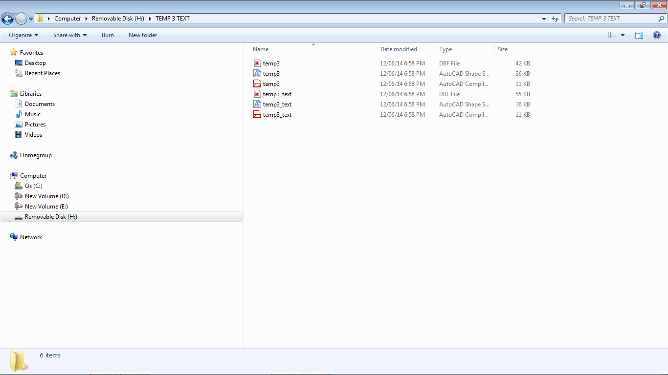
I had created many shapefiles with the extension "-text" in the year 2014.
But now when I am trying to create such a file (i.e. with -Text extension I am not able to do so inspite of trying many ways / methods. I am able to create a somewhat similar file with "-annotation" extension but not the type of files I had created in the year 2014 with the "_text" extension.
Image File of both type of Shapefiles i.e. 1. With "-text" extension and 2. With "_annotation" extension is attached.
I want to know the difference between these 2 types of Shapefile Extensions and how to create the file with "_text" extension which I had created in the year 2014.
Thanks & Regards,
Rahul.
- Mark as New
- Bookmark
- Subscribe
- Mute
- Subscribe to RSS Feed
- Permalink
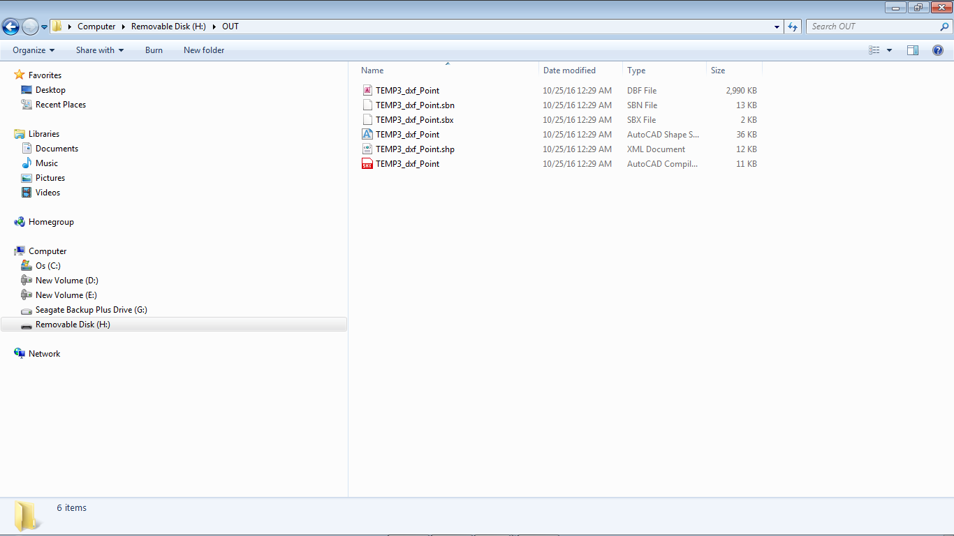
Actually in 2014 when I used to convert the selected DXF File to "Point" Shapefile in ArcGIS it gave me the result as shown in the 1st Attachment. But now when I use the Same File and the same procedure to create a Point Shapefile the resulting shapefile is very different since it does not show i.e. include the Text Data which is vital for me in the Shapefile. I want the generated Point Shapefile to include both the Points Geometry as well as the Associated Text Data. This used to happen Perfectly in the generated "_Text" type Point shapefile in the year 2014. Both the Point Geometry as well as the Associated Text used to appear Perfectly in the generated "_text" type Point Shapefile in the year 2014. But now the generated Point Shapefile (Image Attached) Omits the Associated Text Data Completely. So to overcome this problem I tried using Annotation type Shapefile instead of Point Type Shapefile. This Annotation type Shapefile does include the Associated Text Data but I think it omits the Points Geometry Data. Thus in the year 2014 the Point Shapefile included both Points as well as Text Data but I am unable to generate this type of file with the "_text" extension now.
Thanks & Regards,
Rahul.
- Mark as New
- Bookmark
- Subscribe
- Mute
- Subscribe to RSS Feed
- Permalink
Rahul,
Are you sure that the DXF you are trying to convert now has text associated with the points?
- Mark as New
- Bookmark
- Subscribe
- Mute
- Subscribe to RSS Feed
- Permalink
Its not linked with the Points directly as such i.e. not as a Block - Its a drawing / dxf file with more than a 1500 points and adjoining every point there is a Text Data - So the Drawing / DXF file has equal number of say 1500 Points and Extremely Nearby 1500 Text Data. When we click on the Point the Text Does Not get selected and when we click on the Text the Point Does Not Selected Automatically but Each Text Data is Extremely Near Each Point and contains Associated Text Data particularly for that Point.
In fact I want to combine the Point and the Text Data - I mean when I click on the Point the Extremely Nearby Text Data should get Selected Automatically - But this question / issue we will discuss after the issue of the Difference between the 2 types of Shapefiles i.e. Text (Year 2014) & Annotation (Year 2016) is solved / cleared.
I do have a LISP Program which Links Text to Adjoining Circles but Not For Points.
Actually its 1:25 am (Very Late Night) now in my country i.e. India & my eyes are slightly paining - So I will have a detailed comparative look in the morning and reply back tomorrow to you Sir.
Thanks For Your Great Help & With The Very Best Regards To You Sir,
Yours Sincerely,
Rahul.
- Mark as New
- Bookmark
- Subscribe
- Mute
- Subscribe to RSS Feed
- Permalink
No the DXF does not have the text associated with the Points.
Its not linked with the Points directly as such i.e. not as a Block - Its a drawing / dxf file with more than a 1500 points and adjoining every point there is a Text Data - So the Drawing / DXF file has equal number of say 1500 Points and Extremely Nearby 1500 Text Data. When we click on the Point the Text Does Not get selected and when we click on the Text the Point Does Not Selected Automatically but Each Text Data is Extremely Near Each Point and contains Associated Text Data particularly for that Point.
In fact I want to combine the Point and the Text Data - I mean when I click on the Point the Extremely Nearby Text Data should get Selected Automatically.
I do have a LISP Program which Links Text to Adjoining Circles but Not For Points.
I want to know how to do that i.e Associate The Text With Points.
Thanks For Your Great Help & With The Very Best Regards To You Sir,
Yours Sincerely,
Rahul.
- Mark as New
- Bookmark
- Subscribe
- Mute
- Subscribe to RSS Feed
- Permalink
Rahul,
That is a pretty different topic from your original one. See this help topic for spatial join:
http://desktop.arcgis.com/en/arcmap/latest/tools/analysis-toolbox/spatial-join.htm
- Mark as New
- Bookmark
- Subscribe
- Mute
- Subscribe to RSS Feed
- Permalink
OK Thanks - I will compare them in detail now.
Actually its 1 am (Very Late Night) now in my country i.e. India & my eyes are slightly paining - So I will have a detailed comparative look in the morning and reply back tomorrow to you Sir.
Thanks For Your Great Help & With The Very Best Regards To You Sir,
Yours Sincerely,
Rahul.
- Mark as New
- Bookmark
- Subscribe
- Mute
- Subscribe to RSS Feed
- Permalink
OK Thanks - I will compare them in detail now.
Actually its 1 am (Very Late Night) now in my country i.e. India & my eyes are slightly paining - So I will have a detailed comparative look in the morning and reply back tomorrow to you Sir.
Thanks For Your Great Help & With The Very Best Regards To You Sir,
Yours Sincerely,
Rahul.
Its not linked with the Points directly as such i.e. not as a Block - Its a drawing / dxf file with more than a 1500 points and adjoining every point there is a Text Data - So the Drawing / DXF file has equal number of say 1500 Points and Extremely Nearby 1500 Text Data. When we click on the Point the Text Does Not get selected and when we click on the Text the Point Does Not Selected Automatically but Each Text Data is Extremely Near Each Point and contains Associated Text Data particularly for that Point.
In fact I want to combine the Point and the Text Data - I mean when I click on the Point the Extremely Nearby Text Data should get Selected Automatically - But this question / issue we will discuss after the issue of the Difference between the 2 types of Shapefiles i.e. Text (Year 2014) & Annotation (Year 2016) is solved / cleared.
I do have a LISP Program which Links Text to Adjoining Circles but Not For Points.
Actually its 1:25 am (Very Late Night) now in my country i.e. India & my eyes are slightly paining - So I will have a detailed comparative look in the morning and reply back tomorrow to you Sir.
Thanks For Your Great Help & With The Very Best Regards To You Sir,
Yours Sincerely,
Rahul.
- Mark as New
- Bookmark
- Subscribe
- Mute
- Subscribe to RSS Feed
- Permalink
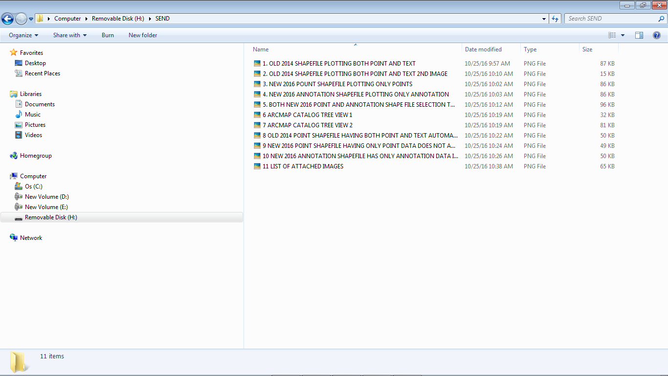
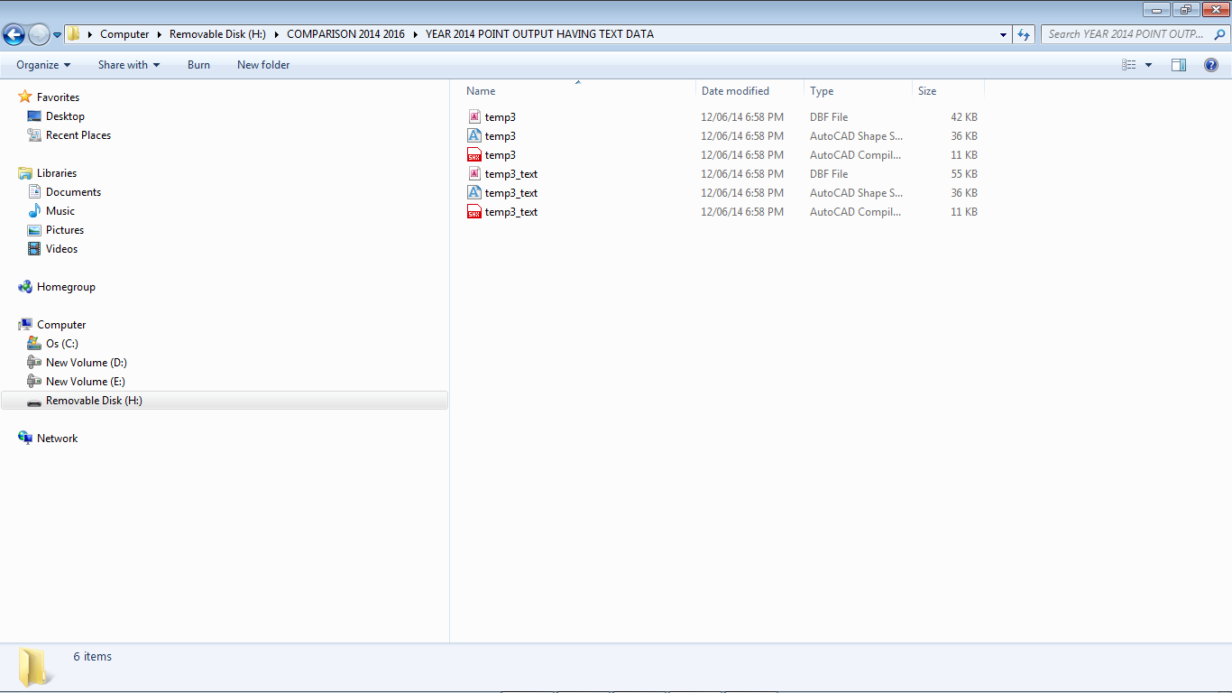
12 Attachments are Embedded Below:
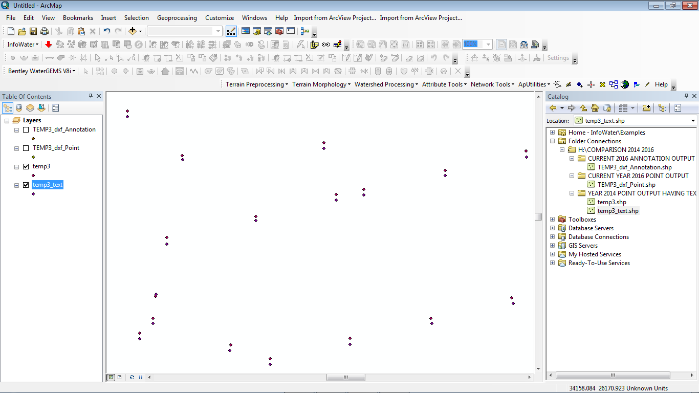
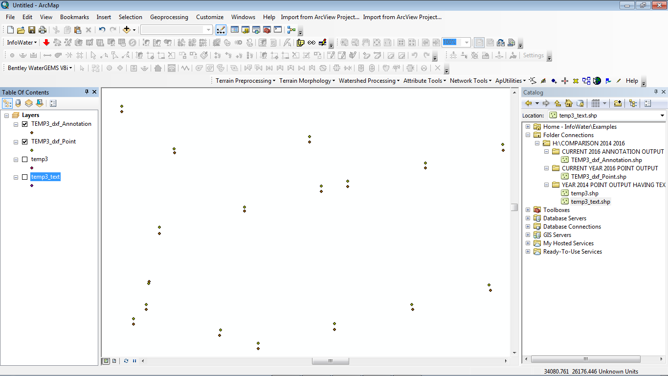
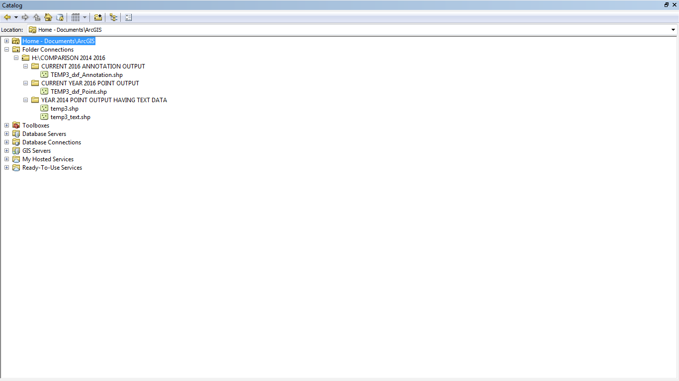
I analysed All The Three Shapefiles - a) YEAR 2014 POINT OUTPUT HAVING TEXT DATA AUTOMATICALLY b) CURRENT YEAR 2016 POINT OUTPUT & c) CURRENT 2016 ANNOTATION OUTPUT:
My Analysis Results Are As Follows:
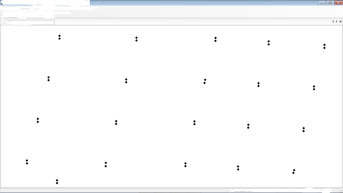
1. As I had written before "Actually in 2014 when I used to convert the selected DXF File to "Point" Shapefile in ArcGIS it gave me the result as shown in the 1st Attachment. But now when I use the Same File and the same procedure to create a Point Shapefile the resulting shapefile is very different since it does not show i.e. include the Text Data which is vital for me in the Shapefile. I want the generated Point Shapefile to include both the Points Geometry as well as the Associated Text Data. This used to happen Perfectly in the generated "_Text" type Point shapefile in the year 2014. Both the Point Geometry as well as the Associated Text used to appear Perfectly in the generated "_text" type Point Shapefile in the year 2014. But now the generated Point Shapefile (Image Attached) Omits the Associated Text Data Completely. So to overcome this problem I tried using Annotation type Shapefile instead of Point Type Shapefile. This Annotation type Shapefile does include the Associated Text Data but I think it omits the Points Geometry Data. Thus in the year 2014 the Point Shapefile included both Points as well as Text Data but I am unable to generate this type of file with the "_text" extension now."
2. We can see the difference in Outputs of the 2014 and 2016 files in the Attachments.
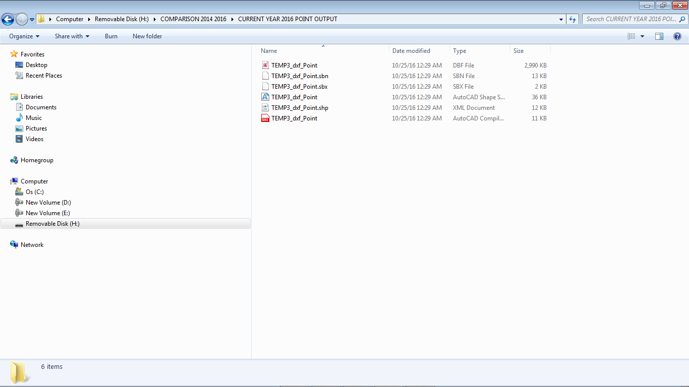
3. Also the 2014 Point Shapefile consists of 2 Parts (Please View Catalog Tree Attachments Number 6 & 7) whereas the New 2016 Point and Annotation Shapefile consists of only 1 Part each (Please View Catalog Tree Attachments Number 6 & 7). This is VERY IMPORTANT - THE 2014 OLD POINT SHAPEFILE USED TO BE OF 2 PARTS AS WE CAN SEE IN THE ARCMAP CATALOG TREE (ATTACHMENTS NUMBER 6 & 7) WHEREAS THE NEW 2016 POINT AND ANNOTATION SHAPEFILES CONSIST OF ONLY ONE PART HAVING THE POINT AND ANNOTATION / TEXT DATA RESPECTIVELY AND NOT COMBINED IN 2 PARTS LIKE THE 2014 POINT SHAPEFILE HAVING THE "_TEXT" EXTENSION & CONSISTING OF BOTH POINT AND TEXT / ANNOTATION DATA IN A SINGLE SHAPEFILE.
4.Thus the 2014 Point Shapefile used to automatically combine Point and Annotation Data in One Shapefile but the new 2016 Point Shapefile Omits the Text/ Annotation Data in the Point Shapefile and therefore we have to create a Separate Annotation Shapefile havong the Text Data.
Thanks For Your Great Help & With The Very Best Regards To You Sir,
Yours Sincerely,
Rahul.


- « Previous
-
- 1
- 2
- Next »
- « Previous
-
- 1
- 2
- Next »