Turn on suggestions
Auto-suggest helps you quickly narrow down your search results by suggesting possible matches as you type.
Cancel
- Home
- :
- All Communities
- :
- Products
- :
- Mapping
- :
- Mapping Questions
- :
- Adjust Traverse by a Scale Factor
Options
- Subscribe to RSS Feed
- Mark Topic as New
- Mark Topic as Read
- Float this Topic for Current User
- Bookmark
- Subscribe
- Mute
- Printer Friendly Page
Adjust Traverse by a Scale Factor
Subscribe
1938
3
10-27-2016 06:07 PM
10-27-2016
06:07 PM
- Mark as New
- Bookmark
- Subscribe
- Mute
- Subscribe to RSS Feed
- Permalink
Hey All,
I do many traverses using the Traverse window in ArcMap.
I am wondering if anyone can tell me how to 'adjust' this traverse by a scale factor?
The surveyor has noted the plan is scaled to 0.999568, I am unsure how to apply this.
Thanks heaps!
3 Replies
10-27-2016
06:29 PM
- Mark as New
- Bookmark
- Subscribe
- Mute
- Subscribe to RSS Feed
- Permalink
too many 'traverse' stuff... for Networks? for Parcel Fabrics? etc which one are you referring to?
10-27-2016
06:31 PM
- Mark as New
- Bookmark
- Subscribe
- Mute
- Subscribe to RSS Feed
- Permalink
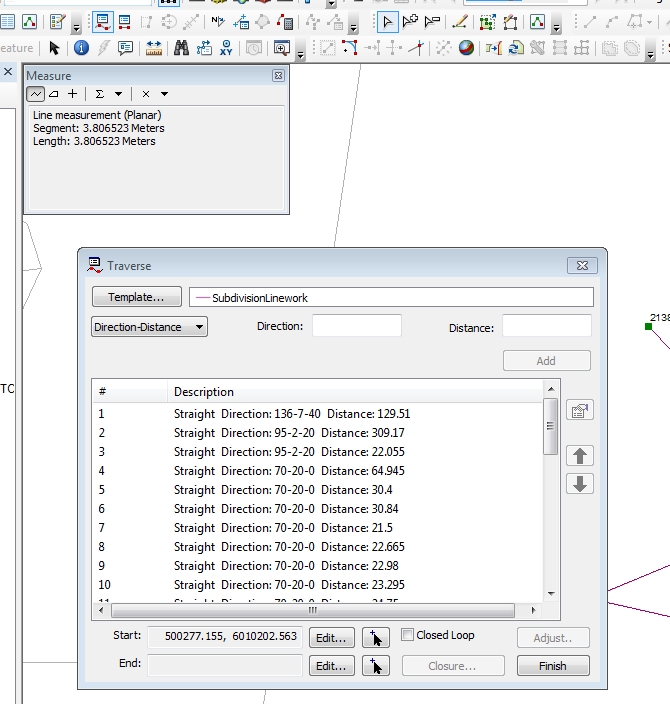
So I am entering in Subdivision linework... see screenshot below:
10-27-2016
07:01 PM
- Mark as New
- Bookmark
- Subscribe
- Mute
- Subscribe to RSS Feed
- Permalink
sorry, can't find anything specific except for some references to ground to grid corrections in Cogo section of creating features... probably nowhere near where you are... You think a list of tool etc dialogs would be useful to attach the visual to the dialog name.