- Home
- :
- All Communities
- :
- User Groups
- :
- LIDAR Resources
- :
- Questions
- :
- Re: What units does the LAS Dataset 3D Viewer use?
- Subscribe to RSS Feed
- Mark Topic as New
- Mark Topic as Read
- Float this Topic for Current User
- Bookmark
- Subscribe
- Mute
- Printer Friendly Page
What units does the LAS Dataset 3D Viewer use?
- Mark as New
- Bookmark
- Subscribe
- Mute
- Subscribe to RSS Feed
- Permalink
I'm using arc map 10.2.1 and using the LAS Dataset 3D View tool to measure the distance between LiDAR points. The measure tool always indicates "Unknown unit".
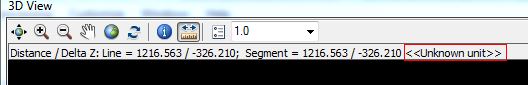
I've tried setting a projection on the LAS Dataset, but I still get "Unknown unit".
How do I get the 3D View to indicate to the user that the measure tool is measuring in US Feet?
Solved! Go to Solution.
Accepted Solutions
- Mark as New
- Bookmark
- Subscribe
- Mute
- Subscribe to RSS Feed
- Permalink
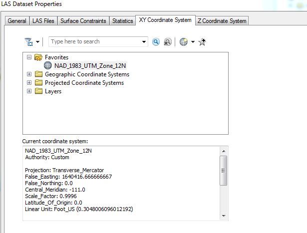
The distance and delta z are 3D and require z units to be defined in addition to XY. If z units differ from XY they will be converted to XY for the sake of reporting units.
We may consider assuming z units are the same as xy if z is undefined but for now we make no assumptions.
- Mark as New
- Bookmark
- Subscribe
- Mute
- Subscribe to RSS Feed
- Permalink
The distance and delta z are 3D and require z units to be defined in addition to XY. If z units differ from XY they will be converted to XY for the sake of reporting units.
We may consider assuming z units are the same as xy if z is undefined but for now we make no assumptions.