Turn on suggestions
Auto-suggest helps you quickly narrow down your search results by suggesting possible matches as you type.
Cancel
- Home
- :
- All Communities
- :
- Products
- :
- Geoprocessing
- :
- Geoprocessing Questions
- :
- using spatial join
Options
- Subscribe to RSS Feed
- Mark Topic as New
- Mark Topic as Read
- Float this Topic for Current User
- Bookmark
- Subscribe
- Mute
- Printer Friendly Page
using spatial join
Subscribe
1575
2
05-24-2012 11:39 AM
05-24-2012
11:39 AM
- Mark as New
- Bookmark
- Subscribe
- Mute
- Subscribe to RSS Feed
- Permalink
I???m currently getting my data ready to go into the parcel fabric. In order to get it ready for fabric, every line has to be cogo. This means no multi-segment lines, which our data had a lot of. So I used the ???curves & lines??? add-in to make nice curves etc.
What this does to the lines is really nice. It converts densified lines into one or more separate circular arcs.
So far so good.
But what about the underlying polygons, you might ask? Well, the topology is broken now, because the edge of the polygon is not perfectly coincident with the nice new lines.
But no problem supposedly???.., according to ESRI there is a work around???. A simple 3 step process???. From the curves and lines add in pdf:
1. Use GP tool Feature to Point to generate a layer to hold onto the attributes from the original polygons. Make sure that the Inside option is checked on. (worked great)
2. Use the GP tool Feature to Polygon to generate new polygons from the updated line-work. (worked great)
3. Use the GP tool Spatial Join and use the results of #2 as the target features, and results of #1 as the Join features to transfer the original polygon attributes. (not so great)
Ok so I???m successful in doing steps #1 and #2, it did exactly what I wanted. It made a point feature to hold the attributes of the polygon it is set upon, and it made glorious polygons (with no attributes, mind you) that are perfectly topologically correct.
The problem comes in on step 3, getting your old attributes, which are now stored on a point, back onto the NEW topologically correct polygon.
I am happy with the way the attributes from the placeholder point file transferred over to the new polygon file but???
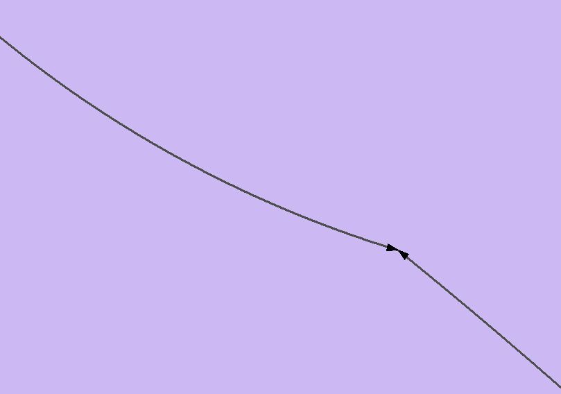
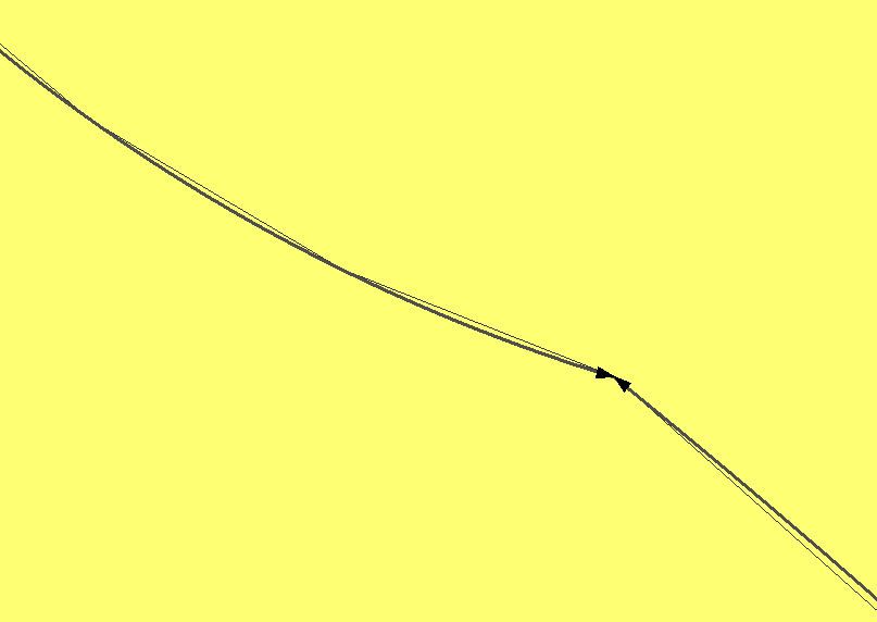
The file that the ???Spatial Join??? tool creates is not topologically correct, even though the target feature it used is perfectly correct. Its weird, its almost as if it creates a polygon that is just an approximate version of its own target. See picture below.. First pic is the result of the ???feature to polygon??? geoprocessing tool, showing the polygon edges are perfectly coincident with the lines, and the second picture shows how far off the resulting file that step number 3 above provides???. Which is bad .. Any help with this would be greatly appreciated
What this does to the lines is really nice. It converts densified lines into one or more separate circular arcs.
So far so good.
But what about the underlying polygons, you might ask? Well, the topology is broken now, because the edge of the polygon is not perfectly coincident with the nice new lines.
But no problem supposedly???.., according to ESRI there is a work around???. A simple 3 step process???. From the curves and lines add in pdf:
1. Use GP tool Feature to Point to generate a layer to hold onto the attributes from the original polygons. Make sure that the Inside option is checked on. (worked great)
2. Use the GP tool Feature to Polygon to generate new polygons from the updated line-work. (worked great)
3. Use the GP tool Spatial Join and use the results of #2 as the target features, and results of #1 as the Join features to transfer the original polygon attributes. (not so great)
Ok so I???m successful in doing steps #1 and #2, it did exactly what I wanted. It made a point feature to hold the attributes of the polygon it is set upon, and it made glorious polygons (with no attributes, mind you) that are perfectly topologically correct.
The problem comes in on step 3, getting your old attributes, which are now stored on a point, back onto the NEW topologically correct polygon.
I am happy with the way the attributes from the placeholder point file transferred over to the new polygon file but???
The file that the ???Spatial Join??? tool creates is not topologically correct, even though the target feature it used is perfectly correct. Its weird, its almost as if it creates a polygon that is just an approximate version of its own target. See picture below.. First pic is the result of the ???feature to polygon??? geoprocessing tool, showing the polygon edges are perfectly coincident with the lines, and the second picture shows how far off the resulting file that step number 3 above provides???. Which is bad .. Any help with this would be greatly appreciated
2 Replies
05-24-2012
08:41 PM
- Mark as New
- Bookmark
- Subscribe
- Mute
- Subscribe to RSS Feed
- Permalink
We will investigate the issue. It'll be great if you can share a small section of your data.
Meanwhile, use Join Field to add the fields from points feature class back to the polygons.
Meanwhile, use Join Field to add the fields from points feature class back to the polygons.
05-24-2012
08:47 PM
- Mark as New
- Bookmark
- Subscribe
- Mute
- Subscribe to RSS Feed
- Permalink
While Nobbir is investigating the issue, I would recommend that you try this:
In your step 2, run Feature To Polygon tool using the updated lines as input and the points from step 1 as the Label Features. The output should have all the attributes carried by the points, unless a point falls outside of the new boundary.
If that works, you wouldn't need Step 3.
In your step 2, run Feature To Polygon tool using the updated lines as input and the points from step 1 as the Label Features. The output should have all the attributes carried by the points, unless a point falls outside of the new boundary.
If that works, you wouldn't need Step 3.