- Home
- :
- All Communities
- :
- Products
- :
- Geoprocessing
- :
- Geoprocessing Questions
- :
- How to calculate percent of polygons covered by a ...
- Subscribe to RSS Feed
- Mark Topic as New
- Mark Topic as Read
- Float this Topic for Current User
- Bookmark
- Subscribe
- Mute
- Printer Friendly Page
How to calculate percent of polygons covered by a buffer
- Mark as New
- Bookmark
- Subscribe
- Mute
- Subscribe to RSS Feed
- Permalink
- Report Inappropriate Content
Hi all,
I have thousands of points across Canada, as well as thousands of polygons. Each polygon represents a population (approximately 550 people). The points are across a rail network. What I need to do is find out the population within a half mile radius of each of these points.
For each Polygon I know the population density, and I've created a 0.5 mile buffer around each of the points, but I can't calculate the number of people in each 0.5 mile radius because many of the buffers contain many polygons, each with a different population density and with different amount of coverage of each polygon.
Any help would be very appreciated!
Please see attached file for reference
-Zach
Solved! Go to Solution.
Accepted Solutions
- Mark as New
- Bookmark
- Subscribe
- Mute
- Subscribe to RSS Feed
- Permalink
- Report Inappropriate Content
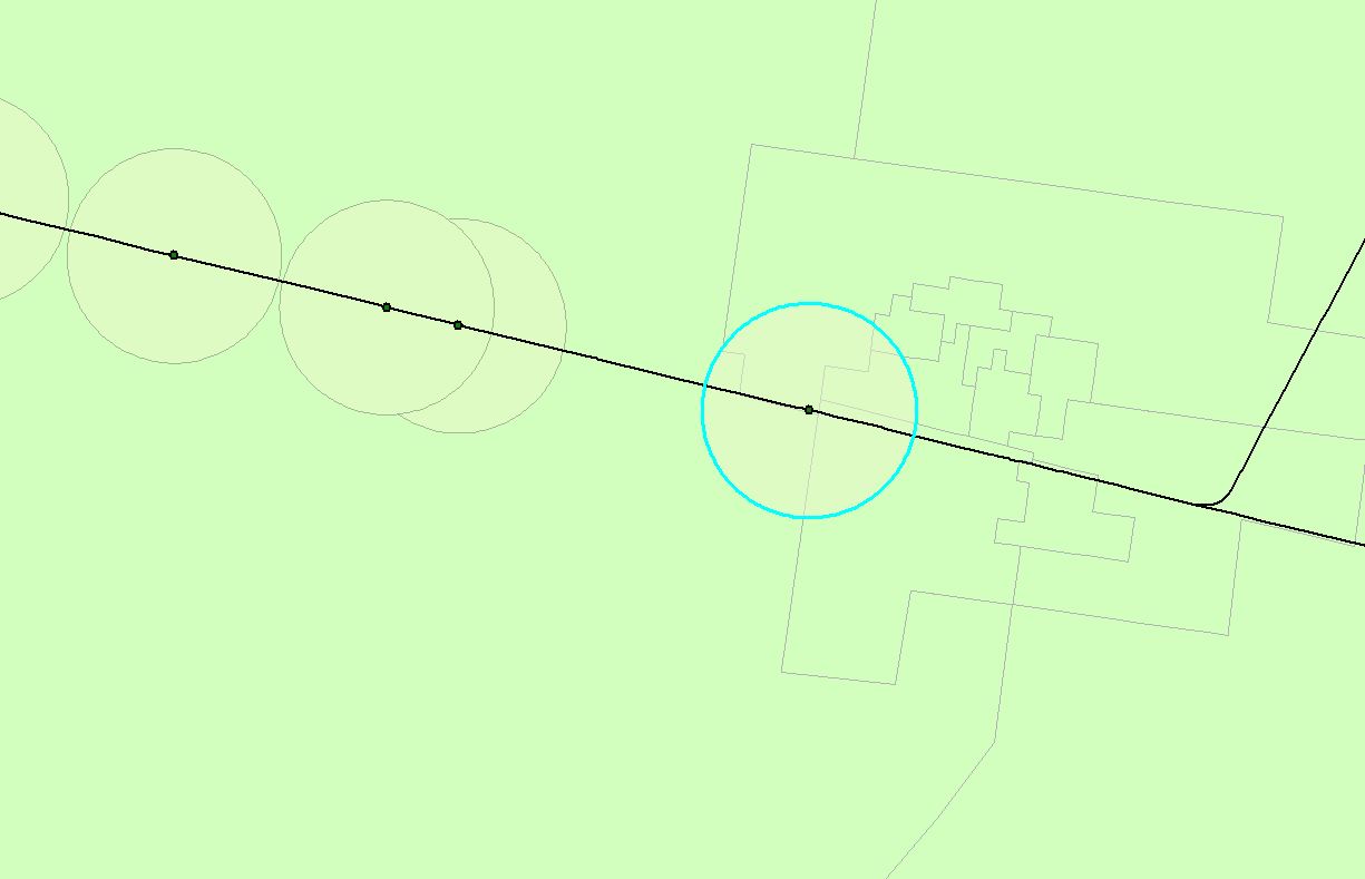
A question first: I noticed in the attached image that the two buffer polygons just left from the selected buffer overlap. Will you be handling the overlap in some way?
What I would do (ignoring the overlap between the buffer polygons to keep it simple), is first add a field with the population density to the polygon featureclass. Next, I would intersect the buffers with the polygons. The resulting intersect area and "joined" population density can be used to calculate the population for each intersecting area. Based on a unique id of the buffer polygons you can dissolve the featureclass to create the buffer polygons and sum the population within each buffer polygon (use the statistics option in the dissolve tool).
- Mark as New
- Bookmark
- Subscribe
- Mute
- Subscribe to RSS Feed
- Permalink
- Report Inappropriate Content
YES thank you!!!
The big thing I was missing was the dissolve step, I'm new to GIS software and didn't realize exactly how it worked!
Thanks again,
Zach
- Mark as New
- Bookmark
- Subscribe
- Mute
- Subscribe to RSS Feed
- Permalink
- Report Inappropriate Content
I'm glad it worked for you. Please don't forget to mark the post that answered your question as the "Correct Answer".