- Home
- :
- All Communities
- :
- Products
- :
- Geoprocessing
- :
- Geoprocessing Questions
- :
- How can I see my raster?
- Subscribe to RSS Feed
- Mark Topic as New
- Mark Topic as Read
- Float this Topic for Current User
- Bookmark
- Subscribe
- Mute
- Printer Friendly Page
- Mark as New
- Bookmark
- Subscribe
- Mute
- Subscribe to RSS Feed
- Permalink
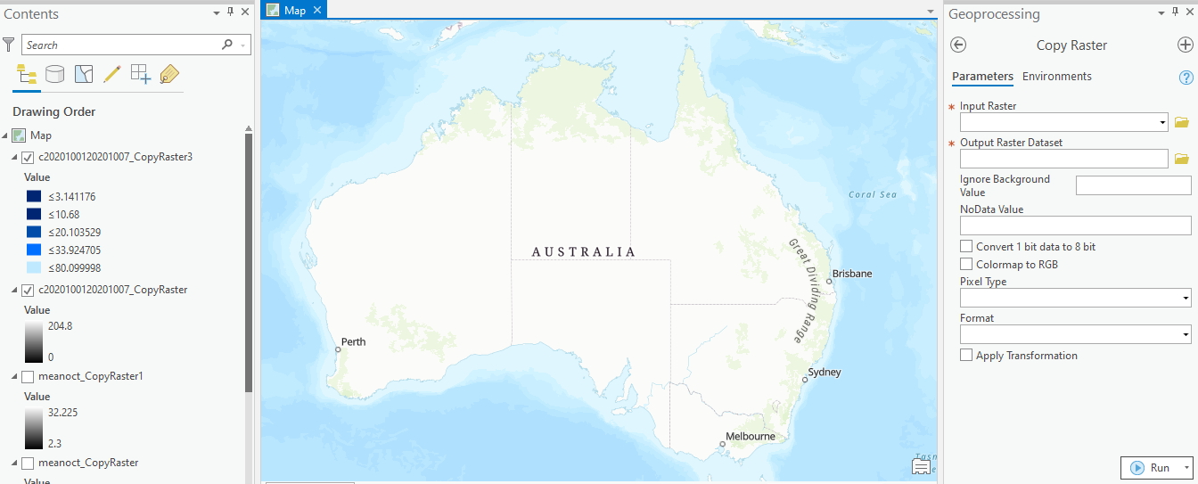
I am fairly new to ArcGIS Pro so apologies if this is a very basic question. I am trying to import a map from an ascii file using the Copy Raster function. I have carried out the operation on several files, and it seems to show that the new rasters are there in the contents pane on the left. I can change symbology etc. but I can't see it on my map? What do I do next please?
Solved! Go to Solution.
Accepted Solutions
- Mark as New
- Bookmark
- Subscribe
- Mute
- Subscribe to RSS Feed
- Permalink
Hi Cathy - just had a go with some Rainfall ASCII files - and, in the Define Projection tool, used GDA 94 as per their website - and that seems to have worked beautifully i,e. GCS_GDA_1994.
- Mark as New
- Bookmark
- Subscribe
- Mute
- Subscribe to RSS Feed
- Permalink
right-click on the layer and try ... zoom to layer
I suspect that the data doesn't have a defined coordinate system so it isn't projecting on the fly to the backmap/map frames coordinate system. That will have to be fixed by one of several approaches
... sort of retired...
- Mark as New
- Bookmark
- Subscribe
- Mute
- Subscribe to RSS Feed
- Permalink
Thanks Dan. I right clicked and zoomed and found the layer. I then tried to Define Projection to GDA_94 which should be the right one but that hasn't helped. It should cover Australia, but it appears to be this tiny little square in the middle of nowhere. Can you please share with me what different approach I could use?
- Mark as New
- Bookmark
- Subscribe
- Mute
- Subscribe to RSS Feed
- Permalink
report the extent values as suggested and compare those to the extent for Australia in the GDA coordinate system,
Also, cell size of the raster would help. All this should be in the raster properties.
If it is a true *.asc file, open it in a text editor and the top 6 rows should contain information needed.
This may also be in a separate world file
https://pro.arcgis.com/en/pro-app/help/data/imagery/world-files-for-raster-datasets.htm
see the example there... eg
20.17541308822119
0.00000000000000
0.00000000000000
-20.17541308822119
424178.11472601280548
4313415.90726399607956
This information provides cell size in the x and y direction and the position of one of the corners.
I have this feeling that the map was in a different coordinate system from the GDA and the raster was made in either Geographic coordinates or maybe even web mercator
... sort of retired...
- Mark as New
- Bookmark
- Subscribe
- Mute
- Subscribe to RSS Feed
- Permalink
In addition to Dan's helpful tip, you can also investigate the properties of the layer in the Contents pane to confirm this.
i.e. :
Right click the layer in the Contents Pane > Properties > Source > Spatial Reference
- Mark as New
- Bookmark
- Subscribe
- Mute
- Subscribe to RSS Feed
- Permalink
Thanks Mary, it tells me Unknown Co-ordinate System. So it seems my attempt to Define Projection didn't work.
- Mark as New
- Bookmark
- Subscribe
- Mute
- Subscribe to RSS Feed
- Permalink
Actually, now it does say GDA 1994, but it is not positioned over Australia
- Mark as New
- Bookmark
- Subscribe
- Mute
- Subscribe to RSS Feed
- Permalink
In the properties section, look at the "extent", what are the values for left, right, top and bottom.
Do they make sense for the GDA 1994 coordinate system? Would they place your raster over Australia or are they something different.
Remember... "Define Projection" does nothing good, if the raster isn't in that coordinate system, it just tells it, it is something that it isn't
... sort of retired...
- Mark as New
- Bookmark
- Subscribe
- Mute
- Subscribe to RSS Feed
- Permalink
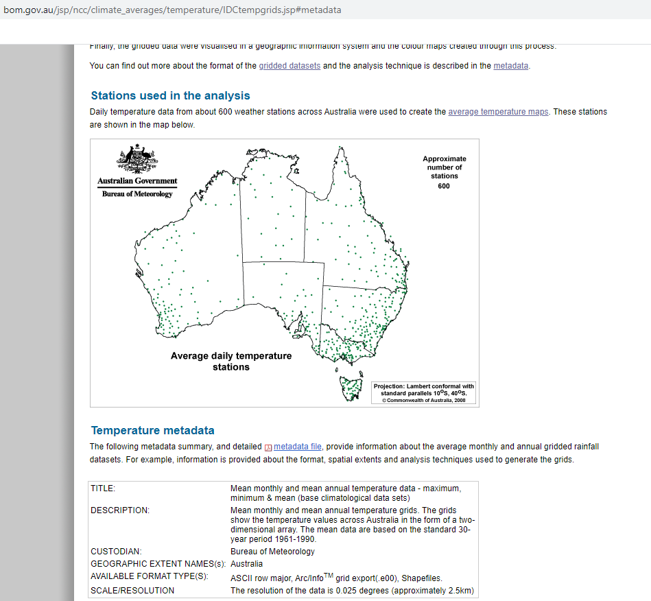
Hi Dan, thanks for helping me out. Below are the extent and spatial reference info, and a snip from the ascii file showing the headers. I am not sure why the projected coordinate system for this one is WGS1984 (I don't think I did that)

It puts the centre of Australia at around 131E 25S

whereas on the base map Australia is:

There is more information here.
- Mark as New
- Bookmark
- Subscribe
- Mute
- Subscribe to RSS Feed
- Permalink
the extent is in a geographic coordinate system... probably WGS 84
It should have been defined as such
Confirm all information in your links... ie the detailed metadata files...
The best thing to do, is to add your raster to an empty blank map.... not nothing... no basemap etc.
The first layer added will allow you to truly see the values of the extent to confirm ... then define the coordinate system, and not before. If it was defined wrong... define it back
Good luck!
... sort of retired...