- Home
- :
- All Communities
- :
- Products
- :
- Geoprocessing
- :
- Geoprocessing Questions
- :
- Generalisation whilst keeping fill
- Subscribe to RSS Feed
- Mark Topic as New
- Mark Topic as Read
- Float this Topic for Current User
- Bookmark
- Subscribe
- Mute
- Printer Friendly Page
Generalisation whilst keeping fill
- Mark as New
- Bookmark
- Subscribe
- Mute
- Subscribe to RSS Feed
- Permalink
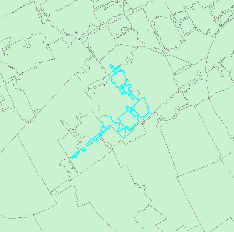
I have dissolved six position postal code areas (~ street part level) to create four position postal code areas (~ neighbourhoud level). Naturally, this has resulted in some strange shapes and multipart features (see below; selected area is a single feature).
I want to generalise these features and make them singlepart features, without losing the fact that the individual shapes share boundaries. Is there a way to do this?
- Mark as New
- Bookmark
- Subscribe
- Mute
- Subscribe to RSS Feed
- Permalink
That is already what I feared. I will see what I can do.
Thanks to everyone for their answers!
(I don't know what is usual behaviour here: closing the conversation as 'answered', although my question is not answered, or leaving it open for an undetermined 'eternity'?)
- Mark as New
- Bookmark
- Subscribe
- Mute
- Subscribe to RSS Feed
- Permalink
Looking at it again, Simplify Polygon (Cartography) will probably get you pretty far. This tool requires an Standard license.
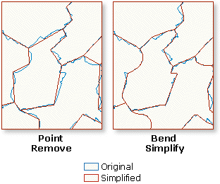
Although you may have to do something with the multiparts first...
- « Previous
-
- 1
- 2
- Next »
- « Previous
-
- 1
- 2
- Next »