- Home
- :
- All Communities
- :
- Products
- :
- Geoprocessing
- :
- Geoprocessing Questions
- :
- Extracting vertices from a polygon to create coord...
- Subscribe to RSS Feed
- Mark Topic as New
- Mark Topic as Read
- Float this Topic for Current User
- Bookmark
- Subscribe
- Mute
- Printer Friendly Page
Extracting vertices from a polygon to create coordinate points (feature vertices to point)
- Mark as New
- Bookmark
- Subscribe
- Mute
- Subscribe to RSS Feed
- Permalink
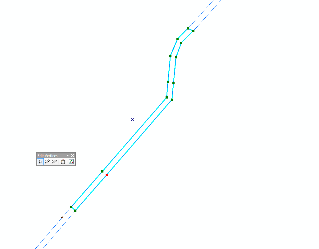
I am looking for a way to extract coordinate points from a road casement i have drawn to put them in a new shapefile and create a table of coordinate points for the road. I have been taught to turn on vertex snapping to the casement in an editing session for my coordinate point shapefile and just run mouse over the casement until it snaps to a vertex and then create a point there but this method seems extremely inefficient so I'm hoping someone has a better way.
Thanks 😃
- Mark as New
- Bookmark
- Subscribe
- Mute
- Subscribe to RSS Feed
- Permalink
seems like an awful hard way to create point vertices when you can use Feature Vertices To Points—Help | ArcGIS for Desktop
or if you don't have the license level, then there are other options
- Mark as New
- Bookmark
- Subscribe
- Mute
- Subscribe to RSS Feed
- Permalink
Thanks Dan, I did check out that option but unfortunately don't have the license to use any of the "feature to" type tools. You mentioned there are other options, would love to hear any other suggestions?
- Mark as New
- Bookmark
- Subscribe
- Mute
- Subscribe to RSS Feed
- Permalink
Try Ianko's tools.
I see Poly to Point is a free tool in ET Geo wizards.
Otherwise you would have to use some python / arcpy magic.
- Mark as New
- Bookmark
- Subscribe
- Mute
- Subscribe to RSS Feed
- Permalink
With Python you can iterate the polygon part vertices and write them to a new table. You can change the field names and outputs as required. Select a single polygon segment to only write one table and run the script from the ArcMap Python console.
import arcpy
mxd = arcpy.mapping.MapDocument('CURRENT')
df = mxd.activeDataFrame
layers = arcpy.mapping.ListLayers(df)
layer = layers[0]
with arcpy.da.SearchCursor(layer, ["SHAPE@", "OBJECTID"]) as lcursor:
for lrow in lcursor:
polygon = lrow[0]
objId = lrow[1]
# create table for selected feature
arcpy.CreateTable_management(arcpy.env.scratchWorkspace, "pntTable_" + str(objId))
table = arcpy.env.scratchWorkspace + "\\pntTable_" + str(objId)
# add fields or use a template
arcpy.AddField_management(table, "X", "DOUBLE")
arcpy.AddField_management(table, "Y", "DOUBLE")
icursor = arcpy.da.InsertCursor(table, ["X", "Y"])
# iterate through polygon parts
part = polygon.getPart(0) # assuming a single part polygon
# list polygon part points
for pnt in part:
print "X: " + str(pnt.X) + " Y: " + str(pnt.Y)
# add to table
icursor.insertRow([pnt.X, pnt.Y])
del icursor
del lcursor- Mark as New
- Bookmark
- Subscribe
- Mute
- Subscribe to RSS Feed
- Permalink
Sorry FC, but shouldn't the Create table and the InsertCursor stuff be outside the Search Cursor loop.
At the mo, you are creating a new table for every row in the SearchCursor.
- Mark as New
- Bookmark
- Subscribe
- Mute
- Subscribe to RSS Feed
- Permalink
Yes Neil, it could/should sit outside. I put it inside just for demo purposes. The main thing is to show the iteration over the polygon part vertices.
- Mark as New
- Bookmark
- Subscribe
- Mute
- Subscribe to RSS Feed
- Permalink
Ha....
- Mark as New
- Bookmark
- Subscribe
- Mute
- Subscribe to RSS Feed
- Permalink
For a shorter way
# -*- coding: utf-8 -*-
"""
:Created on Tue Aug 16 04:47:18 2016 @author: Dan
:Script: poly_to_points.py
:Author: [email protected]
:Modified: 2016-07-09
:Purpose: polygon to point demo
:Requires: nothing
:Notes: none
:Functions: can't you read
:References: none yet
"""
import arcpy
def main():
"""
: - Produce a structured array from an input file
: - Print information for that array
: - Output a shapefile
"""
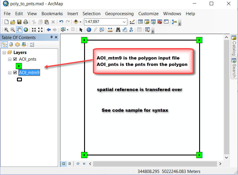
input_shp = r"F:\Test2\AOI_mtm9.shp" # change obviously
output_shp = r"F:\Test2\AOI_pnts.shp" # also
desc_obj = arcpy.Describe(input_shp)
SR = desc_obj.spatialReference # spatial reference object
OID_fld = desc_obj.OIDFieldName # FID normally
shp_fld = desc_obj.shapeFieldName
print("using...\n{}\nto create...\n{}".format(input_shp, output_shp))
print("file read...")
arr = arcpy.da.FeatureClassToNumPyArray(input_shp, [OID_fld, shp_fld],
spatial_reference=SR,
explode_to_points=True)
arcpy.da.NumPyArrayToFeatureClass(arr, output_shp, shp_fld, SR)
print("file written...\n{}".format(arr))
return arr
# -------------------------------------------------------------------------
if __name__ == "__main__":
"""Test section, just modify main() """
arr = main()
output
[(0, [340000.0, 5022000.0]) (0, [340000.0, 5026000.0])
(0, [344000.0, 5026000.0]) (0, [344000.0, 5022000.0])
(0, [340000.0, 5022000.0])]
# with repr(arr)instead of str representation
print(repr(arr))
array([(0, [340000.0, 5022000.0]), (0, [340000.0, 5026000.0]),
(0, [344000.0, 5026000.0]), (0, [344000.0, 5022000.0]),
(0, [340000.0, 5022000.0])],
dtype=[('FID', '<i4'), ('Shape', '<f8', (2,))])Of course this could be all fluffed up if there was more than one polygon, single-part or multipart, with/without holes and it had attributes. It doesn't matter... the polygon is exploded into its constituent parts and returned as a featureclass/shapefile depending on your preference.
- Mark as New
- Bookmark
- Subscribe
- Mute
- Subscribe to RSS Feed
- Permalink
Cool. I had forgotten about the "explode to points" option. Mr Numpy rules