- Home
- :
- All Communities
- :
- Products
- :
- Geoprocessing
- :
- Geoprocessing Questions
- :
- Re: Export to cad results in object with wrong coo...
- Subscribe to RSS Feed
- Mark Topic as New
- Mark Topic as Read
- Float this Topic for Current User
- Bookmark
- Subscribe
- Mute
- Printer Friendly Page
Export to cad results in object with wrong coordinates (Arcmap 10.4.1)
- Mark as New
- Bookmark
- Subscribe
- Mute
- Subscribe to RSS Feed
- Permalink
Hi,
I've been trying to export a map from Arcmap to Autocad for a while. After the command has been executed the contours are found in a new place, as well in arcmap as in autocad.
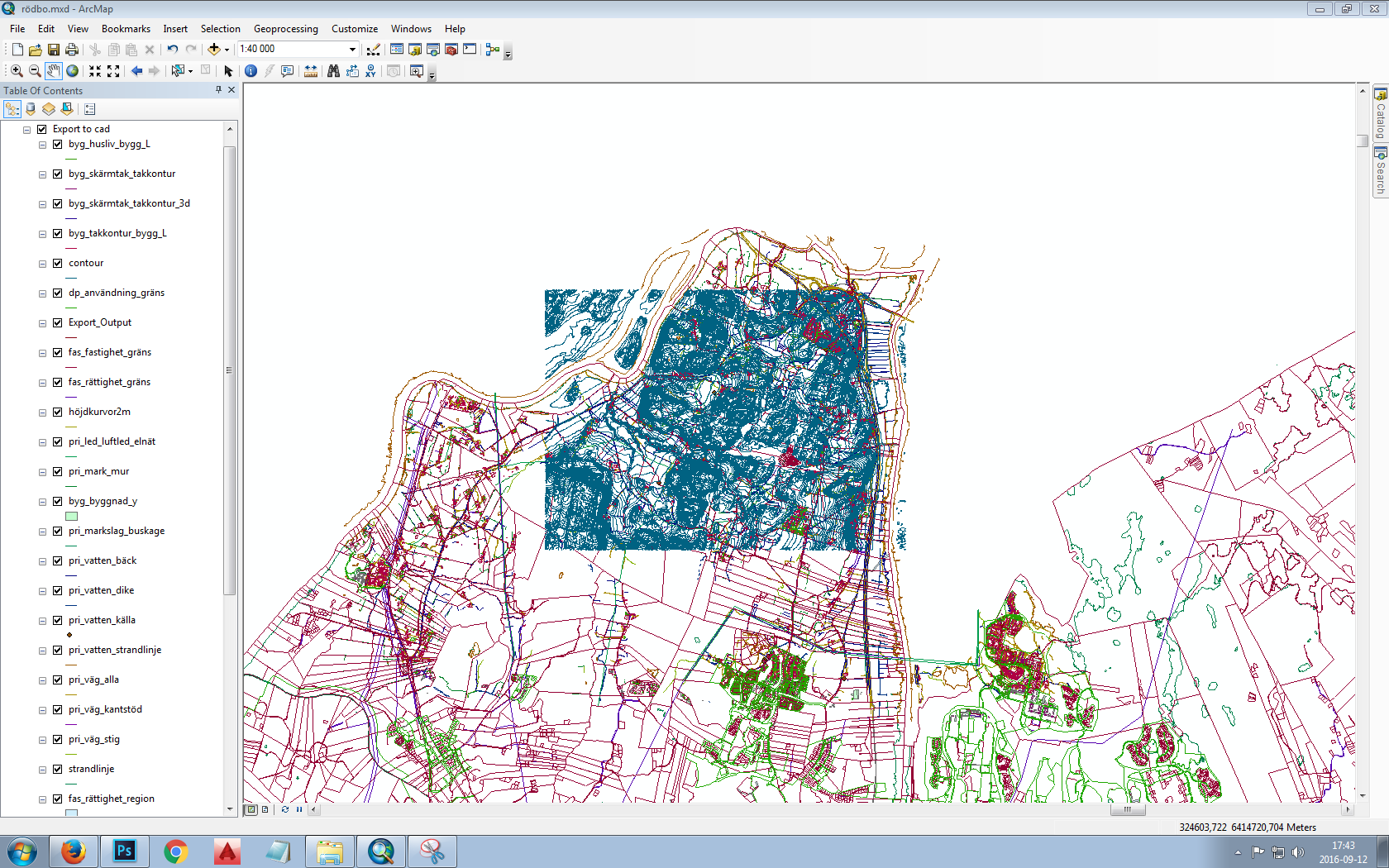
Before exporting
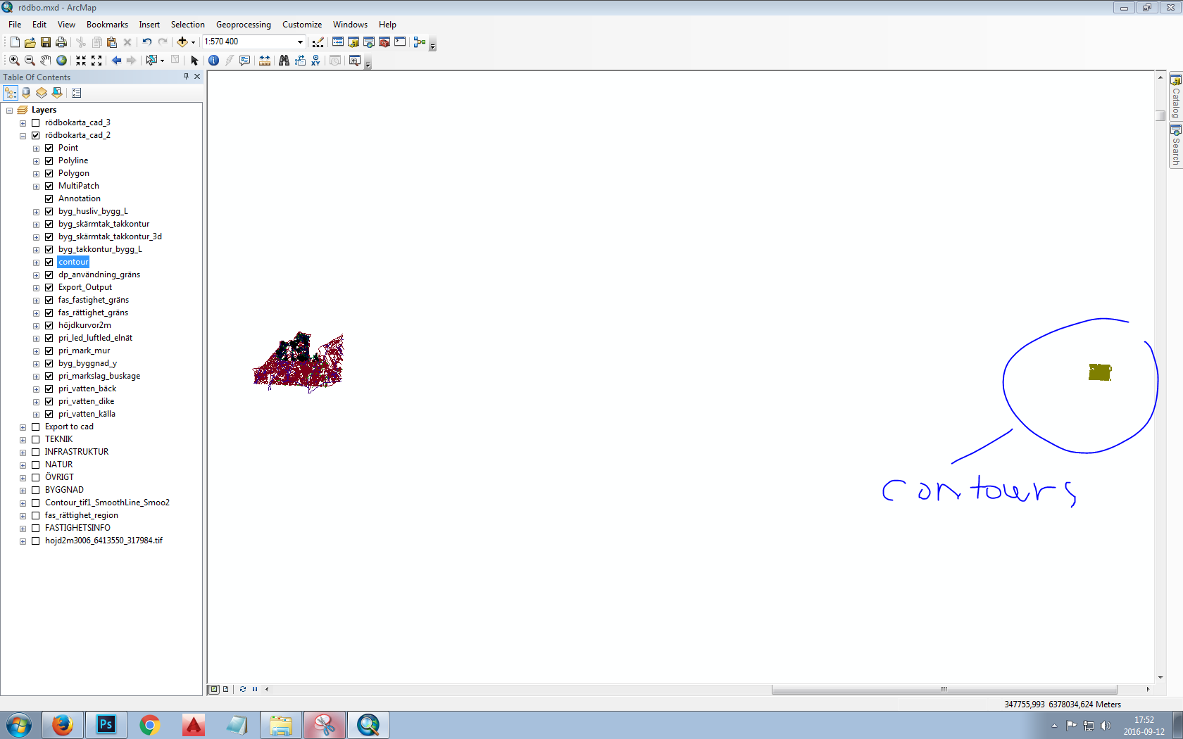
Afterwards with the new layers
Also it should be said that the contours have been converted to 3d, while the rest of the map is still in 2d.
Anyone know what the problem might be?
Thanks on beforehand!
- Mark as New
- Bookmark
- Subscribe
- Mute
- Subscribe to RSS Feed
- Permalink
It would be nice to include, the coordinate system of the data frame and that of the file and what you are trying to get it into. I looks like you have a projected dataframe, but no guess beyond that (web mercator? UTM? MTM? Lambert CC, Albers?)
- Mark as New
- Bookmark
- Subscribe
- Mute
- Subscribe to RSS Feed
- Permalink
Also include a screenshot of the spatial extent of the Contours layer.
At a glance the coordinates of the other layers look fine.
Think Location
- Mark as New
- Bookmark
- Subscribe
- Mute
- Subscribe to RSS Feed
- Permalink
Hi Dan and Jayanta. Sorry to say but I don't know how to check what kind of coordinate system I'm using. As to what I'm trying to get into I am trying to export a map of an area to a dwg-file which later is to become a model, therefore the height contours in 3d.
Jayanta, when you say the spatial extent do you just mean a screenshot of the contours layer zoomed in?
I'm very new to this and also don't have english as a first language so please bear with me 
- Mark as New
- Bookmark
- Subscribe
- Mute
- Subscribe to RSS Feed
- Permalink
Oskar... if you right-click on the layer, you can select Properties. From there, the various tabs will contain all the required information. If you see 'undefined' in the coordinate system or spatial reference section, then the file has none and will need one. There is a tab that will show the extent rectangle values which will give an idea of the size of the file and its east-west and north-south extent
- Mark as New
- Bookmark
- Subscribe
- Mute
- Subscribe to RSS Feed
- Permalink
Oh thanks for superfast answer!
I copied the info from the data source tab:
Data Type: Shapefile Feature Class
Shapefile: D:\GIS_databas\Rödbokarta_cad\höjdkurvor2m.shpGeometry Type: Line
Coordinates have Z values: Yes
Coordinates have measures: YesProjected Coordinate System: SWEREF99_TM
Projection: Transverse_Mercator
False_Easting: 500000,00000000
False_Northing: 0,00000000
Central_Meridian: 15,00000000
Scale_Factor: 0,99960000
Latitude_Of_Origin: 0,00000000
Linear Unit: MeterGeographic Coordinate System: GCS_SWEREF99
Datum: D_SWEREF99
Prime Meridian: Greenwich
Angular Unit: DegreeExtent
Left: 317984,962428 mRight: 322603,000000 m
Top: 6416877,057660 m
Bottom: 6413550,963375 m
So the coordinate system would then be sweref99?
When I compare the data source tab info from the contours layer with the other one, the thing that seems to be different is that the other layers do not have z values and measures.
- Mark as New
- Bookmark
- Subscribe
- Mute
- Subscribe to RSS Feed
- Permalink
The export to cad doesn't show anything suspicious. It is the top coordinate system as confirmed by the extent. It is a transverse Mercator (UTM-like) which I presume your dataframe is in also... or should be. When you say the coordinates are 'wrong' does that mean the X, Y values? or are you referring to the Z values? I am afraid that you will need to provide an example of your coordinates. Also, you have 'regionalized' settings (ie a comma instead of a period as the decimal setting). You might want to confirm that, that is not the difference you are seeing and you may have to check to see if regional settings are honoured by the tool.
- Mark as New
- Bookmark
- Subscribe
- Mute
- Subscribe to RSS Feed
- Permalink
I again Dan,
I am not sure what you mean with checking regional settings and if they are honoured by the tool? Which tool?
I tried to bypass the problem by drawing a rectangular box around the contours, converting it to a shapefile and then converting the whole layerpack but with the contours in a separate cad-file. I thought I then could fit the contours in the rectangular in autocad.
However the rectangle got offset in about the same place as where the contours was.
I checked the data source info in the rectangle properties and this is what it says:
Data Type: CAD Polygon Feature Class
Location: D:\GIS_databas
Feature Dataset: cadtest3 utan kurvor med ruta.DWG
Feature Class: Converted_Graphics
Feature Type: Simple
Geometry Type: Polygon
Coordinates have Z values: Yes
Coordinates have measures: No
Projection File:
D:\GIS_databas\ESRI_CAD.prjProjected Coordinate System: SWEREF99_12_00
Projection: Transverse_Mercator
False_Easting: 150000,00000000
False_Northing: 0,00000000
Central_Meridian: 12,00000000
Scale_Factor: 1,00000000
Latitude_Of_Origin: 0,00000000
Linear Unit: MeterGeographic Coordinate System: GCS_SWEREF99
Datum: D_SWEREF99
Prime Meridian: Greenwich
Angular Unit: Degree
- Mark as New
- Bookmark
- Subscribe
- Mute
- Subscribe to RSS Feed
- Permalink
There must be something going on here.
How did you do this in your original post :
"contours have been converted to 3d"
Also, with the original CAD file, how is it georeferenced. Have you defined the coordinate system of the CAD using ArcCatalog?
- Mark as New
- Bookmark
- Subscribe
- Mute
- Subscribe to RSS Feed
- Permalink
Also, don't understand this bit :
data source info in the rectangle properties and this is what it says:
Data Type: CAD Polygon Feature Class
Location: D:\GIS_databas
Feature Dataset: cadtest3 utan kurvor med ruta.DWG
Feature Class: Converted_Graphics
Feature Type: Simple
Geometry Type: Polygon
Coordinates have Z values: Yes
Coordinates have measures: No
Projection File:
D:\GIS_databas\ESRI_CAD.prj
Projected Coordinate System: SWEREF99_12_00
Projection: Transverse_Mercator
False_Easting: 150000,00000000 etc
What application is giving you this. Why the reference to a projection file?
If I look at a georeferenced CAD in ArcCatalog it doesn't show me a reference to another prj file,
it simply shows me the coordinate system. ie the prj is the same name as the CAD.