Turn on suggestions
Auto-suggest helps you quickly narrow down your search results by suggesting possible matches as you type.
Cancel
- Home
- :
- All Communities
- :
- Products
- :
- Geoprocessing
- :
- Geoprocessing Questions
- :
- Bizarre buffer behaviour
Options
- Subscribe to RSS Feed
- Mark Topic as New
- Mark Topic as Read
- Float this Topic for Current User
- Bookmark
- Subscribe
- Mute
- Printer Friendly Page
Bizarre buffer behaviour
Subscribe
2051
3
05-16-2011 01:35 PM
05-16-2011
01:35 PM
- Mark as New
- Bookmark
- Subscribe
- Mute
- Subscribe to RSS Feed
- Permalink
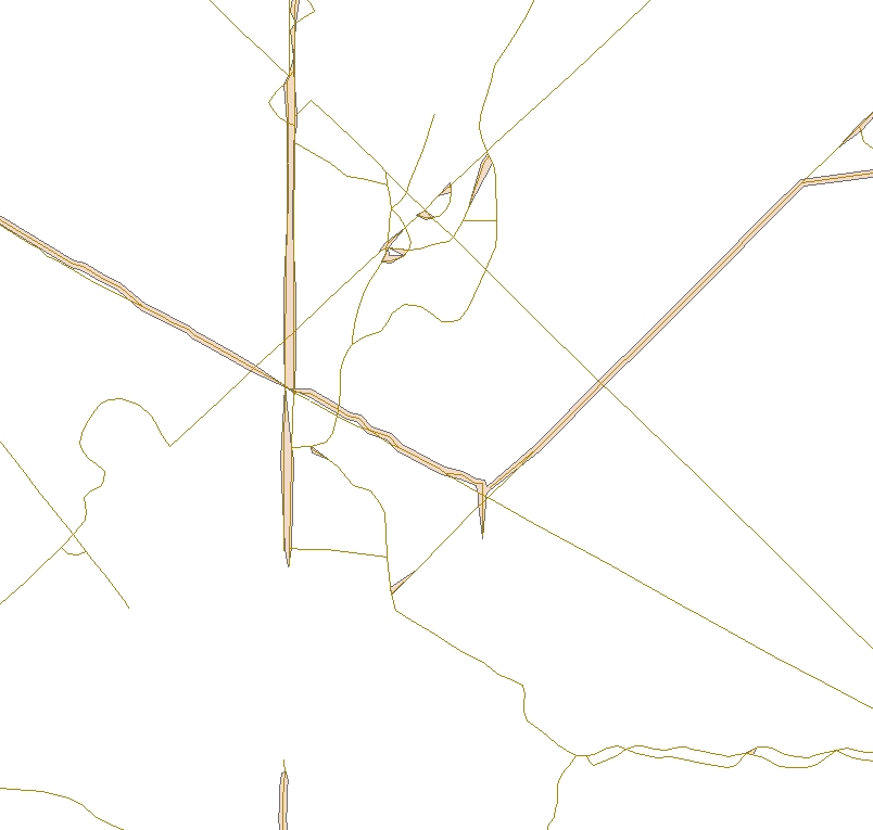
I've got a street feature class in a file geodatabase that I'm trying to buffer by the value of metres in a field, and dissolve based on the values in another field. The output is totally useless (see below). There are ~34,000 roads, which I don't think should be hitting any sort memory limit. Any thoughts?
3 Replies
by
Anonymous User
Not applicable
05-16-2011
03:07 PM
- Mark as New
- Bookmark
- Subscribe
- Mute
- Subscribe to RSS Feed
- Permalink
Original User: csny490
How does the buffer output look if you don't use the dissolve option?
Another potential problem: "True curve" geometry cause all sorts of bad things with many of the geoprocessing tools (buffer included). If you have curve features, try "densifying" the curve features by exporting to .shp format (shapefiles don't support curve geometry).
05-17-2011
06:52 AM
- Mark as New
- Bookmark
- Subscribe
- Mute
- Subscribe to RSS Feed
- Permalink
Thanks, you're a life saver - the shapefile worked fine (which is good, but annoying that this is the "solution"). I'm not sure if there were true curves in the feature class, but I inherited this dataset.
As a side note, removing the dissolve option worked fine with the feature class, but then failed once I tried to run the Dissolve tool.
As a side note, removing the dissolve option worked fine with the feature class, but then failed once I tried to run the Dissolve tool.
by
Anonymous User
Not applicable
05-17-2011
08:06 AM
- Mark as New
- Bookmark
- Subscribe
- Mute
- Subscribe to RSS Feed
- Permalink
Original User: csny490
Cool - glad that worked. I hate true curve features, and wish ESRI had a better way of dealing with them (like some sort of auto-densification algorithm) in the GP tools.
It can be very difficult to dissolve large interconnected buffer FCs (think roads, streams, etc), because the resulting features(s) tend to have a huge number of verticies in a single shape field, that often exceed the computers ability to load the feature geometry into the memmrry in order to read/process/write geoprocessing results. I have the need to build large and complex statewide srtream buffers for timber harvest regulatory stuff, and have had to build an automated tiling scheme to properly depict non-overlapping rioparian buffers. Basically I build a fishnet-type polygon, and then build the buffers for each tile.