- Home
- :
- All Communities
- :
- Products
- :
- Geoprocessing
- :
- Geoprocessing Questions
- :
- ArcMap Dem to Raster cutting off Data
- Subscribe to RSS Feed
- Mark Topic as New
- Mark Topic as Read
- Float this Topic for Current User
- Bookmark
- Subscribe
- Mute
- Printer Friendly Page
- Mark as New
- Bookmark
- Subscribe
- Mute
- Subscribe to RSS Feed
- Permalink
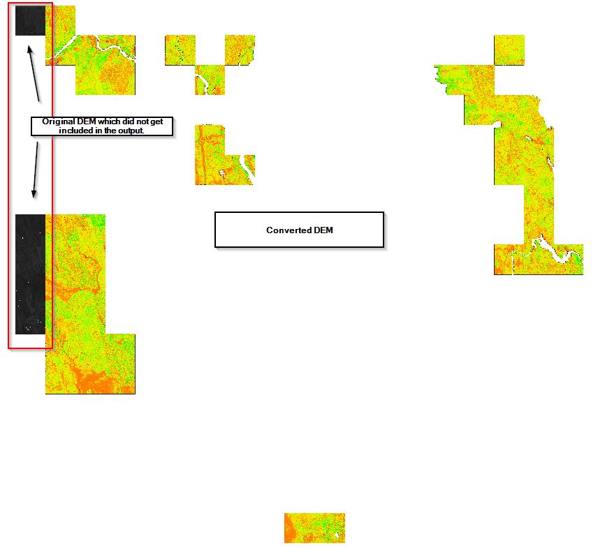
I have a floating point USGS DEM that I am putting through the ArcMap DEM to Raster tool. The output consistently cuts off a portion of the input (see below). Any thoughts as to why?
Solved! Go to Solution.
Accepted Solutions
- Mark as New
- Bookmark
- Subscribe
- Mute
- Subscribe to RSS Feed
- Permalink
Rather use the CopyRaster tool if you want it in another format. It should also be noted that the USGS DEM is a valid raster dataset and can be used without being converted.
DEMToRaster has been deprecated in ArcGIS Pro 2.5
-Steve
- Mark as New
- Bookmark
- Subscribe
- Mute
- Subscribe to RSS Feed
- Permalink
Thank you, CopyRaster is a new tool for me, but it accomplished what I needed it to!