- Home
- :
- All Communities
- :
- Industries
- :
- Natural Resources
- :
- Forestry
- :
- Forestry Questions
- :
- Re: How do I symbolize by category and quantity?
- Subscribe to RSS Feed
- Mark Topic as New
- Mark Topic as Read
- Float this Topic for Current User
- Bookmark
- Subscribe
- Mute
- Printer Friendly Page
How do I symbolize by category and quantity?
- Mark as New
- Bookmark
- Subscribe
- Mute
- Subscribe to RSS Feed
- Permalink
I have polygons for protected properties in a 5 county area. Ideally, because of scale issues, I would like to symbolize these by a single point in the center of each polygon; whose color corresponds to ownership category (ie: public, private, municipal, etc.) and whose size corresponds to acreage (number of acres in the protected property). Is this possible?
- Mark as New
- Bookmark
- Subscribe
- Mute
- Subscribe to RSS Feed
- Permalink
like graduated symbols Using graduated symbols—Help | ArcGIS for Desktop other options abound in the symbology section
- Mark as New
- Bookmark
- Subscribe
- Mute
- Subscribe to RSS Feed
- Permalink
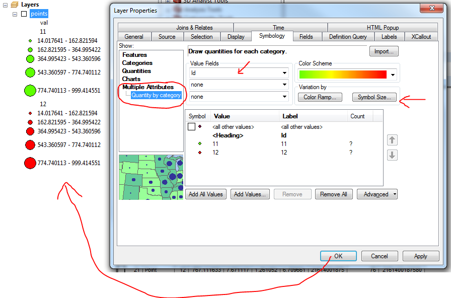
I think you're looking for the Multiple Attributes option. Value Field = ownership category, Variation by Symbol Size = acreage.
- Mark as New
- Bookmark
- Subscribe
- Mute
- Subscribe to RSS Feed
- Permalink
Thank you. That worked great for when the ownership categories are in different layers.
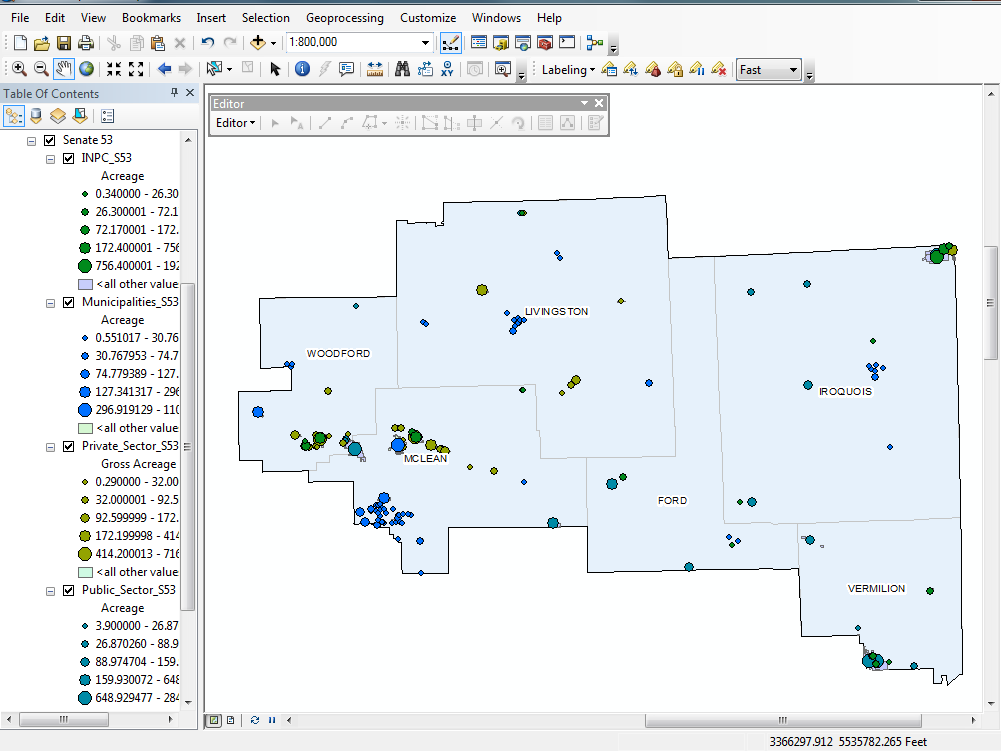
In an effort to try to standardize the acreage classification across the categories, I merged the layers. Is there a way to symbolize from one layer by both ownership category (color) and acreage (point size). When I try to use quantity by category in the merged layer it places graduated symbolized points by acreage in the center of polygons colored to symbolize the categories.
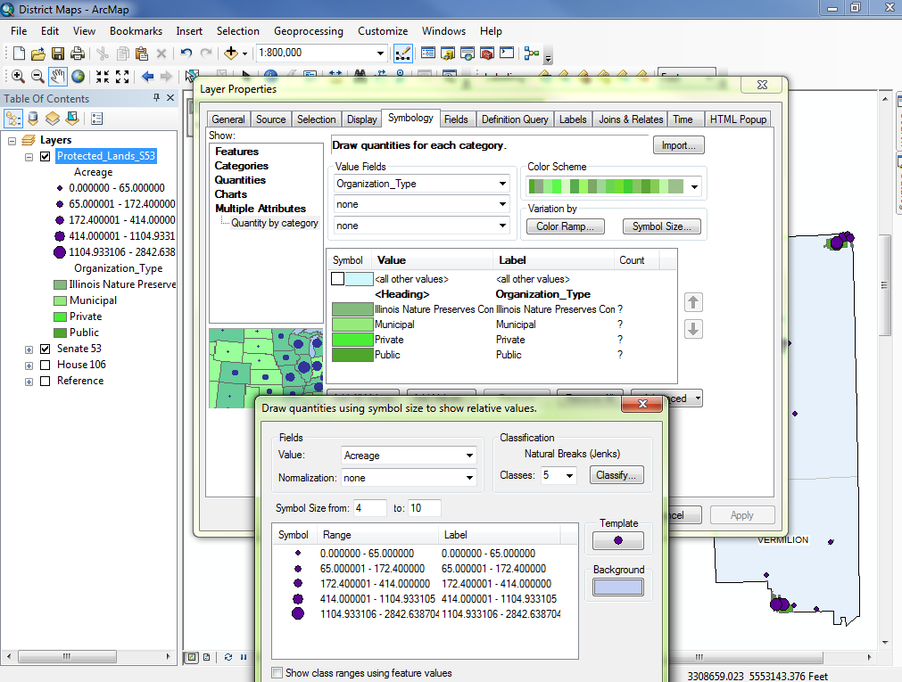
Is there a simpler way to do this? Should I just manually classify the acreage so its the same across each category?
Thanks for the help.
- Mark as New
- Bookmark
- Subscribe
- Mute
- Subscribe to RSS Feed
- Permalink
If you want to standardize across regions for example, I prefer to use a manual classification scheme, rather than on that is calculated from the statistical or distribution parameters (ie std dev, natural breaks, quantiles etc). Also look at your ranges, 0-65 then 65-172 etc etc. the sizes of the symbols is one thing, whether the increments makes sense to the observer is totally separate issue.