- Home
- :
- All Communities
- :
- Services
- :
- Esri Training
- :
- Esri Training Questions
- :
- Apr. 24, 2018 - Location Advantage AMA (Ask Me Any...
- Subscribe to RSS Feed
- Mark Topic as New
- Mark Topic as Read
- Float this Topic for Current User
- Bookmark
- Subscribe
- Mute
- Printer Friendly Page
Apr. 24, 2018 - Location Advantage AMA (Ask Me Anything)
- Mark as New
- Bookmark
- Subscribe
- Mute
- Subscribe to RSS Feed
- Permalink
- Report Inappropriate Content
Live AMA Event on GeoNet
Tuesday, April 24, 10:30 a.m. - 11:30 a.m. (PDT)
We invite you to join The Location Advantage MOOC instructors John Shramek and Joseph Kerski here on the GeoNet Community for a LIVE AMA (Ask Me Anything) event. The AMA will take place in this discussion thread on Tuesday, April 24, 2018, from 10:30 a.m. - 11:30 a.m. (PDT).
*Click HERE to convert exact time for different countries.
This is an opportunity to ask the Location Advantage MOOC instructors questions about the course, about earth imagery data, Esri software, GIS or anything else that comes to mind.
How does the AMA work?
During the AMA, you can post your questions by clicking  the "Add Reply" button below and John and/or Joseph will reply to your questions in comments. You are welcome to post questions ahead of the AMA and they will answer them during the AMA.

Please note: You must be logged in to post questions and see responses. Please see instructions on How to Log into GeoNet for the AMA.
AMA Tips and GeoNet Community Guidelines
- When asking questions and comments during the AMA, remember to follow the GeoNet Community Guiding Principles: Be Helpful, Be Human, Be Smart.
- This discussion page will not auto-refresh, so please remember to refresh this page to see new questions, comments and replies.
 Please note: The AMA will be live when you see a picture below with John and Joseph.
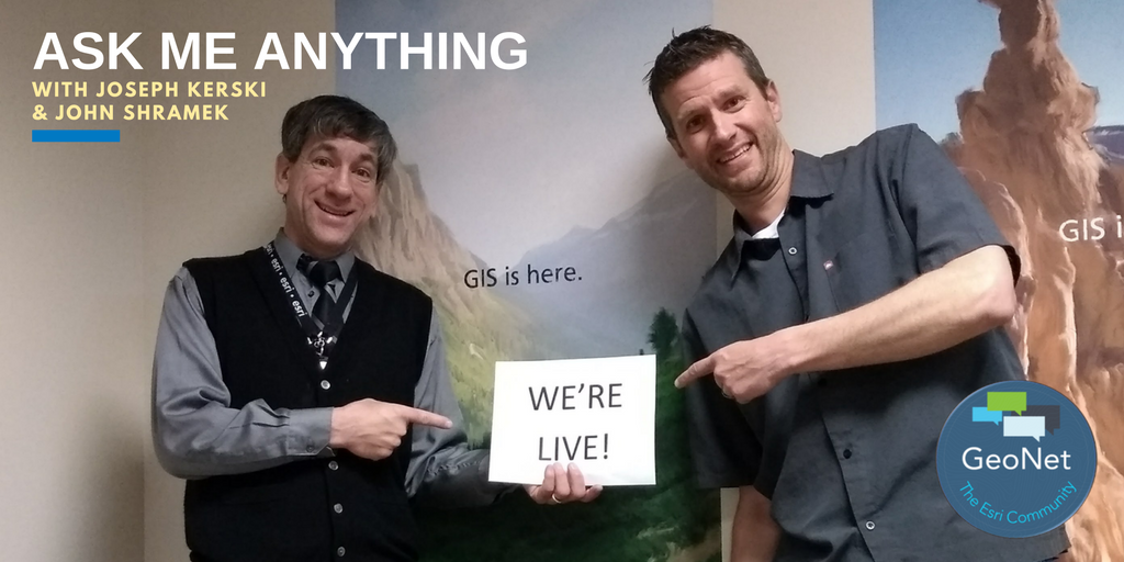
- 10:30 a.m. - And we're live! Go ahead and ask your questions!
- 10:45 a.m. - If you are just joining us, feel free to ask any question.
- 11:00 a.m. - We're halfway through, Great questions! Keep them coming!
- 11:15 a.m. - If you are just joining us, feel free to ask any question.
- 11:25 a.m. - Five minutes to go! Got any last minute fun questions for John and Joseph?
- 11:30 a.m. - And that's a wrap! The live AMA has ended with John and Joseph.
Thank you for your questions and participation. Feel free to continue to post your questions and we will answer them.
- Mark as New
- Bookmark
- Subscribe
- Mute
- Subscribe to RSS Feed
- Permalink
- Report Inappropriate Content
Hi Julie - I had a similar experience that John had and I think many others here do as well. So, be patient with the interview process because the ultimate goal is to make sure that the applicant is a good fit for the job position. Which is a good thing! I spent much of my career in federal agencies so I wanted to work for a private company that had that similar mission of public service - and that is definitely something that Esri strives for - to serve and empower the decision-making community, worldwide.
--Joseph K
- Mark as New
- Bookmark
- Subscribe
- Mute
- Subscribe to RSS Feed
- Permalink
- Report Inappropriate Content
Thank you Joseph (and John!)
I have been considering getting into map-making as a career, but I am unsure if it's too specific of a career path because I want to delve into other aspects of applied science. Do either of you ever go out into the field and look at the land that you map? And out of all the people you worked with in Esri, what kind of people have you worked/collaborated with the most (engineers, soil scientists, urban planners, etc.) and how? (If you have worked more closely with a variety of people before working for Esri, I would be happy to hear about that too!)
For either or both of you, what was the most interesting/fun experience where you have worked with maps?
- Mark as New
- Bookmark
- Subscribe
- Mute
- Subscribe to RSS Feed
- Permalink
- Report Inappropriate Content
(copied from my reply to your reply)
I have been considering getting into map-making as a career, but I am unsure if it's too specific of a career path because I want to delve into other aspects of applied science. Do either of you ever go out into the field and look at the land that you map? And out of all the people you worked with in Esri, what kind of people have you worked/collaborated with the most (engineers, soil scientists, urban planners, etc.) and how? (If you have worked more closely with a variety of people before working for Esri, I would be happy to hear about that too!)
For either or both of you, what was the most interesting/fun experience where you have worked with maps?
- Mark as New
- Bookmark
- Subscribe
- Mute
- Subscribe to RSS Feed
- Permalink
- Report Inappropriate Content
Hi Julie - I serve on the education outreach team so the people I interact with most are professors, teachers, deans, provosts, campus facilities people, and students. But also I work with publishers, education outreach people at national parks, and lots of others in the field of education. Internally at Esri, education touches on many other teams. Yes, I get into the field and use Survey123 in conjunction with teaching workshops and courses. I would say that this is a GREAT time to get into GIS and mapmaking - there are so many fields - see www.esri.com/mapmuseum that use GIS in expanding ways.
--Joseph K
- Mark as New
- Bookmark
- Subscribe
- Mute
- Subscribe to RSS Feed
- Permalink
- Report Inappropriate Content
Hi Julie,
Your questions are great. Thank you for posting them. If you are really interested in a career in GIS and mapmaking, just like you would use your LinkedIn to build your professional network, you can do the same here. GeoNet is also a wonderful place to network with other professionals, build the professional relationships and get to know who is hiring. Don't forget to include your experience on your GeoNet profile. Follow as many professionals in the field as you can learn from and don't be shy to ask our top participants for a little mentoring or career guidance. Many have been in the field a while and are experts in the world of GIS.
- Mark as New
- Bookmark
- Subscribe
- Mute
- Subscribe to RSS Feed
- Permalink
- Report Inappropriate Content
Also, be sure to introduce yourself in the GeoNet Resource Hub Introduce Yourself! discussion.
- Mark as New
- Bookmark
- Subscribe
- Mute
- Subscribe to RSS Feed
- Permalink
- Report Inappropriate Content
Julie,
I would say not too specific at all, if anything, you'll need to narrow it down! GIS and the geospatial analysis that it allows is applied science, and it can be applied to...anything. Anything related to the environment, business, engineering, pretty much any industry has a space and a need to know where things are and how they relate to each other.
In Education Services at Esri I no longer interact with people who do the exciting stuff, outdoors, but there are lots of them, here and in other industries. I worked in engineering consulting, building roads and bridges, and between GIS analysts, map-makers, survey folks, CAD engineers, and remote sensing analysts, there were a lot of us needed to support that work.
My advice is, think about what industry or career you want to target, and then apply GIS to it. You'll be extremely marketable if you know, say, urban planning, or marketing, or whatever, and then also GIS and how it can be used in addition. Good luck, contact me through the course if you have more questions!
- Mark as New
- Bookmark
- Subscribe
- Mute
- Subscribe to RSS Feed
- Permalink
- Report Inappropriate Content
Around location data, point information usually geocodes to the site entrance driveway, and this is insufficient for first responders who need to know there's a gate, where the entry doors to the building(s) may be, where the roof hatches are located, where the emergency exits empty out, etc. Do you know where to point me for best practices recording and coding such points at fine enough resolution?
- Mark as New
- Bookmark
- Subscribe
- Mute
- Subscribe to RSS Feed
- Permalink
- Report Inappropriate Content
Hi Paul,
This course is about business geography, not overly applicable to public safety. But, I forwarded your question to someone in that realm, here's the reply I got:
"Currently, many in the fire industry are using several of our solutions on the Solutions page: http://solutions.arcgis.com/. Under local government, there are many solutions that get fire services started in creating fire incident maps and help develop pre-incident plans, which is what that question is referring to. Best practices have been to have fire folks using these solutions, that guide them through using Pro, creating maps online, and getting web maps ready for use in Collector. Then, they go collect information about roof hatches, emergency exits…or use web apps to edit those points for fine resolution... If you go to this page: https://www.esri.com/en-us/industries/public-safety/webinars, there are many webinars on fire planning. One, Modernizing Your Fire Department with ArcGIS Online shows exactly that, how you can go about creating pre plans by using the platform. Unfortunately, we don’t have “fire” training, yet, but this is planned for the future."
- « Previous
-
- 1
- 2
- Next »
- « Previous
-
- 1
- 2
- Next »