- Home
- :
- All Communities
- :
- Networks
- :
- Esri Startup Program
- :
- Esri Startup Program Questions
- :
- Don't Miss the Startup Zone at Esri UC!
- Subscribe to RSS Feed
- Mark Topic as New
- Mark Topic as Read
- Float this Topic for Current User
- Bookmark
- Subscribe
- Mute
- Printer Friendly Page
Don't Miss the Startup Zone at Esri UC!
- Mark as New
- Bookmark
- Subscribe
- Mute
- Subscribe to RSS Feed
- Permalink
Check out the Esri UC blog covering the Esri Startup Zone: Get in the (startup) zone at EsriUC | Esri User Conference
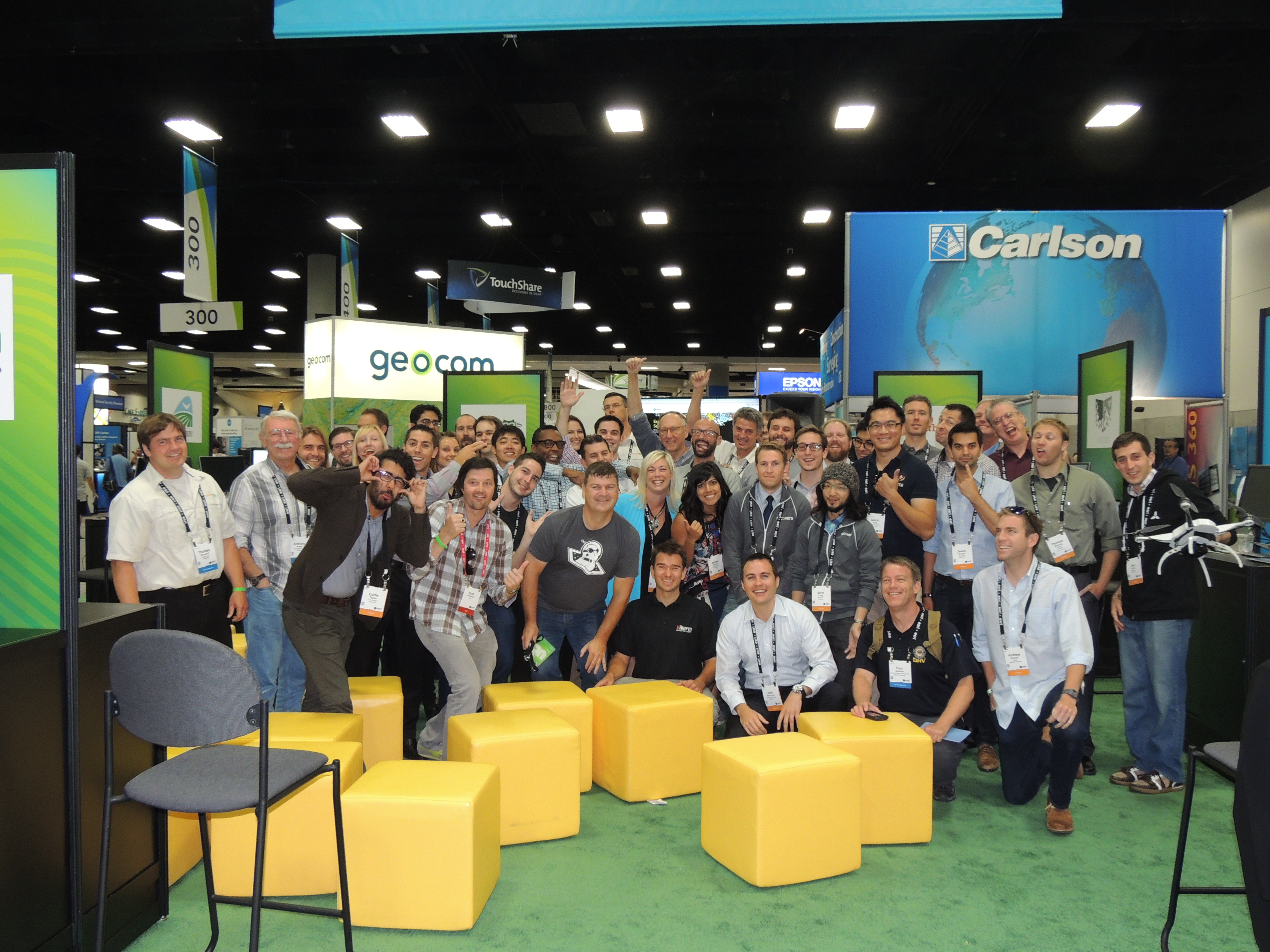
We hope to see you at Esri UC, the biggest GIS event of the year. We know there are a lot of amazing sessions, demonstrations and other activities but don’t miss the Esri Startup Zone (SUZ) in Hall D on the expo floor. This is a unique area hosted by the Esri Startup Program, esri.com/startups, featuring the work of 35 up-and-coming businesses who have integrated spatial functionality within their products as well as for their own organizational understanding and optimization.
Startup Zone Exhibitors: Hall D
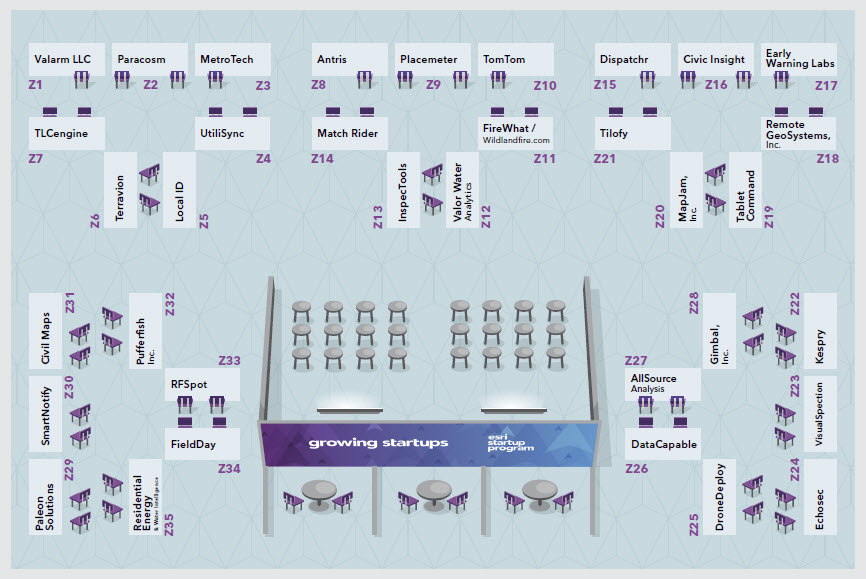
Company | Booth | Industry Focus | Company Description |
SPONSOR: | Z10 | Location Based Services, Navigation, Hardware/Software | TomTom is a leading global supplier of location and navigation products and services. We provide GIS enterprise, government, automotive and consumer markets with digital maps, traffic intelligence, POIs, fleet management services, smartphone apps, automotive systems, fitness devices, navigation software, and PNDs. Discover more about TomTom Geospatial for Esri, visit www.tomtom.com/licensing. TomTom has worked with Esri Startup team to build a premium content offering for large volume geocoding and routing called “StreetMap Premium for Startups”. This is not a free product for startups, but radically discounted, and only available to companies inside of Esri Startup Program. |
Z27 | Defense, Commercial Intelligence | AllSource Analysis is at the forefront of the commercial intelligence industry with multi-source solutions that provide actionable intelligence. | |
Z8 | Public Safety/Emergency Management | Antris is a multiplatform mobile resource management system designed for organizations with traveling at-risk workers and companies with work-alone employees. | |
Z16 | Planning/Economic Development | Civic Insight makes information about buildings and construction projects available to the public in an easy-to-use web interface. | |
Z31 | 3D, Public Works | Civil Maps creates 3D maps & reports from survey data, are 50x faster than current methods, with over 99.9% accuracy delivered to transportation & utility clients. | |
Z26 | Electric/Gas Utility, Telecommunication | DataCapable provides social media aggregation, machine-learning analytics and engagement tools for the utilities industry. | |
Z15 | Electric/Gas Utility, Transportation/Fleet Management | Dispatchr provides the world’s most sophisticated predictive workforce management system to proactively increase the resiliency of the grid. | |
Z25 | Drones Architecture/Engineering/Construction, Mining | A simple, cloud-based software solution which allows anyone to create on-demand aerial drone maps in a single click. | |
Z17 | Public Safety/Emergency Management | Early Warning Labs, an official USGS Partner, is a turnkey Earthquake Early Warning solution provider offering both enterprise and consumer solutions. A seven second earthquake warning can save your life. | |
Z24 | Social Media Mapping, Location-based Services, Public Safety, Journalism, | Echosec is a new location-based social media search platform that provides intelligence to public safety, marketing, and security professionals | |
Z34 | Agriculture | Optimized planning and planting schedule for fresh produce crops. FieldDay helps farmers optimize when and where to plant for a steady harvest. | |
Z11 | Fire, Public Safety/Emergency Management | Emergency disaster response for wildfires using real-time GIS along with expert sourced fire information. | |
Z28 | Retail/Commercial, Indoor Mapping, Beacons | Gimbal is the leading location and proximity-based mobile engagement platform. | |
Z13 | Drones, Electric/Gas Utility, Natural Resources | InspecTools develops & deploys GIS-centric utility asset risk reduction systems, utilizing aerial & mobile data acquisition methods. | |
Z22 | Drones, Architecture/Engineering/Construction, Mining | Kespry designs and builds a versatile commercial-grade drone system that autonomously collects and analyzes high resolution geospatial information. | |
Z5 | Retail/Commercial Business, Location-based Services | Local ID helps multi-unit retail businesses maximize their local marketing opportunity and activity. Revolutionizing local marketing playbooks for commercial retailers. | |
Z20 | Retail/Commercial Business, Media/Publishing | MapJam is a next generation location mapping platform empowering brands to create and distribute customized maps with contextualized information. | |
Z14 | Transportation/Fleet Management, Location-based Services | Match Rider creates a mobility network based on private rides with dynamic meeting locations. | |
Z3 | Transportation/Fleet Management, Planning/Economic Development | MetroTech aggregates realtime traffic data, applies analytics, and publishes actionable information. It’s the next generation of traffic analytics. | |
Z29 | Electric/Gas Utility, Water/Wastewater/Stormwater | Paleon Solutions provides a hosted solution for Utilities wanting to extract actionable information and spatial analysis. | |
Z2 | 3D, Architecture/Engineering/Construction | Paracosm develops acquisition & reconstruction tools to create 3D models of the real world for indoor navigation & facilities management applications. | |
Z9 | Planning/Economic Development, Retail/Commercial Business | Placemeter turns video into data, measuring how cities move in real time for developers, citizens, cities, and retailers. | |
Z32 | 3D, Marketing and Advertising, Digital Display | Puffersphere design & develop new platforms for display of digital content outside confines of traditional flat screen media. 360 Video | |
Z18 | Electric/Gas Utility, Pipeline | Geospatial Video Recording Systems and Integrated GIS Software for Utilities, Oil & Gas, Defense and other Critical Infrastructure Inspections. | |
Z35 | Electric/Gas Utility, Water Resources | Res-Intel provides remote benchmarking of residential energy and water use, customized demand management measures, and predictive uptake modelling. | |
Z33 | Location-based Services, Internet, Indoor Mapping | Indoor mapping and analytics service - we use mapping carts and automated machines to capture data on your indoor environment. | |
Z30 | Mobile Commerce, Communications | Make sure your audience gets your messages at the right time, on the right channel. SmartNotify helps humans and machines communicate with your GIS. | |
Z19 | Fire, Public Safety/Emergency Management | Tablet Command is a tablet-based incident command software for fire fighters, delivered on iPads. | |
TerrAvion | Z6 | Agriculture, Aerial Imagery | High-quality Real-time aerial imagery for operational use. |
Z21 | Social Media Mapping, Location-based Services, Media/Publishing | Tilofy systematically sifts through data from social media and the rest of the web to detect what's trending in the offline world. | |
Z7 | Real Estate, Banking/Credit Unions/Financial Services | TLCengine is an Professional Search Platform that empowers MLS & REALTORS to search homes on total affordability (TLC=True Lifestyle Cost) | |
Z4 | Public Works, Utilities, Local Government | UtiliSync is a mobile app that Public Works personnel use to take photos, create sketches, and complete forms related to their utility infrastructure | |
Z1 | Internet of Things, Natural Resources, Petroleum | Valarm is an open platform that facilitates rapid deployment of geo-enabled, real-time, mobile sensors with easy integration into the ArcGIS platform. | |
Z12 | Water/Wastewater/Stormwater, Public Works | Delivering data-driven tools for water utilities to actively address revenue issues like conservation, missed revenue, revenue risk, and cutoffs. | |
Z23 | Smart Glasses, Electric/Gas Utility, Petroleum | Esri integrated hands free inspection software through smart glasses for improved efficiency and safety in the field. | |
Outside Startup Zone (exhibiting on expo floor) | |||
2312 | Satellite Imagery, Natural Resources, Agriculture | OmniEarth specializes in data fusion. Our planned constellation combined with our current geo-analytics capabilities tackle complex global problems. | |
511 | Drones, Aerospace | SenseFly develops, assembles and markets autonomous mini-drones and related software solutions for civil professional applications. | |
1018 | 3D, Information Technology and Services | SmarterBetterCities brings your ideas to life. Smart and easy 3D software - built on ArcGIS - to create and manage 3D cities and buildings. | |
1606 | Novel Geocoder Location-based Services, Transportation/Fleet Management | what3words is a global grid of 57 trillion 3mx3m squares. Each square has a 3 word address that can be communicated quickly and easily. | |