- Home
- :
- All Communities
- :
- Networks
- :
- Esri Startup Program
- :
- Esri Startup Program Blog
- :
- Disruptive Esri Hacks Featured at TechCrunch Disru...
Disruptive Esri Hacks Featured at TechCrunch Disrupt NY 2017
- Subscribe to RSS Feed
- Mark as New
- Mark as Read
- Bookmark
- Subscribe
- Printer Friendly Page
Recently, Esri participated at the TechCrunch Disrupt NY 2017 Hackathon, May 13-14, and Conference, May 15-17, in New York, NY. #TCdisrupt debuts revolutionary startups, introduces game-changing technologies, and discusses what’s top of mind for the tech industry’s key innovators.

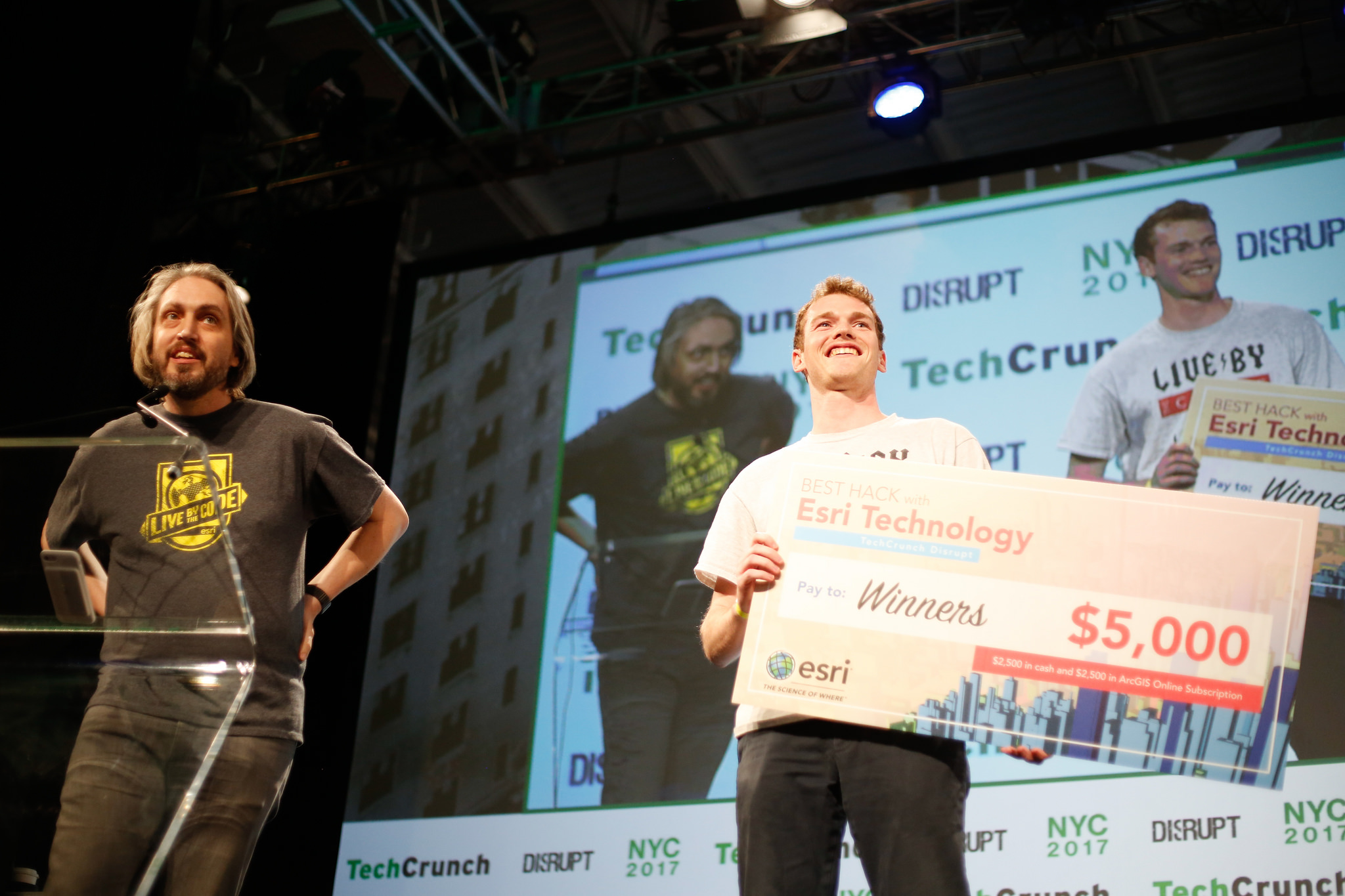
The hackathon occurs the weekend before the Disrupt conference. Over 750 developers from all over took part in a 24-hour coding test of endurance. At the hackathon we provided free ArcGIS Developer Subscriptions and credits to developers creating apps that included mapping, visualization, analysis, imagery, authoritative data and more. Hackers could build web, mobile, and desktop apps for any device. The lucky Esri prize winner received a $5,000 prize ($2,500 cash, plus $2,500 ArcGIS Online subscription).
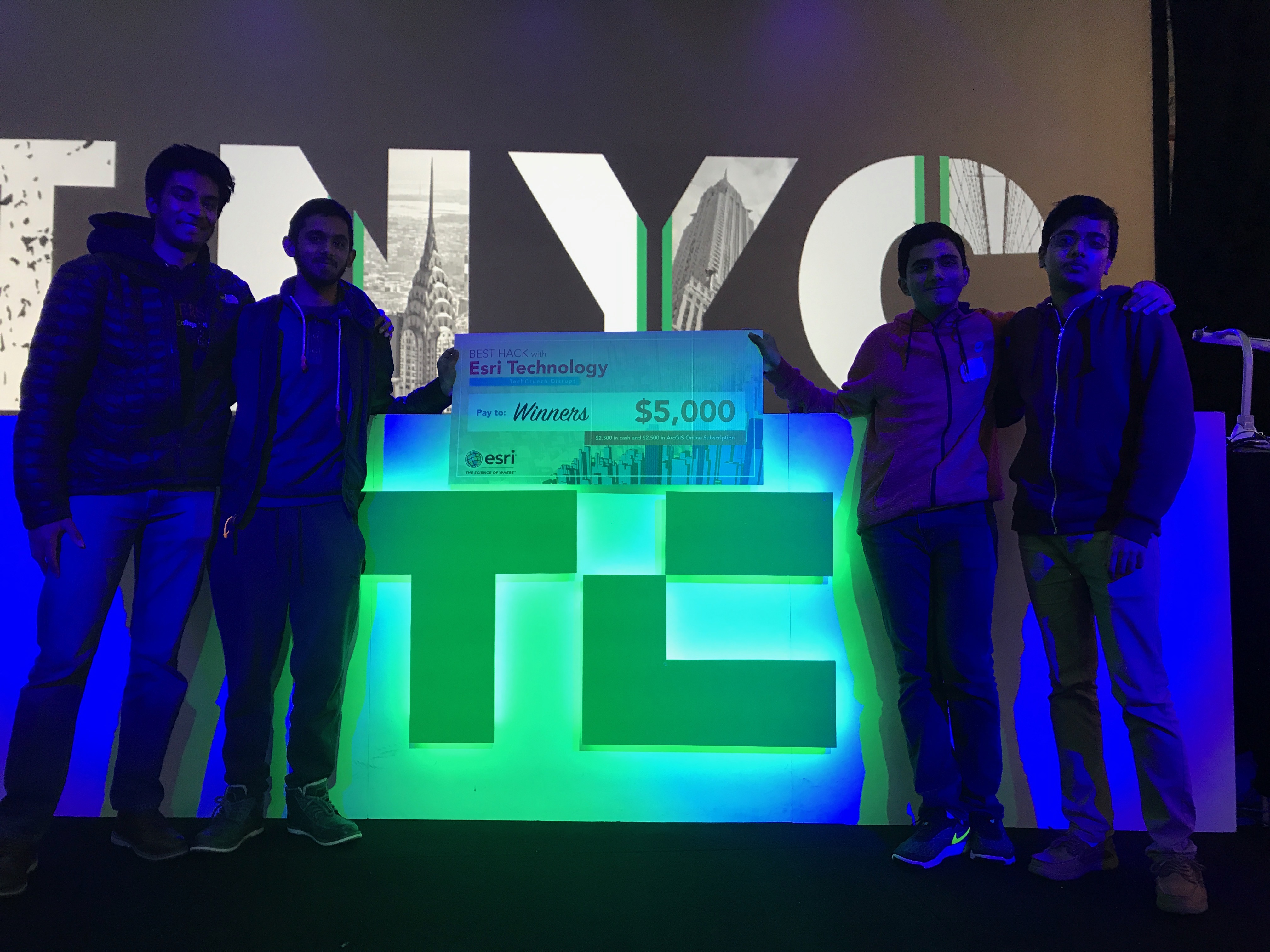
Congratulations to our winner SafePath! While we could only pick one winner, we had a few other honorable mentions we wanted to share. You can view all the submissions here. Learn more about our winner and other Esri submissions below:
SafePath
SafePath is an Android app built by four students from Rutgers University. This project won the Esri $5,000 prize for the best integration of Esri technology in a hack.
SafePath is a mobile app that notifies you when you enter a geofence designated as a recent area of hostile activity and offers you a safe route to a safe zone. The app used the ArcGIS Runtime SDK for Android together with the PubNub block we provided for geofence notification. The team utilized the night streets vector base map and added features to visualize where hostile activity was taking place and where the safe zones were located. Hostile data was aggregated from several sources including crowdsourcing and social media and then added to a hosted feature service. When the device entered a hostile polygon, or recent activity indicates the device is now inside the hostile geofence, the app sends a SMS message using PubNub to contacts registered with the app. Then it invokes Esri’s routing task to determine a route to the nearest safe zone and visualize that route on the map.
The team was eager to continue working on SafePath after the hackathon and experimenting with other Esri technology. They plan to update the visual rendering with a heatmap and improve the real-time collection of data. Congratulations to our TechCrunch Disrupt NY 2017 winners!
BackMap
These developers found that 17,000 pedestrians were injured in the past year and wanted to create a system to help pedestrians, the visually impaired, and cyclists navigate through streets and buildings without ever pulling out their phone to distract them.
BackMap is a system that includes a backpack with a vibration motor in the right and left strap of the backpack, an application to input navigation data, and a set of BLE beacons. This allows us to create two different navigation scenarios, one indoors and one outdoors. For the outdoors scenario, the user inputs a location, and the backpack leads you to that location by vibrating the right strap whenever you should turn right, and vibrate the left whenever you should turn left. This helps the visually impaired, pedestrians, and bikers navigate busy streets, along with anyone not able to constantly monitor their phone. This navigation and routing is performed using the Esri directions PubNub block.
The project was built with Esri ArcGIS API for JavaScript, PubNub, ArcGIS Runtime SDK for Android, with geocoding, routing, and mapping services. Learn more in this TechCrunch feature.
Wheelable
Wheelable was inspired by personal experiences with accessibility. Wheelable is a web service that helps identify venues that have accessible facilities such as elevators, ramps, escalators, and others. Wheelable allows its user to review a location when it is not accessible for users with mobility disabilities to improve their experience organizing trips.
The project was built with Esri ArcGIS API for JavaScript, PubNub, Node, Express, Handlebars, and MongoDB.
Congratulations to the winners and other hacks! Supporting a hackathon requires a lot of energy, focus, and time, but is incredibly rewarding. Seeing eyes light up as people start to see what our GIS tools can do for them makes our work worthwhile, and at each hackathon we support, we see the work that’s been leveraged from developers.arcgis.com really paying off with teams integrating more advanced geo development than they had previously.
Many thanks to the awesome team at TechCrunch, and especially to all the hackathon contestants and Disrupt attendees who chose to learn more about Esri and ArcGIS. We look forward to participating in TechCrunch Disrupt SF in September and hope to see you there.
You must be a registered user to add a comment. If you've already registered, sign in. Otherwise, register and sign in.