- Home
- :
- All Communities
- :
- User Groups
- :
- Elevation Data
- :
- Questions
- :
- Re: how is slope actually calculated within ArcMap...
- Subscribe to RSS Feed
- Mark Topic as New
- Mark Topic as Read
- Float this Topic for Current User
- Bookmark
- Subscribe
- Mute
- Printer Friendly Page
Re: how is slope actually calculated within ArcMap?
- Mark as New
- Bookmark
- Subscribe
- Mute
- Subscribe to RSS Feed
- Permalink
So, this is just to clarify what is going on in the slope tool ... I want channel slope along stream channel sections and as I understand it, slope is simply the change in elevation over the change in distance or (delta E / delta L) where L is the length of each channel section and delta E is the maximum elevation (usually at the head of the channel) and the min elevation (at the base of the channel).
Even in the tutorial I read about getting the slope of a winding hiking trail, it doesn't seem like that is how ArcMap does ... the values don't match up. Could someone clarify what calculation is being used to get just one line in the attached screenshot?
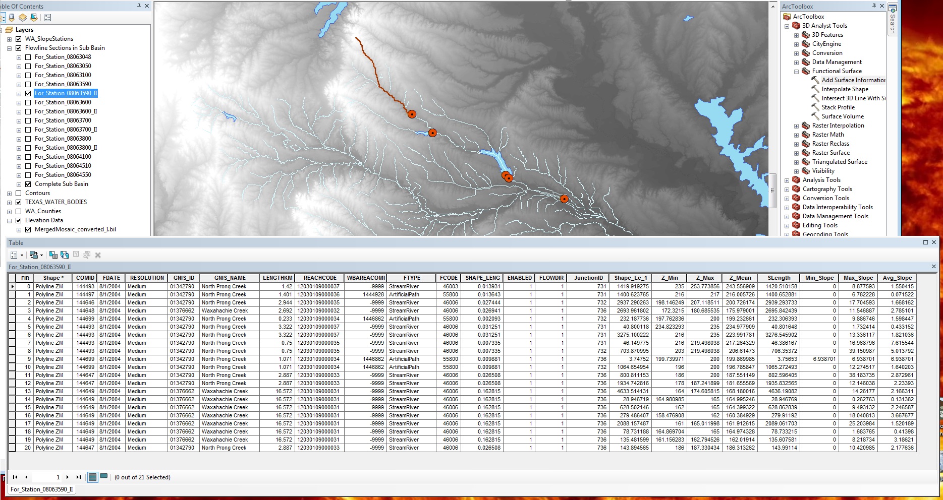
Thus far I am just figuring the whole average slope of the stream would be (253.77 - 186)/(sum SLength) = (67m)/(24587.46 m) = 0.00272502
Solved! Go to Solution.
Accepted Solutions
- Mark as New
- Bookmark
- Subscribe
- Mute
- Subscribe to RSS Feed
- Permalink
The default is slope in degrees, so that is probably what you calculated.
- Mark as New
- Bookmark
- Subscribe
- Mute
- Subscribe to RSS Feed
- Permalink
You've calculated percent slope (0.2%). It's hard to tell what your attribute table is supposed to be demonstrating, but are you sure you haven't calculated slope there in degrees?
- Mark as New
- Bookmark
- Subscribe
- Mute
- Subscribe to RSS Feed
- Permalink
That might be what I'm missing - does the slope tool in ArcMap automatically calculate the degree of slope as opposed to percent?
- Mark as New
- Bookmark
- Subscribe
- Mute
- Subscribe to RSS Feed
- Permalink
The Slope tool can calculate either based on your input parameters . ArcGIS Help (10.2, 10.2.1, and 10.2.2)
The Slope Tool works on calculating the maximum change of z values for a cell based on all surrounding cells. ArcGIS Help (10.2, 10.2.1, and 10.2.2) Therefore, when you run slope it may not match the slope of your stream since the direction of the slope of the stream may not be the maximum slope value for that cell, which is what the slope tool measures. Perhaps you could subset your DEM to only pixels that intersect your stream line, then run slope on only those pixels. Then the maximum slope should be more proximate to the slope of your streams since it should only consider pixels that the stream is in(flowing into or from).
- Mark as New
- Bookmark
- Subscribe
- Mute
- Subscribe to RSS Feed
- Permalink
The default is slope in degrees, so that is probably what you calculated.