- Home
- :
- All Communities
- :
- User Groups
- :
- Elevation Data
- :
- Questions
- :
- Elevation raster problem!
- Subscribe to RSS Feed
- Mark Topic as New
- Mark Topic as Read
- Float this Topic for Current User
- Bookmark
- Subscribe
- Mute
- Printer Friendly Page
Elevation raster problem!
- Mark as New
- Bookmark
- Subscribe
- Mute
- Subscribe to RSS Feed
- Permalink
Hello everyone,
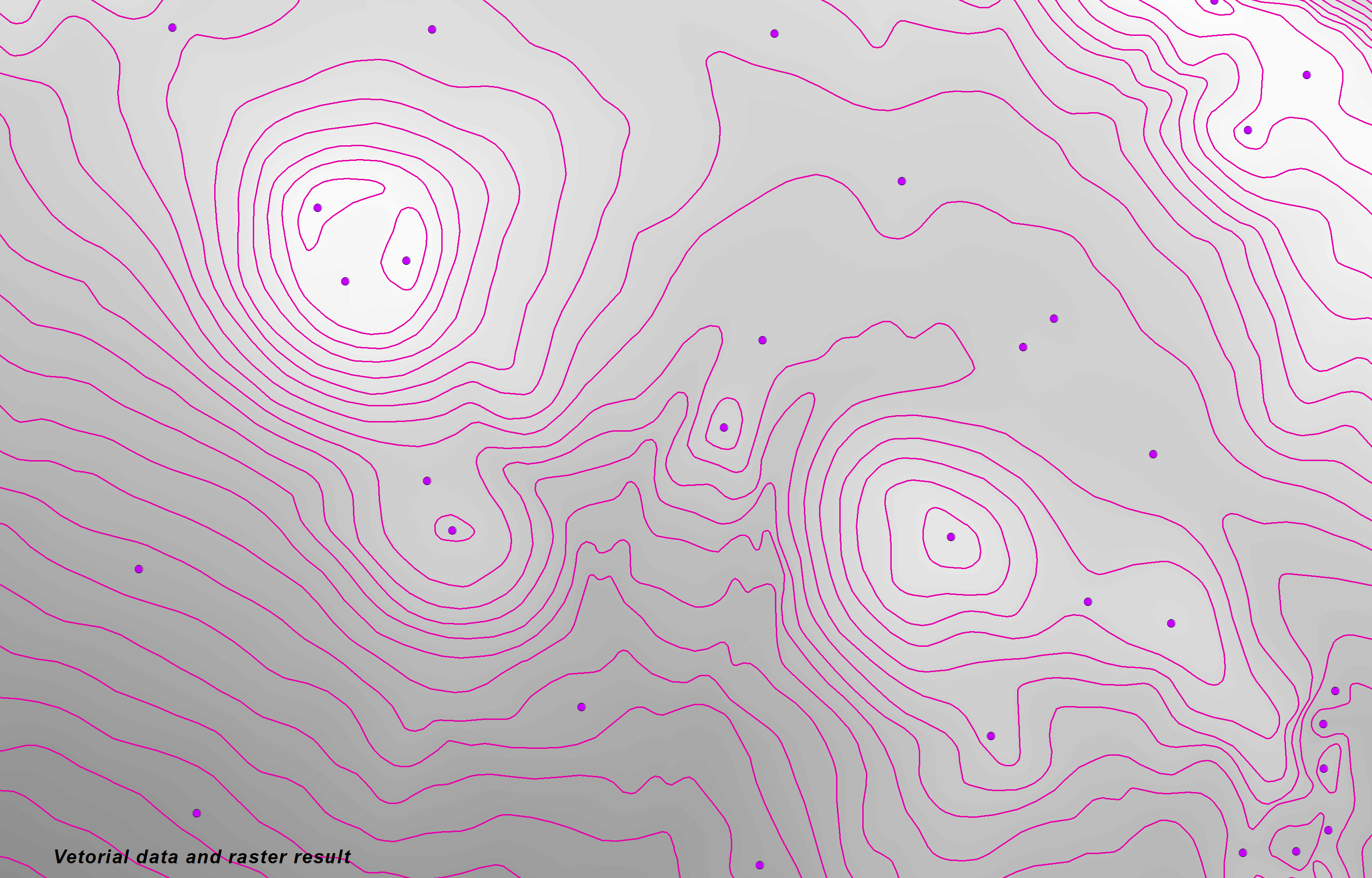
I created a raster with the Topo to Raster tool. for this I used layers of points and lines with elevation attributes (TopoToRaster.png). Everything looks normal! However, after using the raster for other purposes, for example creating a Hillshade map, the result doesn't look very good (HillShade.png). In other words, in the Hillshade raster, where the interpolation lines (contours) existed, the value seems different, causing a strange effect.
Is this a problem with the tool or will it be necessary to modify some parameters?
Thank you!
- Mark as New
- Bookmark
- Subscribe
- Mute
- Subscribe to RSS Feed
- Permalink
It looks like you're viewing the raster you created with cubic convolution or bilinear interpolation. Change the display/symbology setting to nearest neighbour and you'll probably see the raster isn't quite as friendly as it looks.
I'd guess its a case of GIGO so you may need to recreate it using alternate parameters or input more/better data to feed it.
- Mark as New
- Bookmark
- Subscribe
- Mute
- Subscribe to RSS Feed
- Permalink
Hi David, thanks for reply.
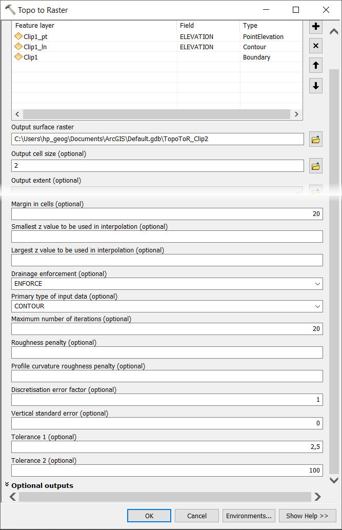
I think the problem is not with the visualization. Maybe it's the parameters (Topo2raster_toolparameters.png). But I have already tried to change some and the result is always similar.
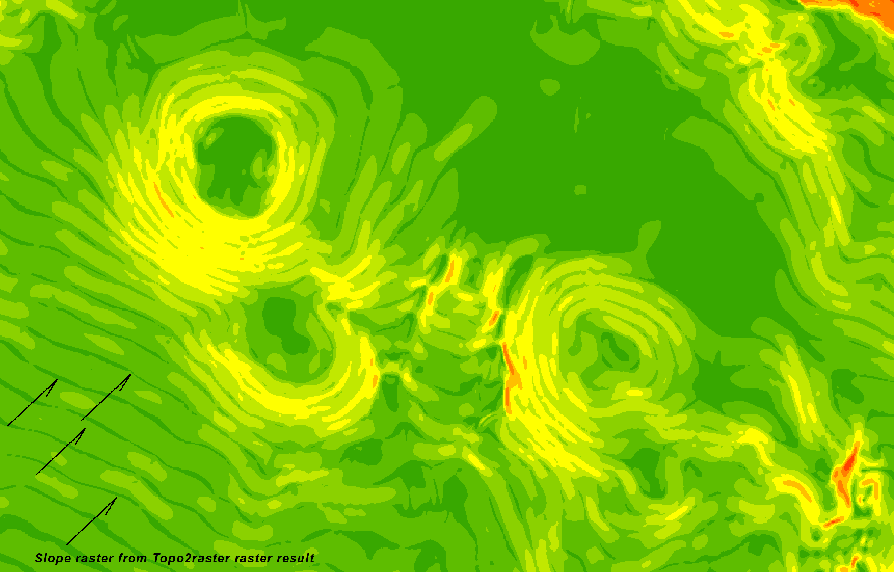
As you can see along the contour it seems that cells are created with very different values from those around them (Topo2raster_curvature.png; Topo2raster_curvature2.png; Topo2raster_slopeD.png).
Any suggestions regarding parameter improvements.
Thank you very much.
- Mark as New
- Bookmark
- Subscribe
- Mute
- Subscribe to RSS Feed
- Permalink
I'm saying that if you're looking to compare the result of the slope etc to the original raster to understand what may be happening, it would be useful to look at it without any interpolated cisualisation method, and probably a good idea to use a colour ramp rather than grayscale. I'd imagine when you do this, it would highlight the probable cause of your slope and curvature outputs being a bit funky. Other causes might also be common projection/units and parameters for the slope and curvature also.