Turn on suggestions
Auto-suggest helps you quickly narrow down your search results by suggesting possible matches as you type.
Cancel
- Home
- :
- All Communities
- :
- User Groups
- :
- Elevation Data
- :
- Questions
- :
- DEM- Change height under building
Options
- Subscribe to RSS Feed
- Mark Topic as New
- Mark Topic as Read
- Float this Topic for Current User
- Bookmark
- Subscribe
- Mute
- Printer Friendly Page
DEM- Change height under building
Subscribe
4468
1
04-13-2016 09:17 AM
04-13-2016
09:17 AM
- Mark as New
- Bookmark
- Subscribe
- Mute
- Subscribe to RSS Feed
- Permalink
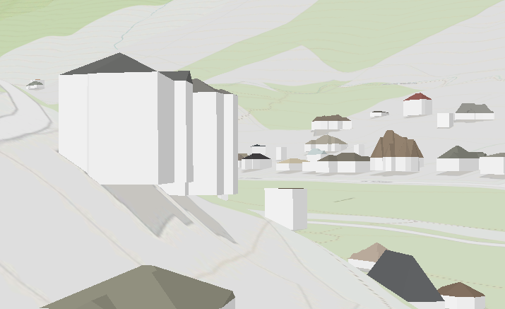
I am trying to change a DEM to have the same elevation under a polygon. Is there a tool or process where this can be accomplished? Imagery and Remote Sensing

My goal is to add this dem to arcgis pro. I want to add 3d buildings to the layer without the building being off the ground.
1 Reply
04-13-2016
12:32 PM
- Mark as New
- Bookmark
- Subscribe
- Mute
- Subscribe to RSS Feed
- Permalink
If you polygon has an elevation, determine the difference between it and the surface. I assume that this would show the elevation difference that you want to fill. Then use a con statement to fill the area by that difference.