- Home
- :
- All Communities
- :
- Industries
- :
- National Government
- :
- Defense and Intelligence
- :
- Defense and Intelligence Blog
- :
- Management of Intelligence Operations
- Subscribe to RSS Feed
- Mark as New
- Mark as Read
- Bookmark
- Subscribe
- Printer Friendly Page
Intelligence can be distinguished from data and information in that intelligence provides reasoned insight into future conditions or situations. GIS provides a common framework for turning data into decisions.
Capable of handling big data, ArcGIS allows decision-makers and analysts to access very large amounts of near real-time data and information relating to all aspects of the operational environment. Raw data can be plentiful, and information on its own may have minimal utility. But when integrated and considered with other information in the light of patterns and relationships, this new understanding of the information is what we call "intelligence."
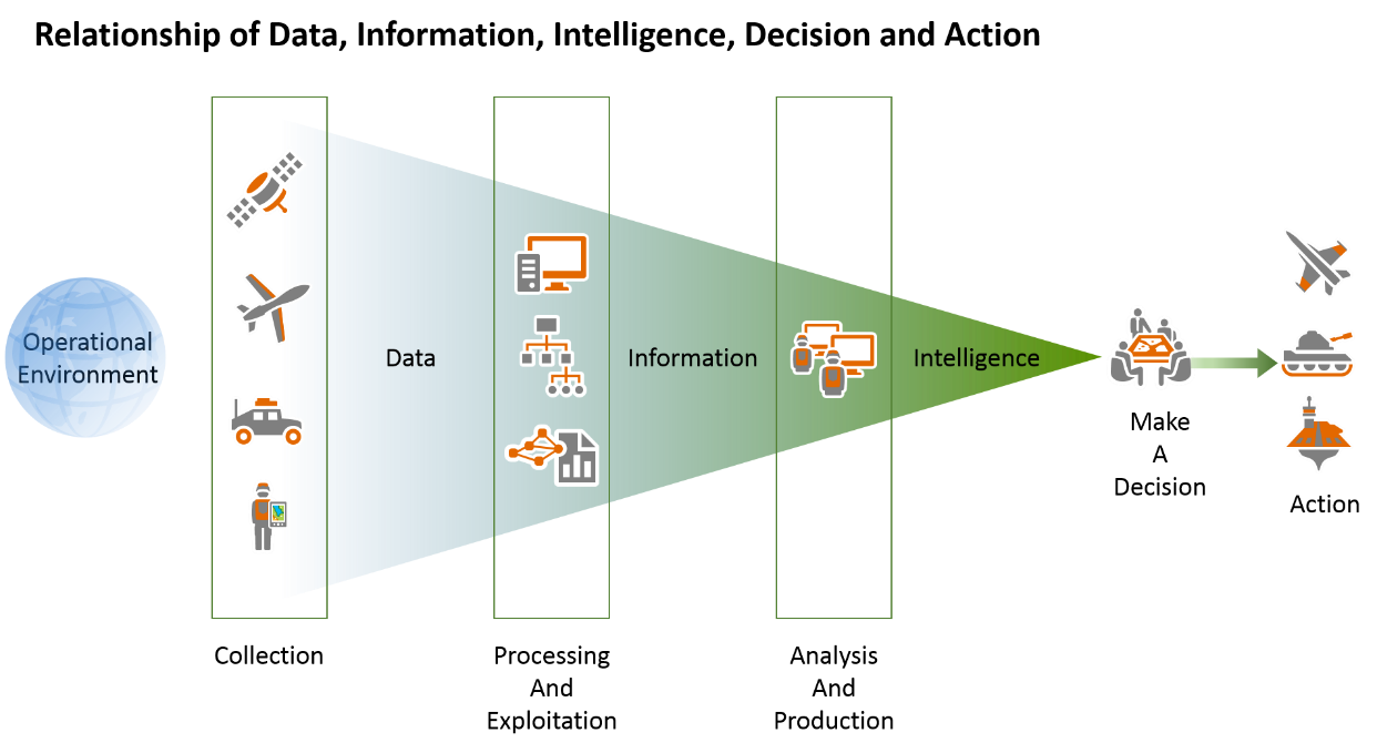
The intelligence process incorporates a common workflow and terminology to facilitate the production of relevant intelligence products that support many missions. The process includes the following:
- Requirements and planning
- Collection
- Processing and exploitation
- Analysis and production
- Dissemination and integration
At the 2018 Esri User Conference, we took a focused look at the management of intelligence processes. Robert Feuerstein and I demonstrated the use of Esri web maps and apps that replace paper and email-based workflows and streamline the activities associated with Requests for Information (RFI) management, collection and asset management, data management, and production management.
These easy to use ArcGIS apps enable the following:
- Field units, analysts, and operational planners can discover and access authoritative data and services from multiple databases and open sources. This content can be shared between units and organizations, at all levels of command. Keep in mind that handling instructions are a function of policy and still apply
- Production Managers can use portal groups to prioritize and assign production tasks, while analysts leverage shared models and tools that streamline workflows and improve tradecraft
- Use web forms and apps to manage requirements, data collection, and assets in real time. Field data collection units improve on paper-based workflows and directly contribute to intelligence production
- Intelligence products and information can be shared with planners, decision-makers, and operators through dynamic briefings and story maps
Apps are revolutionizing how we communicate and share information across units and levels of command. If you missed our informative session, links to view the recording will be coming soon.
You must be a registered user to add a comment. If you've already registered, sign in. Otherwise, register and sign in.