- Home
- :
- All Communities
- :
- Products
- :
- Data Management
- :
- Data Management Questions
- :
- Vectorization trace and Vectorization trace Betwee...
- Subscribe to RSS Feed
- Mark Topic as New
- Mark Topic as Read
- Float this Topic for Current User
- Bookmark
- Subscribe
- Mute
- Printer Friendly Page
Vectorization trace and Vectorization trace Between Points Tool's
- Mark as New
- Bookmark
- Subscribe
- Mute
- Subscribe to RSS Feed
- Permalink
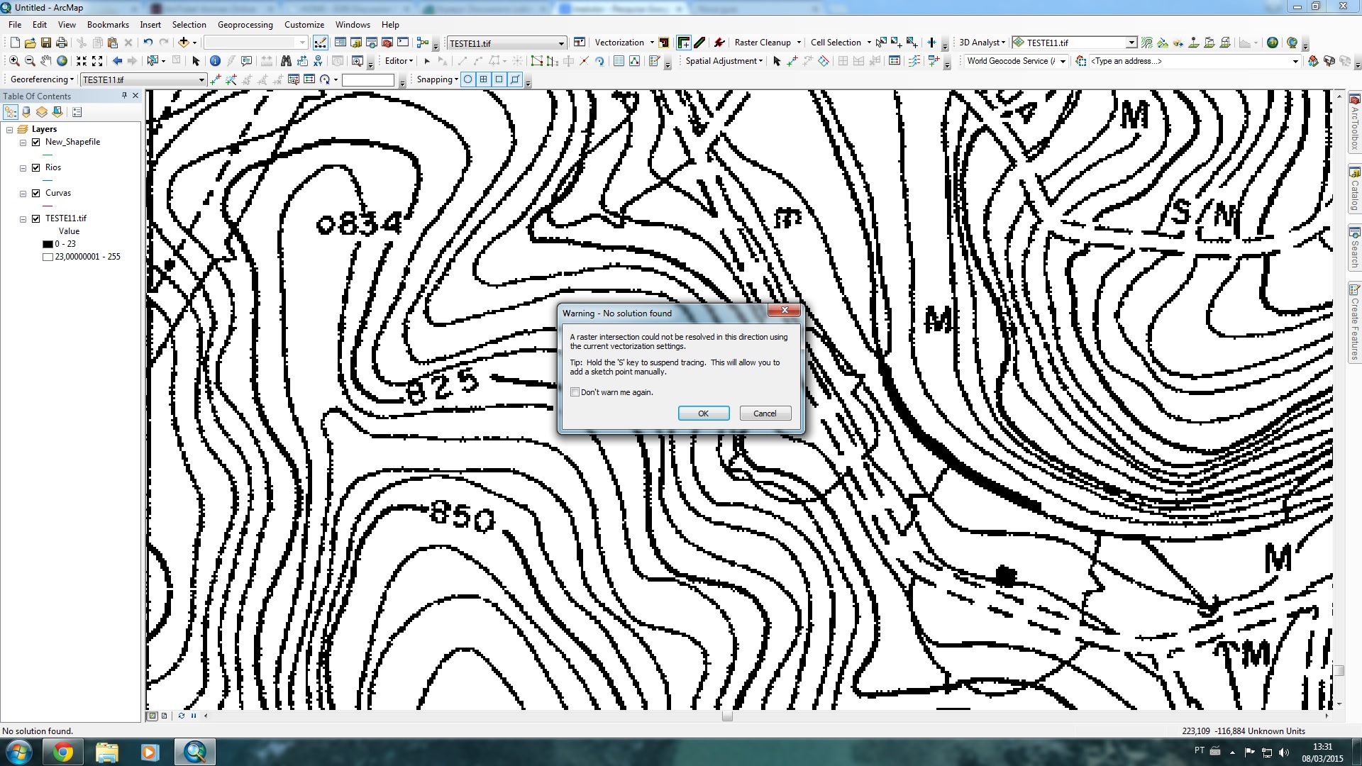
I'm having problems with "Vectorization Trace Tool" and "Vectorization trace Between points Tool". Every time I try to use at any point of the scanned image appears the following error message with : " The raster intersection Could Not Be resolved in this direction using the current vectorizarion settings" .
I've tried changing all settings and I can not solve.
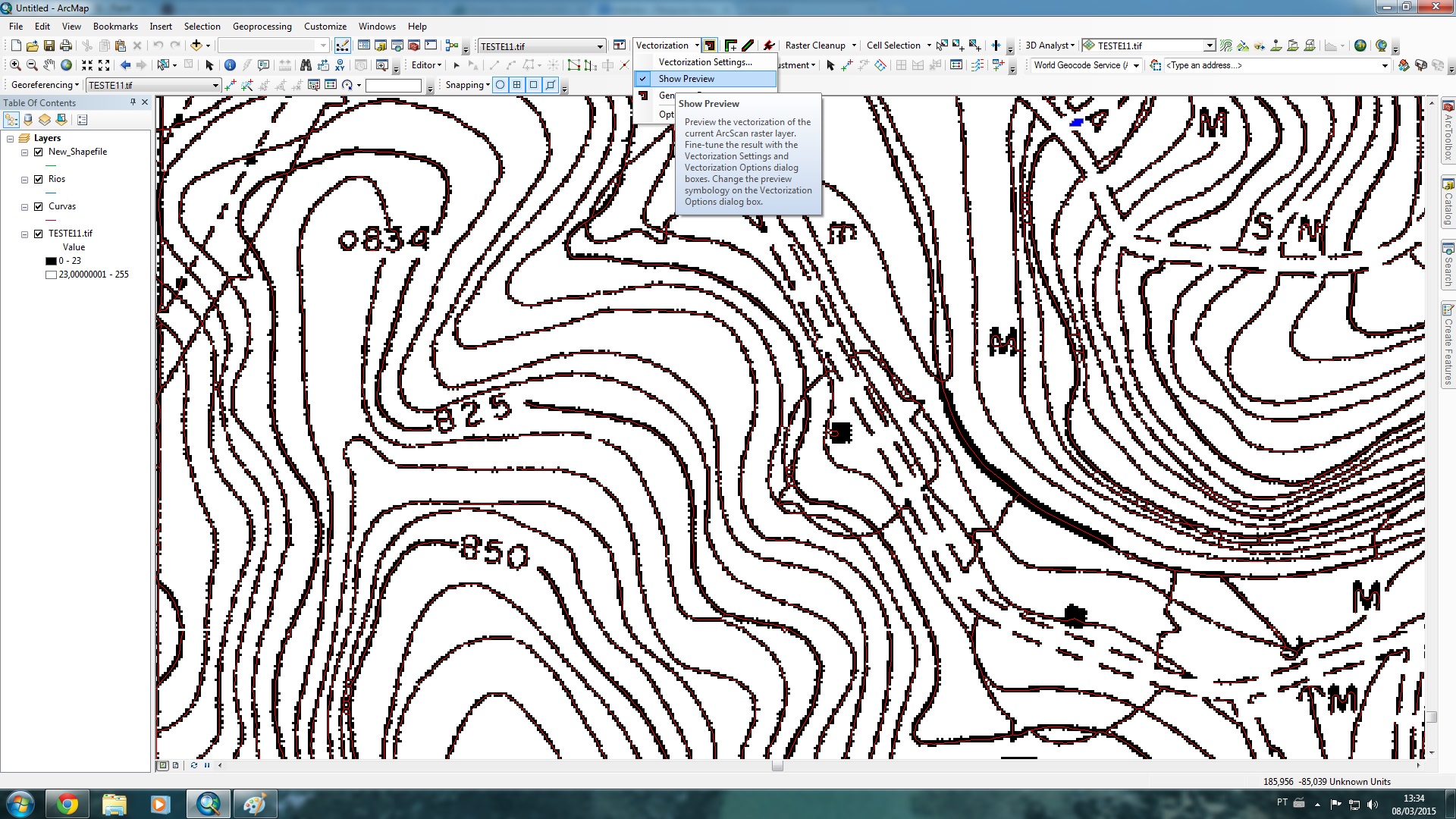
The funny thing is that if you use the tool "Generate feartures inside Area" works well , however , I need to use another tool to control digitized contour lines.
I was working with a great picture , but when the problem started I opted to try to resolve it in a smaller image for testing ... but so far not come to a solution.
follows below pictures of the warning and preview of the vectorization using "Generate feartures inside Area " and the test files .
- Mark as New
- Bookmark
- Subscribe
- Mute
- Subscribe to RSS Feed
- Permalink
I almost get the feeling that digitizing the contour lines the old fashioned way (tracing the lines manually) might be the best solution for this type of input, if tracing between points with ArcScan does not work with any settings...
- Mark as New
- Bookmark
- Subscribe
- Mute
- Subscribe to RSS Feed
- Permalink
That would be too bad, cuz I have a tool that should work and it doesn ... just like to know why this is happening...
I tried the image from the tutorial and its work with those tools ... i'm thinking may be my image , but i dont get the problem yet and how fix it.
- Mark as New
- Bookmark
- Subscribe
- Mute
- Subscribe to RSS Feed
- Permalink
I tried to put my picture in the tutorial file that ran the tools , and finally worked on my picture scanned base, now the problem is because when I open a new map does not work ?
- Mark as New
- Bookmark
- Subscribe
- Mute
- Subscribe to RSS Feed
- Permalink
I will have to try to see what happens on my system. What version of ArcGIS are you using? May not be able to get back to this today, since I'm at a course at the DevSummit at this moment.
- Mark as New
- Bookmark
- Subscribe
- Mute
- Subscribe to RSS Feed
- Permalink
Frederico,
Most of the ArcScan tools benefit from raster snapping.
You can turn this on by first enabling 'classic snapping' in editor>options then enable the raster snap agents centerline and intersection in the snapping window. Under snapping options set the snapping tolerance to 10 pixels.
The vectorization tools should snap to the raster, making it easier to trace or manually capture features.