- Home
- :
- All Communities
- :
- Products
- :
- Data Management
- :
- Data Management Questions
- :
- spurious nodata-pixels after rectifying TIF-images
- Subscribe to RSS Feed
- Mark Topic as New
- Mark Topic as Read
- Float this Topic for Current User
- Bookmark
- Subscribe
- Mute
- Printer Friendly Page
spurious nodata-pixels after rectifying TIF-images
- Mark as New
- Bookmark
- Subscribe
- Mute
- Subscribe to RSS Feed
- Permalink
Hello,
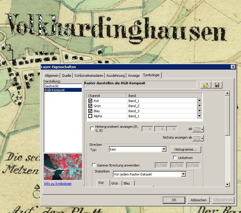
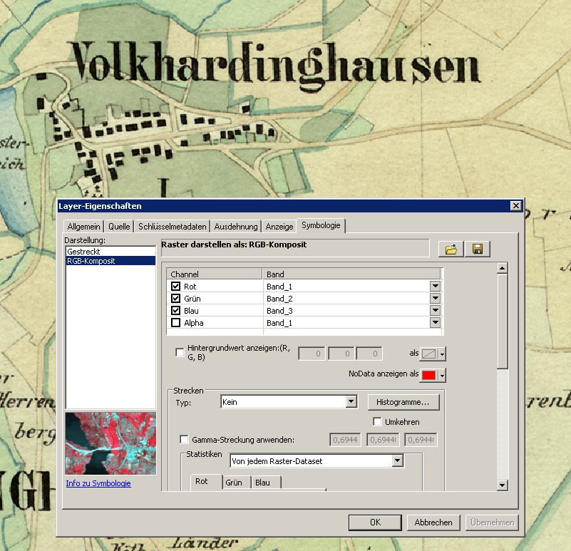
I am georeferencing scanned historical maps (RGB-tif). After rectification the images show spurious nodata pixels, usually the darkest parts of inscriptions. In the original file these pixels are not tagged as nodata so somehow during the rectifying process ArcGIS 'decides' to set these pixels to nodata.
I have tried different options in the rectify menu but to no avail.
To make things more clear I have attached two images: original_nodata_red shows the original file with nodata set to red to demonstrate that there are no nodata pixels. In georef_nodata_null spurious nodata pixels are set to null to demonstrate how pixels have been tagged as nodata by ArcGIS in the georeferenced image.
As I have to set the wedges outside of the georeferenced image to null I need to be able to set nodata pixels. Is there any explanations why this happens and of course - any idea how to prevent it?
Any ideas welcome!
Regards,
Axel