- Home
- :
- All Communities
- :
- Products
- :
- Data Management
- :
- Data Management Questions
- :
- Re: Sid Files not working in catalog
- Subscribe to RSS Feed
- Mark Topic as New
- Mark Topic as Read
- Float this Topic for Current User
- Bookmark
- Subscribe
- Mute
- Printer Friendly Page
Sid Files not working in catalog
- Mark as New
- Bookmark
- Subscribe
- Mute
- Subscribe to RSS Feed
- Permalink
I hope everyone is doing fine.
I recently downloaded sid files to develop a raster. For some reason I am unable to view them in arc catalog nor arcmap. When I try to open up its properties I get a "Failed to open dataset error". "Invalid raster dataset. Failed to create raster layer" followed by "Could not add specified data object to the map" are the errors fo get for arcmap.
- Mark as New
- Bookmark
- Subscribe
- Mute
- Subscribe to RSS Feed
- Permalink
which mrsid type since they are both supported Supported raster dataset file formats—Help | ArcGIS for Desktop
where do you have them stored/saved that they can't be opened ... locally? on a network?
- Mark as New
- Bookmark
- Subscribe
- Mute
- Subscribe to RSS Feed
- Permalink
I'm trying to work with them locally. they are .sid and .sdw files. I can see that they exist, but can't preview them.


- Mark as New
- Bookmark
- Subscribe
- Mute
- Subscribe to RSS Feed
- Permalink
And you said you can't add them to a new data frame in ArcMap?
- Mark as New
- Bookmark
- Subscribe
- Mute
- Subscribe to RSS Feed
- Permalink
That is correct. I got the files through here. If it helps to recreate the isuue.
https://njgin.state.nj.us/NJ_NJGINExplorer/IW.jsp?DLayer=NJ%202015%20Orthophotography%20MG4
- Mark as New
- Bookmark
- Subscribe
- Mute
- Subscribe to RSS Feed
- Permalink
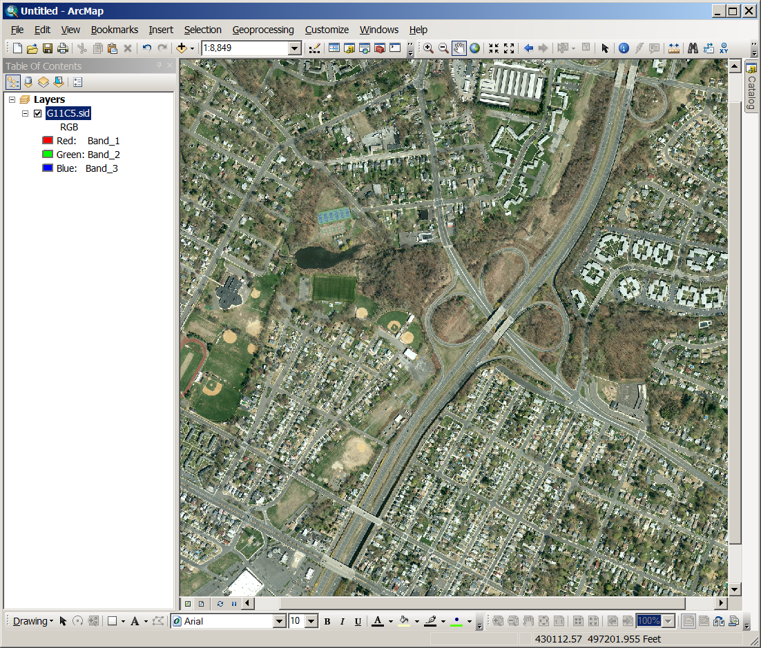
downloaded one... you forgot to unzip the file perhaps?
- Mark as New
- Bookmark
- Subscribe
- Mute
- Subscribe to RSS Feed
- Permalink
haha...im having trouble after the unzipping.
- Mark as New
- Bookmark
- Subscribe
- Mute
- Subscribe to RSS Feed
- Permalink
Neil what version of arcmap is that?
- Mark as New
- Bookmark
- Subscribe
- Mute
- Subscribe to RSS Feed
- Permalink
Also what window OS is on ur machine?
