- Home
- :
- All Communities
- :
- Products
- :
- Data Management
- :
- Data Management Questions
- :
- Seeking datasets that has the degree, minutes and ...
- Subscribe to RSS Feed
- Mark Topic as New
- Mark Topic as Read
- Float this Topic for Current User
- Bookmark
- Subscribe
- Mute
- Printer Friendly Page
Seeking datasets that has the degree, minutes and seconds world longitude and latitude
- Mark as New
- Bookmark
- Subscribe
- Mute
- Subscribe to RSS Feed
- Permalink
I am seeking a GIS datasets that has the longitude and latitude that I really need badly that has the degrees, minutes and seconds .... I am aware that there is 1 degree, 5 degree, 30 degree and 45 degrees.... I do not want them...
Where do I find them ? I have looked around on the internet and didn't find it.... Does ArcGIS Pro come with it ? How about ArcGIS Desktop ?
Yes I know that ArcGIS has its own Longitude and Latitude but I really want the datasets...
- Mark as New
- Bookmark
- Subscribe
- Mute
- Subscribe to RSS Feed
- Permalink
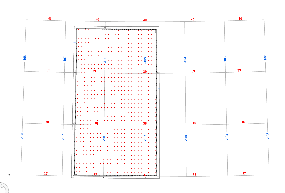
The only thing I am retaing is the 1 degree graticule I have here from the Natural Earth site... Which is good ...just need the seconds...
Let me know if you are able to see it or not but here is the picture of what I am talking about...

- Mark as New
- Bookmark
- Subscribe
- Mute
- Subscribe to RSS Feed
- Permalink
This depends on the coordinate system used by the map. If you are using ArcGIS, open Arccatlog and right click on the map. Click on Properties and drop down on the coordinate system. Is it in the UTM for the picture is unclear if you work on it and you want first Geometric correction and selection of appropriate projection
In ArcMap, use the "Grid" icon by right-clicking on the "layer" and selecting Properties
- Mark as New
- Bookmark
- Subscribe
- Mute
- Subscribe to RSS Feed
- Permalink
maybe it was just marked off in 1 degree increments, meaning that the seconds would be 0.
If you are georeferencing old maps marked in longitude/latitude, you could just use an online DMS - DD converter to do the conversion for your control points.
- Mark as New
- Bookmark
- Subscribe
- Mute
- Subscribe to RSS Feed
- Permalink
Thanks.. I have never thought about that....good idea... I will try and do this method and see..
BTW, I tried what Joshua Bixby's suggesting to do this tool : Make Grids And Graticules Layer—Topographic Production toolbox | ArcGIS Desktop
It is a good tool only if you are working on a small area but for a large area might be too much....though also it takes a lot of time and it took me a while to understand this tool works...
I was able to get it done what I wanted....but I will do your suggestion and compare with the other tool.
- Mark as New
- Bookmark
- Subscribe
- Mute
- Subscribe to RSS Feed
- Permalink
Phew... I have been working very hard and tired and got what I wanted...so here is the picture..
I still have not georeferenc the old picture yet....so the begins now !

- « Previous
-
- 1
- 2
- Next »
- « Previous
-
- 1
- 2
- Next »