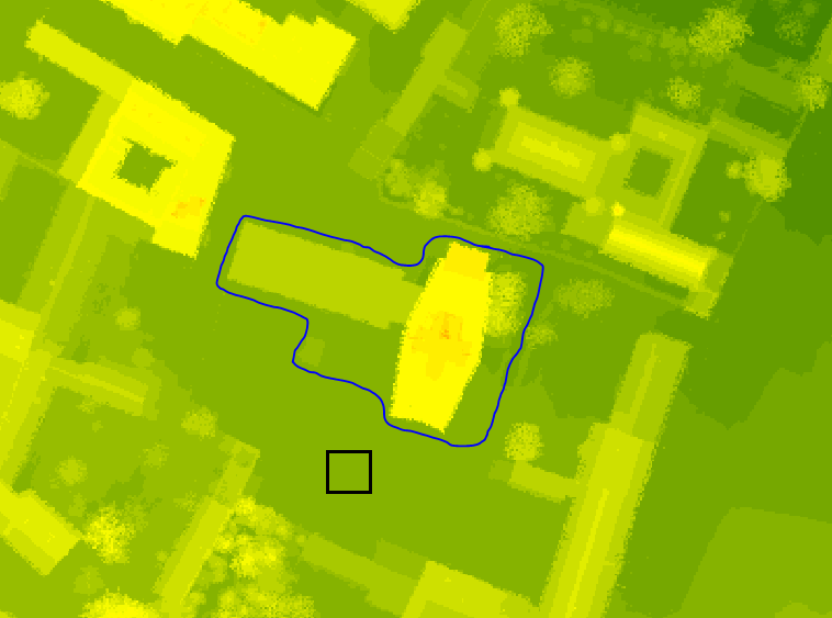
First, I would like to remove the area outlined in blue pen from the raster. And then on the entire surface of the cut area, insert the area as it appears in the black frame. The area in the black frame has height 192,460007 (meters above sea level).

Next, I have a shapefile with a new building and I would like to attach it to the raster. The new building consists of three parts, the first with a height of 7.5 meters, the second 5 meters, the third 10 meters. So the height of these parts in the raster in meters above sea level should look like: 199,960007, 197,460007, 202,460007.

Please explain how to do all this in ArcMap