- Home
- :
- All Communities
- :
- Products
- :
- Data Management
- :
- Data Management Questions
- :
- Re: Rasters comparison after load
- Subscribe to RSS Feed
- Mark Topic as New
- Mark Topic as Read
- Float this Topic for Current User
- Bookmark
- Subscribe
- Mute
- Printer Friendly Page
Rasters comparison after load
- Mark as New
- Bookmark
- Subscribe
- Mute
- Subscribe to RSS Feed
- Permalink
Maybe this one is an easy fix, but I just can't see the difference.
I have a raster dataset in a file geodatabase that looks smooth and good at all scales. I imported it to SDE geodatabase and set the same parameters for compression and pyramids (which I build after the import operation), but the raster looks very coarsely compared at small scales. Calculated statistics trying, but the results do not vary. Any suggestions are appreciated.
Thanks
- Mark as New
- Bookmark
- Subscribe
- Mute
- Subscribe to RSS Feed
- Permalink
little things, like are the cell sizes the same?
- Mark as New
- Bookmark
- Subscribe
- Mute
- Subscribe to RSS Feed
- Permalink
Hi Dan,
yes...same cell size.
- Mark as New
- Bookmark
- Subscribe
- Mute
- Subscribe to RSS Feed
- Permalink
Can you provide a comparative screenshot? Is it just a display thing - have you applied the same kind and amount of stretching to each raster?
- Mark as New
- Bookmark
- Subscribe
- Mute
- Subscribe to RSS Feed
- Permalink
This link may help if it is purely a display issue
Improving the display of raster data—Help | ArcGIS for Desktop
but I didn't quickly see anything directly regarding SDE
- Mark as New
- Bookmark
- Subscribe
- Mute
- Subscribe to RSS Feed
- Permalink
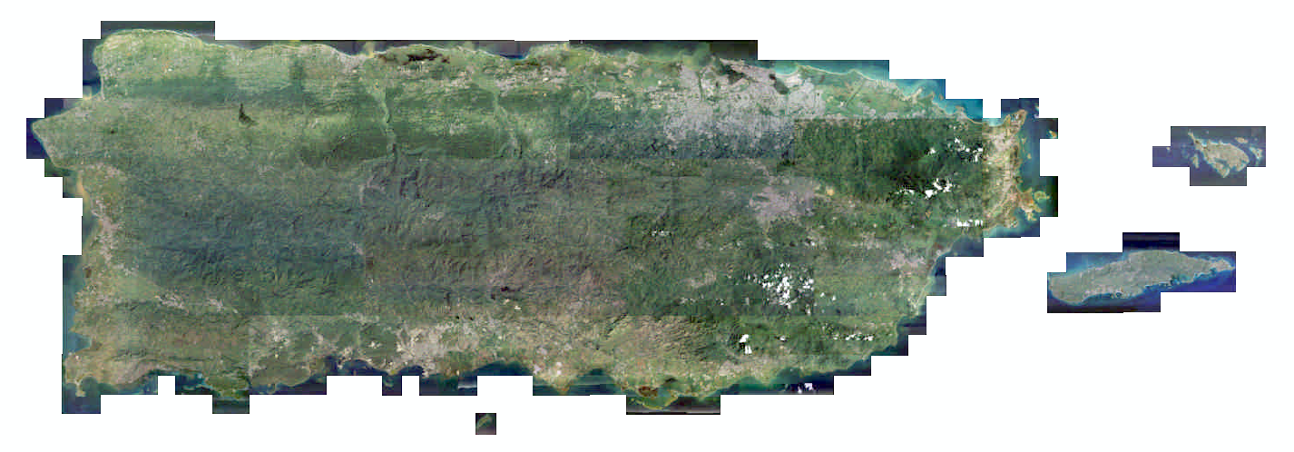
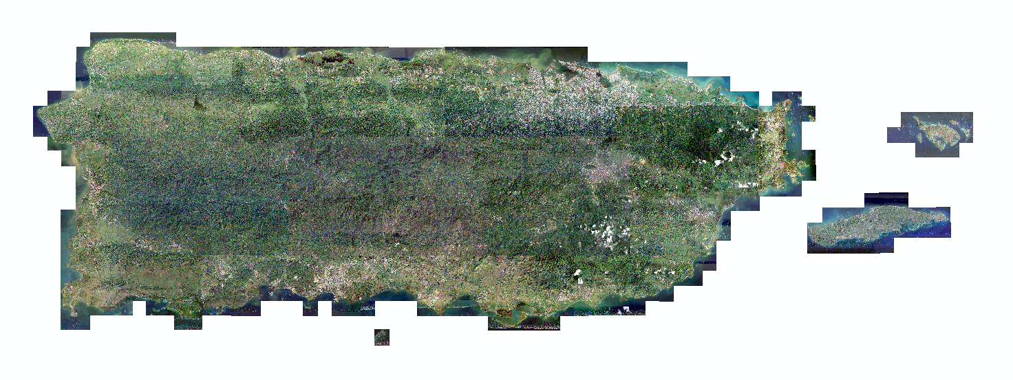
Screenshots of the rasters...
File Geodatabase
SDE
- Mark as New
- Bookmark
- Subscribe
- Mute
- Subscribe to RSS Feed
- Permalink
And when you zoom in does it still remain crummy? Nothing in the link I provided suggested any clues if everything is identical?
- Mark as New
- Bookmark
- Subscribe
- Mute
- Subscribe to RSS Feed
- Permalink
As I zoom in the raster display better until it shows almost the same. I imagine there must be something about with the pyramids but I set the same parameters when creating them and yet can't make them display as expected. I recreated the pyramid just specifying the compression format and resampling method, but the result is the same.
- Mark as New
- Bookmark
- Subscribe
- Mute
- Subscribe to RSS Feed
- Permalink
Well, if that is the case, and everything is exactly as you said, then my only conclusion is that an SDE geodatabase handles pyramids and the like differently than a file geodatabase or there is a bug or something has been missed. I will defer to those that use SDE and can provide some enlightenment. Good luck
- Mark as New
- Bookmark
- Subscribe
- Mute
- Subscribe to RSS Feed
- Permalink
Unless this is coincidence, have a look at this thread and Robert's and Jake's answers