- Home
- :
- All Communities
- :
- Products
- :
- Data Management
- :
- Data Management Questions
- :
- Re: Raster to Polygon
- Subscribe to RSS Feed
- Mark Topic as New
- Mark Topic as Read
- Float this Topic for Current User
- Bookmark
- Subscribe
- Mute
- Printer Friendly Page
- Mark as New
- Bookmark
- Subscribe
- Mute
- Subscribe to RSS Feed
- Permalink
Hello all,
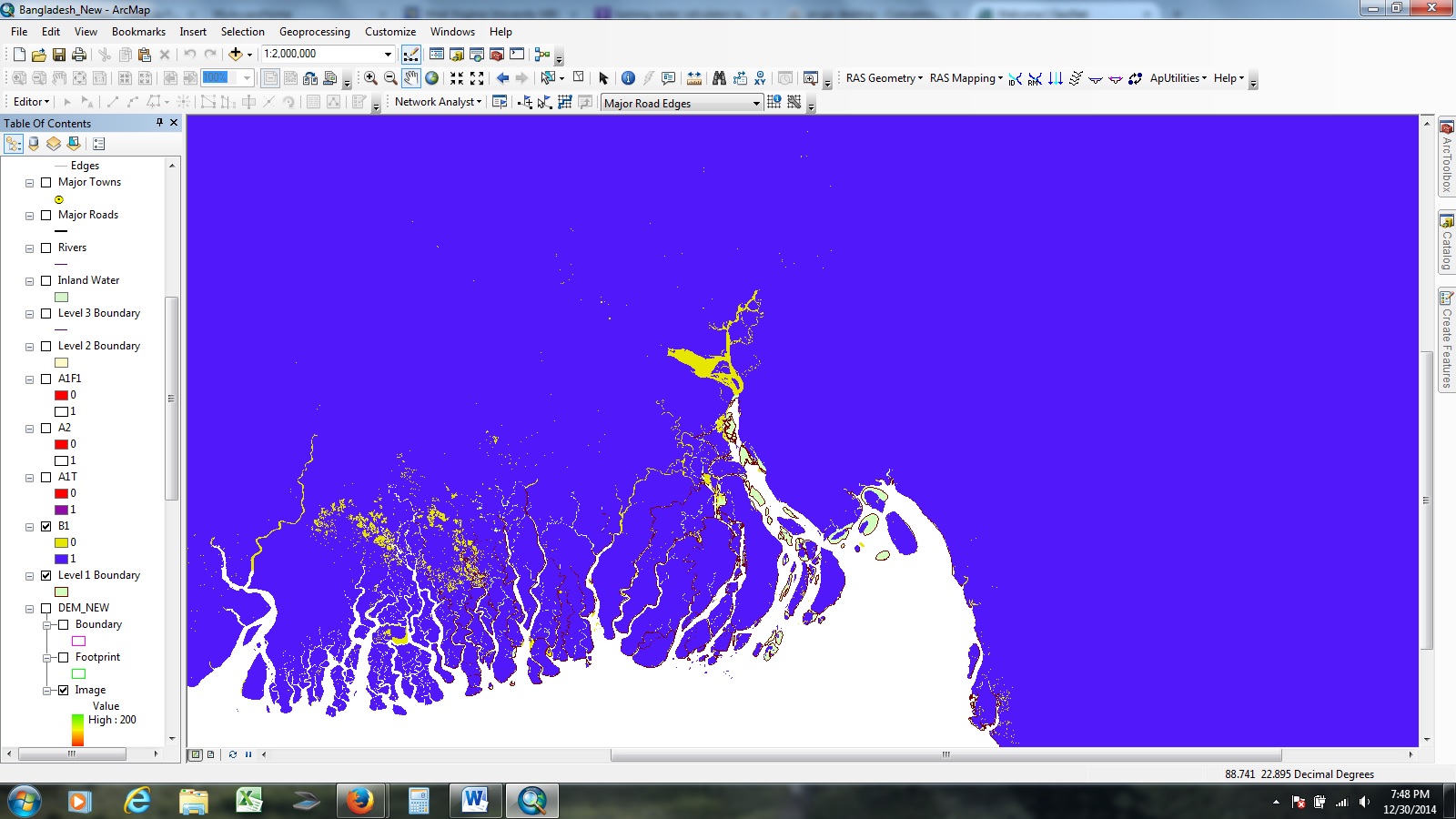
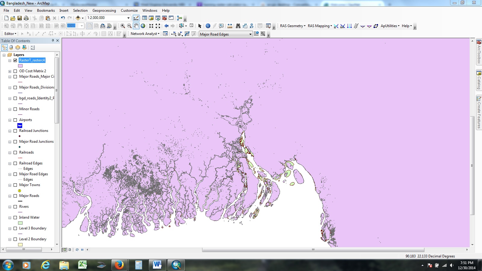
I have a problem converting my raster calculator values into polygons. When I convert these raster calculator rasters into polygons, it not only gives me the raster I ask for, but also a large polygon. This makes it hard to intersect the rasters with my road files in order to determine how many miles of road the new polygon made by raster to polygon intersects. I am having a somewhat difficult time explaining what I am meaning so I have attached some pictures. When I make my polygon, I would like the new polygon to only contain the yellow parts, not the blue parts. Hopefully the pictures help make some sense of this question. In the images, the blue and yellow is the original raster and the pink and gray is the new polygon made. I do not want the pink part of the new polygon but only the gray part.
Thanks for any help and sorry if this makes no sense.
Solved! Go to Solution.
Accepted Solutions
- Mark as New
- Bookmark
- Subscribe
- Mute
- Subscribe to RSS Feed
- Permalink
You can either correct the raster B1 to only have value 0 (yellow) before conversion, or set a definition query on the resulting polygon featureclass using Gridcode = 0 (this will only show the yellow polygons). When using this layer in a intersection it will only use the yellow polygons and ignore the blue ones.