- Home
- :
- All Communities
- :
- Products
- :
- Data Management
- :
- Data Management Questions
- :
- Re: Raster image not matching spatial extent
- Subscribe to RSS Feed
- Mark Topic as New
- Mark Topic as Read
- Float this Topic for Current User
- Bookmark
- Subscribe
- Mute
- Printer Friendly Page
Raster image not matching spatial extent
- Mark as New
- Bookmark
- Subscribe
- Mute
- Subscribe to RSS Feed
- Permalink
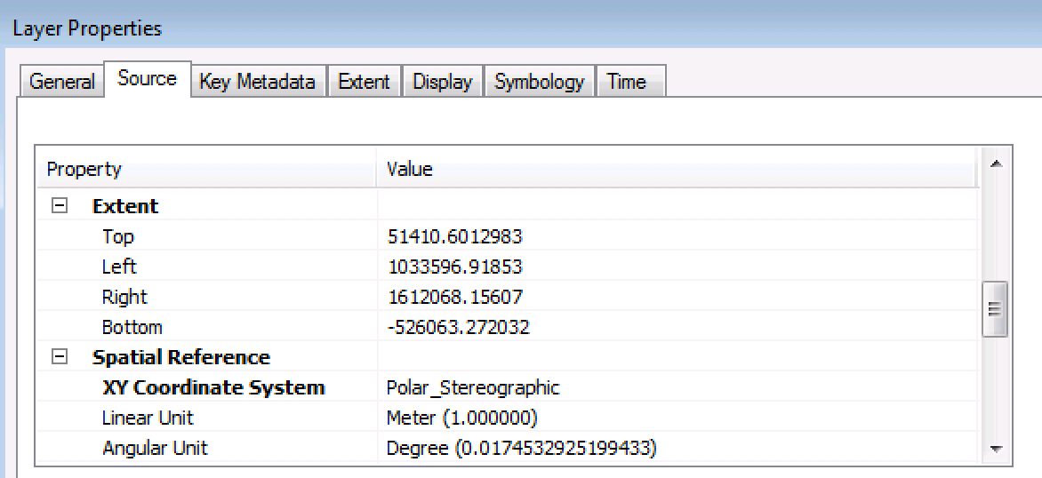
I'm trying to figure out why my raster image does not match its spatial extent. For example, the bottom-left corner of the image is supposed to be at (1033596, -526063) (see attachment "projection info"), but this point (green dot) does not line up with the bottom-left corner of the raster (see attachment "raster"). I've set the coordinate system of the data frame to that of the image (polar stereographic). Any help would be much appreciated.
- Mark as New
- Bookmark
- Subscribe
- Mute
- Subscribe to RSS Feed
- Permalink
what is the coordinate system of the point? and if you calculate those values in its table using the coordinate system of the data frame... what do you get ?
- Mark as New
- Bookmark
- Subscribe
- Mute
- Subscribe to RSS Feed
- Permalink
Thanks for the reply, Dan. I created that point by plugging the bottom-left coordinates into the "Go to XY" tool ("Add labeled point"), so I assume its coordinate system would be the coordinate system of the data frame, which is polar stereographic. The tool creates graphic elements, not point features, so it doesn't have a table. In the properties of the graphic element, the position is listed as X: 1,033,372.4939 m, Y: -526,158.4686 m.
- Mark as New
- Bookmark
- Subscribe
- Mute
- Subscribe to RSS Feed
- Permalink
You will have to go back to the beginning to unravel the issue. If the image, was in a different coordinate system, I might suggest making an 'area of interest' polygon file that matches the extent image, then densify that (Densify tool). Make sure that the extents of both are the same. At this point, if you projected the image, perform the same Project on the vector polygon file. I just want to see if there was an issue with the initial extents or something that is unique to polar projections.
MKennedy-esristaff ... flagging you in case you have some insights on this type of projection and extents.
- Mark as New
- Bookmark
- Subscribe
- Mute
- Subscribe to RSS Feed
- Permalink
If I understand you correctly, your suggestion might help diagnose the problem if I had projected the raster image from its original coordinate system. I haven't performed any projections on the image, so it's either in its original coordinate system, or it was projected by someone else before I received the image.
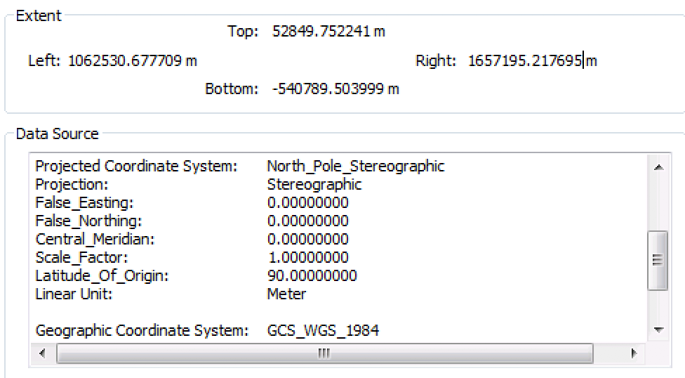
In attempting your solution, I noticed something interesting. I converted the image to polygon (raster to polygon, conversion toolbox), and the resulting polygon has the extent of the image as it is being displayed, rather than the extent shown in the image's source properties. Not sure if that sheds any light on the problem.
- Mark as New
- Bookmark
- Subscribe
- Mute
- Subscribe to RSS Feed
- Permalink
Hmm, because of the rotation and jagged edges, it looks like it has been reprojected. Converting to polygon should lose the white area because it's probably no-data or 0 so not considered part of the polygon. It doesn't surprise me that the extents would be different.
Otherwise, I have no suggestions...but it is Friday at the end of a long week at almost 5pm. 
- Mark as New
- Bookmark
- Subscribe
- Mute
- Subscribe to RSS Feed
- Permalink
Ok, thanks Melita. I'll ask the creators of the data if they reprojected the image.