Turn on suggestions
Auto-suggest helps you quickly narrow down your search results by suggesting possible matches as you type.
Cancel
- Home
- :
- All Communities
- :
- Products
- :
- Data Management
- :
- Data Management Questions
- :
- Polygons in Address Locator
Options
- Subscribe to RSS Feed
- Mark Topic as New
- Mark Topic as Read
- Float this Topic for Current User
- Bookmark
- Subscribe
- Mute
- Printer Friendly Page
Polygons in Address Locator
Subscribe
2957
1
04-22-2012 01:33 PM
04-22-2012
01:33 PM
- Mark as New
- Bookmark
- Subscribe
- Mute
- Subscribe to RSS Feed
- Permalink
Hi,
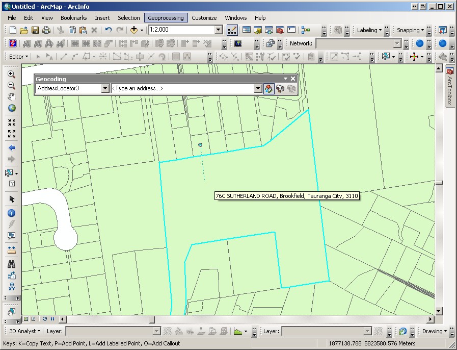
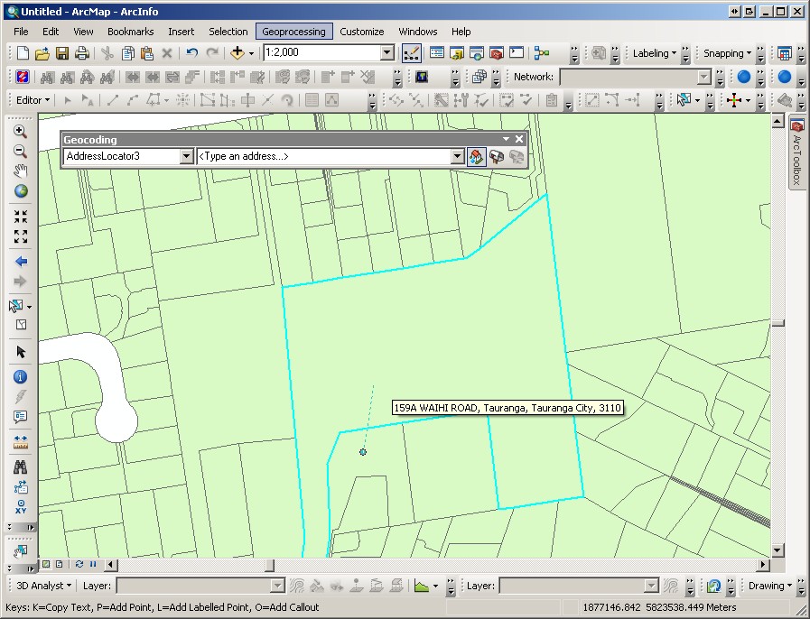
I have used a polygon layer in my Address Locator, however this is still treated like points when I use the Address Inspector on the geocoding toolbar in ArcMap. If I click in a large polygon the address inspector finds the closest polygon centroid to where I clicked (even if that centroid is NOT in the polygon I clicked in). Is there a way to force my address locator to use the polygon I click in, or nearest if I click where there is no polygon?
See screenshots - I click in three places all within the same polygon (selected polygon in screenshot). In two of them, the centre of a different polygon was nearer where I click, so it has offered that address, rather than the address of the polygon I've click in. To me it would make more sense that if something is within a parcel it should get the address of that parcel, not another one nearby?
Cheers,
Mike.
1 Reply
by
Anonymous User
Not applicable
04-23-2012
05:36 AM
- Mark as New
- Bookmark
- Subscribe
- Mute
- Subscribe to RSS Feed
- Permalink
Original User: MOelschlegal
Mike,
Simply put the address inspector picks the centroid closest to the point where you clicked and, even if the target is a polygon, it acts like a point. You can change the search distance by right-clicking once you have the address inspector tool in use. This can help solve the problem of pointing to a centroid outside the polygon you have clicked in but will not help pick a centroid if you click somewhere that a polygon doesn't exist. Unfortunately, you can't have it both ways.
Matt