- Home
- :
- All Communities
- :
- Products
- :
- Data Management
- :
- Data Management Questions
- :
- Re: Mosaic to new raster
- Subscribe to RSS Feed
- Mark Topic as New
- Mark Topic as Read
- Float this Topic for Current User
- Bookmark
- Subscribe
- Mute
- Printer Friendly Page
- Mark as New
- Bookmark
- Subscribe
- Mute
- Subscribe to RSS Feed
- Permalink
I have 33 DEM tiles that I am trying to mosaic together using this tool in ArcGIS Desktop,
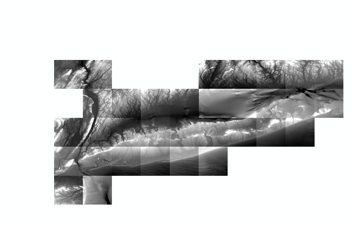
but I keep getting strange results.
All of the DEM pixel depths/sizes are 32 bit float, 1 band and are in NAD83, which I have been specifying in the tool. I'm saving it to a gdb and not specifying a cellsize. I am also leaving the mosaic operator and colormap modes as the defaults. This is the result I am getting:
Wondering if anyone knows why this is happening.
I tried using a mosaic dataset, but I am having issues with performing additional manipulation of it after I added all of the tiles. I would prefer to use the mosaic to new raster as I know the additional analysis and manipulation I need to perform has worked in the past.
Solved! Go to Solution.
Accepted Solutions
- Mark as New
- Bookmark
- Subscribe
- Mute
- Subscribe to RSS Feed
- Permalink
Someone else recently had this issue and it was solved by creating the new mosaic in a regular folder then moving the resultant raster back to the gdb.
- Mark as New
- Bookmark
- Subscribe
- Mute
- Subscribe to RSS Feed
- Permalink
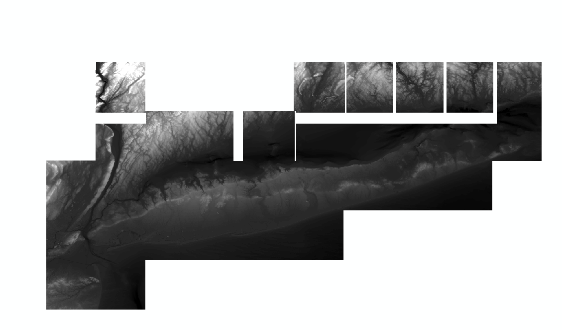
Could you change mosaic operator to Mean and retry?
- Mark as New
- Bookmark
- Subscribe
- Mute
- Subscribe to RSS Feed
- Permalink
Thanks for the reply Abdullah!! I tried your suggestion, but now I got this as the result:
I'm going to try the other suggestions now. Hopefully one of these works!!
- Mark as New
- Bookmark
- Subscribe
- Mute
- Subscribe to RSS Feed
- Permalink
If you are able create a Mosaic Dataset > Load the Rasters to it, then you could use Copy Raster to convert the Mosaic Dataset to a Raster Dataset.
Think Location
- Mark as New
- Bookmark
- Subscribe
- Mute
- Subscribe to RSS Feed
- Permalink
I didn't get to try this suggestion. It may work, but I didn't have the rasters in a gdb, only a regular folder and it would take time to import them and then try this.
- Mark as New
- Bookmark
- Subscribe
- Mute
- Subscribe to RSS Feed
- Permalink
Someone else recently had this issue and it was solved by creating the new mosaic in a regular folder then moving the resultant raster back to the gdb.
- Mark as New
- Bookmark
- Subscribe
- Mute
- Subscribe to RSS Feed
- Permalink
This solution worked. Thank you very much. Strange that you have to do it this way though.
- Mark as New
- Bookmark
- Subscribe
- Mute
- Subscribe to RSS Feed
- Permalink
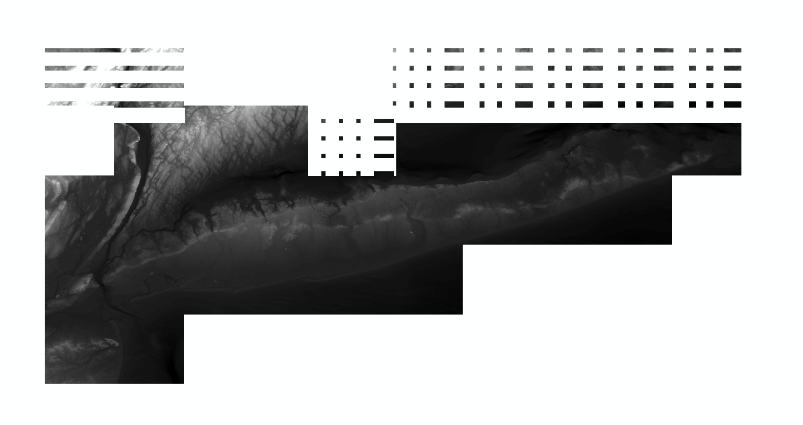
Could you check by create this mosaic with mosaic dataset instead of mosaic to new raster.
and please snapshot of footprint of raster.
- Mark as New
- Bookmark
- Subscribe
- Mute
- Subscribe to RSS Feed
- Permalink
HI Mich - Thanks for asking your questions and welcome to the GeoNet community! I wanted to let you know that we're moving your question from the GeoNet Help group to the https://community.esri.com/community/gis?sr=search&searchId=00654b19-947b-4193-836a-6470cab8eb7f&sea... space so our Esri and user subject matter experts can further help answer this and future questions. So you're aware on how and where to post your questions, here's a few quick tips and reminders:
- First, use the GeoNet search (top right corner by your profile icon) to search and see if your question has already by asked/answered previously.
- If not, than we suggest reviewing the GeoNet Community Structure, to find the most relevant space to post your question.
- The GeoNet GeoNet Help group is for questions and tips on how to use the GeoNet community platform not the Esri ArcGIS platform. Following steps 1 & 2 above will give you the best results for getting Esri product questions answered.
- This GeoNet 101 "How to Ask Questions on GeoNet" post is also a helpful guide to asking questions: https://community.esri.com/community/help-and-feedback/blog/2016/08/15/community-news-and-tips-how-t...
Thanks again for contributing and I hope this helps and let us know if you have any questions.
- Mark as New
- Bookmark
- Subscribe
- Mute
- Subscribe to RSS Feed
- Permalink
Thank you for the information Christopher. I wasn't sure where to post, but now I know.